Forecasts Point to an Increasing Chance for Significant Rain Next Week
June 6, 2025
The broad dome of high pressure that is expected to bring very hot temperatures to the region this weekend is forecast to weaken and back southwest into Mexico early next week. As the high shifts southwest, it is expected to cause winds in the middle and upper atmosphere to flow from the southern Rockies into Texas for most of next week. This type of pattern in early June often results in a very active weather pattern for much of Texas. In this pattern, waves of low pressure often move in from the northwest, causing the development of widespread rain showers and thunderstorms. Forecasts call for a weak cold front to sink south into Central Texas the middle of next week and this feature may help to enhance the chance for rain and thunderstorms.
The outlook for next week shows a high chance for rain next Tuesday through Thursday, with the chance for rain decreasing late week into next weekend.
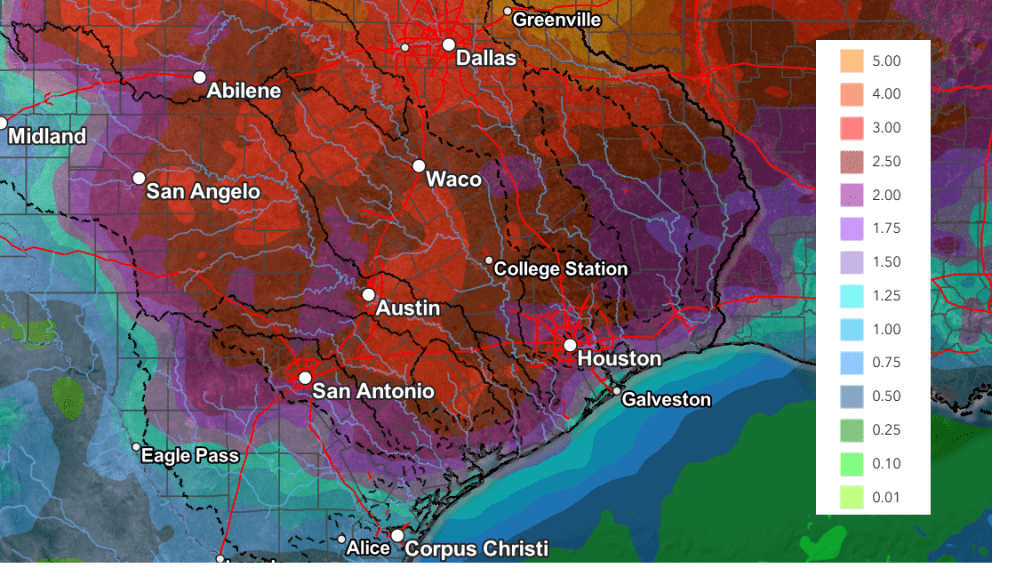
The National Weather Service’s rainfall forecast through 7 pm next Friday calls for widespread totals of 2-4 inches, with some pockets of 3-5 inch totals possible.
NWS Rainfall Forecast Valid through 7 pm Next Friday:
Stay tuned for additional updates as the forecasts get a better handle of this changing weather pattern.
Have a great weekend!
Bob
Social Media