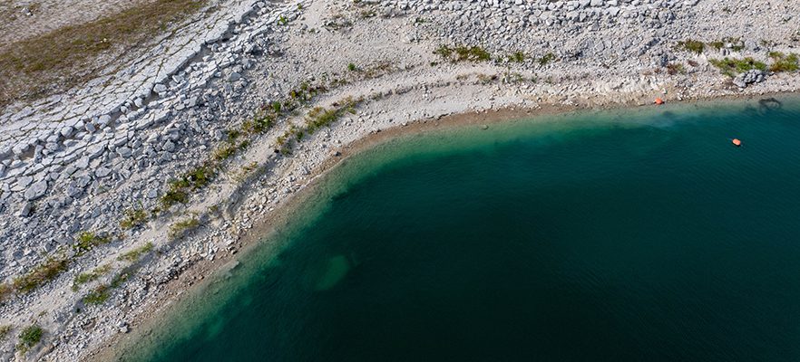
Managing the Highland Lakes Through Drought

Lakes Buchanan and Travis, the region’s primary water supply reservoirs, continue to be stressed by several years of serious drought conditions.
Lakes Buchanan and Travis are part of the chain of Highland Lakes on the Colorado River northwest of Austin. Lakes Buchanan and Travis were designed to fluctuate, capturing water during rainy times and holding it for use when the weather turns drier. The lakes have provided a reliable water supply for Central Texas since Lake Travis was completed in the 1940s.
The last time lakes Buchanan and Travis were full was in July 2019.
Drought and the lower Colorado River basin FAQs
Levels in lakes Travis and Buchanan can vary significantly from year to year, or even month to month. That’s how the lakes were designed – to fluctuate as they go up while capturing water during rainy times and going down during drier times as water evaporates and is used by people, businesses and industries.
Throughout the history of the Highland Lakes, levels in lakes Travis and Buchanan are almost always rising or falling; the lakes are not constant-level lakes.
What happens if this drought continues?
If the drought continues and the combined storage of lake Buchanan and Travis falls to 750,000 acre-feet, or about 37.5% of capacity, LCRA will move into Stage 3 of its Drought Contingency Plan. At that point, LCRA would require its firm water customers to implement additional drought response measures, including prohibiting operation of automatic or manual sprinkler irrigation systems or restricting systems to no more than 6 hours per week, with a goal of reducing water use by 25%.
Why does LCRA release water from the Highland Lakes dams during a drought?
Water is moved downstream through the dams to meet water supply needs even during a drought. Cities throughout Central Texas, including Austin, Burnet, Cedar Park, Dripping Springs, Leander, Horseshoe Bay, Marble Falls and Pflugerville depend on water released through dams along the Highland Lakes.
As a regional water provider, LCRA provides “firm” water to wholesale customers such as cities and power plants, and to maintain environmental flows in the lower river and Matagorda Bay. LCRA also provides “interruptible water” for agriculture (primarily rice farming) in Wharton, Colorado and Matagorda counties near the Texas Gulf Coast under criteria set out in LCRA’s state-approved Water Management Plan. LCRA has cut off stored water from the Highland Lakes to most interruptible customers since July 2022. Read more about LCRA’s water supply operations.
Am I required to limit my water use?
Yes, many communities have watering restrictions in place, and your water provider may impose additional restrictions if the drought continues.
LCRA’s Drought Contingency Plan outlines when its wholesale customers such as cities and industries are required to cut back water use during a drought.
Those customers have specific plans that apply to their end-use customers, including residences and businesses. As drought conditions worsen, these plans cut back on certain uses, such as outdoor watering. Check with your local water provider for details on how water use restrictions may apply to you.
What can I do to save water?
See WaterSmart Tips, Tools and Resources for ways to save water. LCRA also offers several programs to encourage water conservation:
- WaterSmart Rebates can help offset the cost of upgrading irrigation systems, maintaining landscapes and pools, and testing your soil.
- WaterMyYard offers recommendations on how long to run irrigation systems efficiently while maintaining healthy lawns.
LCRA is encouraging everyone to implement water conservation habits and efficient, non-wasteful water use now. We can’t control how much it rains or how much water from the lakes evaporates, but we can control how much water we use.
Lake levels
How full are the lakes?
LCRA now in Stage 2 of its drought response
Under Stage 2 conditions, LCRA is requiring its firm customers – mostly cities, industries and retail water providers – to implement additional water-saving measures, including limiting outdoor watering to no more than once per week, with a target demand reduction goal of 20%. Each firm water customer decides what conservation measures to enact and how to enforce them.
LCRA moved to Stage 2 under the Drought Contingency Plan for Firm Water Customers because on March 1, 2025, the amount of water in lakes Buchanan and Travis was below 1.1 million acre-feet, and the prior three months of inflows were less than the 25th percentile of historic inflows for that three-month period.
LCRA would return to Stage 1 if combined storage of lakes Buchanan and Travis increases to more than 1.1 million acre-feet, or about 55% of capacity. LCRA would move to Stage 3 if combined storage falls to 750,000 acre-feet, or 37.5% of capacity.
LCRA was last in Stage 2 of its drought response from August 2023 through June 2024.
No Highland Lakes water available for most interruptible agricultural customers for third straight year
LCRA determined no water from the Highland Lakes will be available for most interruptible customers in 2025, following provisions in the Water Management Plan. Interruptible customers are agricultural customers in the lower basin that purchase water that can be cut back or cut off during droughts. Read the March 3 news release.
Read more about LCRA’s water supply operations and why LCRA releases water from the Highland Lakes.
Current conditions
River Operations Report
Daily report on routine water supply operations at the dams.
Inflows into lakes Buchanan and Travis (.pdf)
June inflows totaled 117,940 acre-feet, which is about 76% of the June historical average and about 147% of the June historical median.
Hydromet
Interactive map and reports on rainfall and more.
Lake levels
Current lake level information.
Basin streamflow summary
Current streamflow data in the basin.
Historical lake levels
Daily lake levels and combined storage (.pdf)
Lake Buchanan (.xls)
Inks Lake (.xls)
Lake LBJ (.xls)
Lake Marble Falls (.xls)
Lake Travis (.xls)
Lake Austin (.xls)


Social Media