A High Fire Danger Will Continue Through Thursday
FEB. 25, 2026
Near Critical fire weather conditions are in place across the region on this Wednesday due to gusty southerly winds up to 25 mph and very low relative humidity readings. These high fire danger conditions look to continue into the evening hours before relative humidity readings rise late evening and overnight.
Near critical-to-critical fire weather conditions are forecast to develop again across the region again on Thursday. Forecasts call for a Pacific cold front to sweep southeast out of the Hill Country Thursday morning and spread southeast through the Austin and Central Texas area Thursday afternoon. While no noticeable change in the temperature is forecast with the front, the front is expected to bring in more dry air and cause gusty northerly winds to near 20 mph. With dry to critically dry vegetation in place, a very high fire danger is forecast.
The National Weather Service has posted a Red Flag Warning for the Hill Country just west of Austin, including Burnet, Llano, Gillespie, Blanco, Kerr, Kendall, and Bandera Counties for the hours between 11 am and 7 pm.
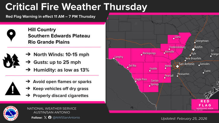
For the rest of the region, near critical-to critical fire weather conditions are forecast Thursday.
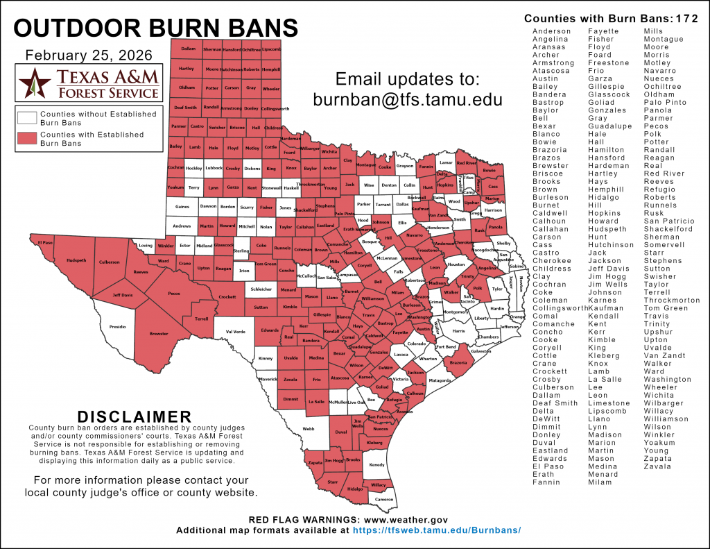
Everyone is urged to avoid open flames, keep vehicles off dry grass, use grills only on pavement, properly discard cigarettes, and obey burn bans! Most counties across Central Texas and the Hill Country have outdoor burn bans in place.
Bob
Social Media