Showers and Scattered Thunderstorms Will Continue through Late Next Week
May 22, 2026
We remain in an active and wet weather pattern that looks to remain in place through late next week. The latest complex of rain and thunderstorms that spread across the northern half of the Hill Country Thursday evening produced areas of intense rain, resulting in widespread totals of 0.5 to 2 inches. LCRA’s Hydromet showed a couple of isolated totals to near 3 inches. For most locations to the southeast of Austin, the rain stayed north, resulting totals of less than a tenth of an inch.
Friday is expected to be a drier day as sinking air spreads over the area in the wake of Thursday evening’s storms. There will be a 20 percent chance for a few scattered afternoon showers or isolated thunderstorms due to lingering moisture and atmospheric instability. However, no organized or widespread storm systems are forecast. Under a partly cloudy sky, expect the temperature to climb to the mid and upper 80s.
Friday evening, forecasts call for scattered thunderstorms to develop along the dry line across the Concho Valley and West Texas in advance of a trough of low pressure moving into Far West Texas and the southern Plains states. The thunderstorms are predicted to spread east to the Edwards Plateau and western Hill Country region late Friday evening, then diminish around midnight. For most locations, there will be a 20 percent chance for a few scattered showers or thunderstorms after midnight.
An unsettled weather pattern is forecast to remain in place through the weekend and next week. Saturday through Sunday, forecasts call for the West Texas trough to slowly track east, with several weak disturbances rotating through the main trough. With a very moist air mass in place, these small waves of low pressure will likely cause the development of numerous rain showers and thunderstorms across the region. Timing out these disturbances and the resultant thunderstorms is extremely difficult. Generally speaking, the chance for rain will be near 50-60 percent both Saturday and Sunday, falling to 30 percent on Memorial Day.
The Weather Prediction Center’s rainfall forecast shows the highest totals of rain occurring Saturday afternoon through Saturday night, with widespread totals of 1-1.5 inches possible. Totals of 0.25-0.5 inches are forecast for Sunday. Totals are predicted to average less than a quarter inch on Monday.
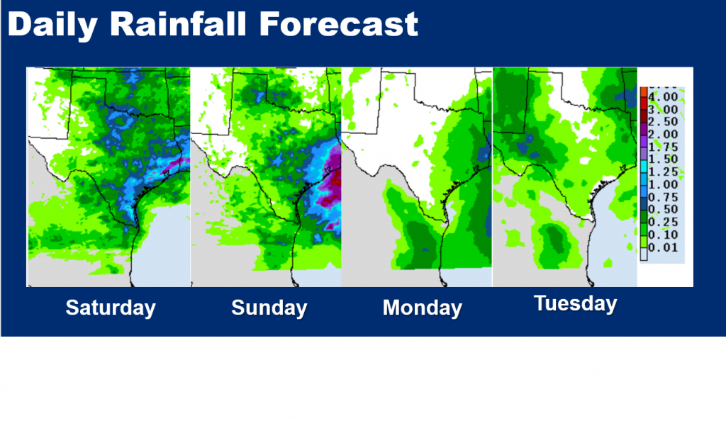
According to the National Weather Service, total rain amounts through Monday are forecast to generally average between 1 and 2 inches, with isolated totals of 3-4 inches possible.
NWS Rainfall Forecast Valid through 7 pm Monday:
The threat for severe thunderstorms through Memorial Day appears low. Daily high temperatures through Monday are predicted to be in the mid and upper 80s.
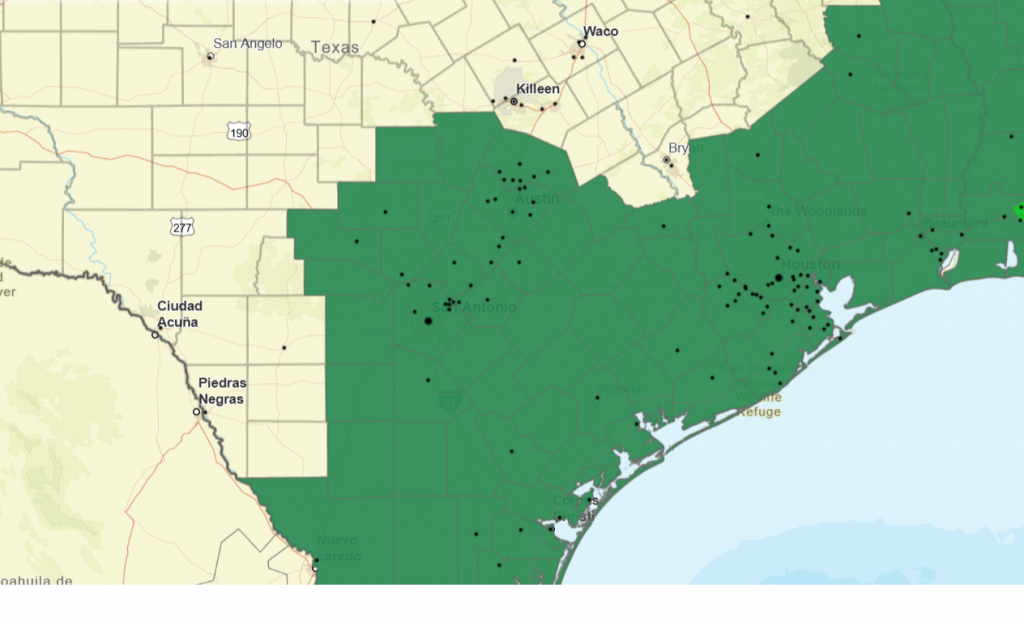
With the ground wet from recent rains, additional rains through the weekend could cause rapid runoff, leading to flash flooding. The National Weather Service has posted a Flood Watch through Monday morning for the counties highlighted in green.
Flood Watch 7 pm Friday through 7 pm Monday:
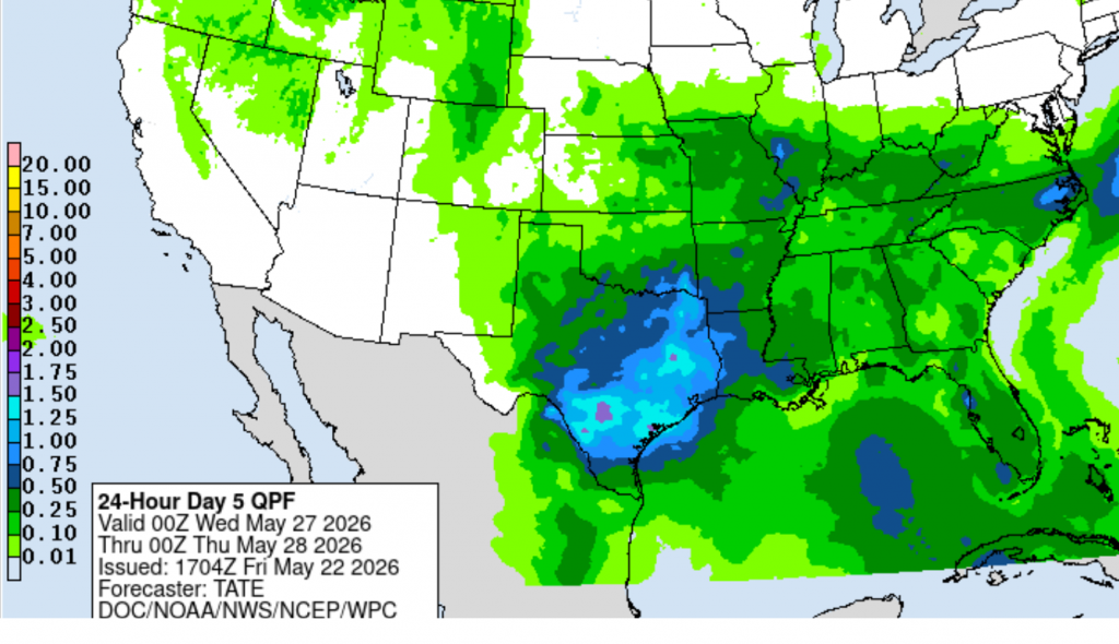
For next Tuesday through Friday, a daily chance for showers and thunderstorms looks to continue due to lingering deep tropical moisture and weak atmospheric lift. A somewhat higher chance for rain and storms is predicted for Tuesday and Wednesday as the next upstream trough of low pressure moves across Texas. This system has the potential to bring another 1-2 inches of rain to much of the area over these two days. Totals of 0.25 to 0.5 inches are forecast for Thursday and Friday.
High temperatures next week are forecast to remain mostly in the upper 80s.
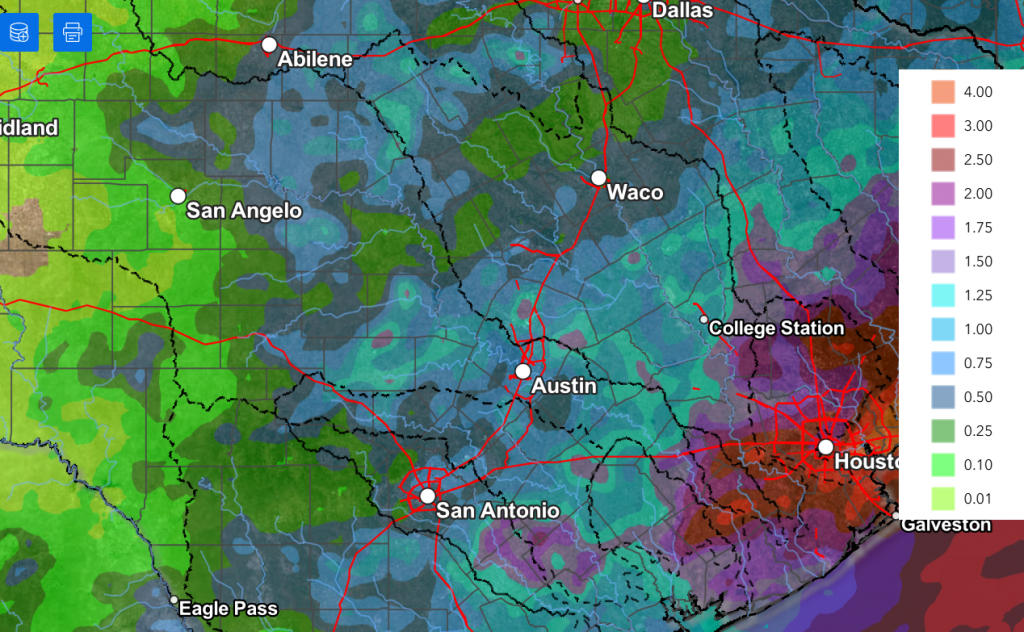
NWS Rainfall Forecast 7 pm Tuesday through 7 pm Wednesday:
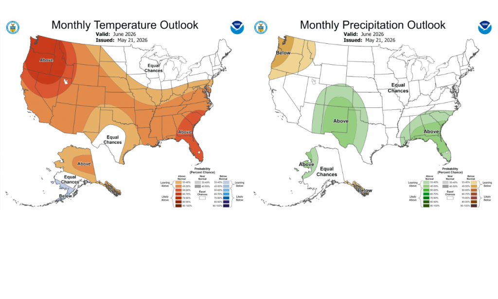
Updated Climate Outlook for June
NOAA’s Climate Prediction Center issued its monthly climate outlook update Thursday, including the update for June. The latest June prediction calls for no clear trend for rainfall across the eastern half of Texas. However, the outlook leans toward above normal rain for the western half. The temperature outlook leans toward above normal for areas east of Interstate 35 but shows no clear trend for the Hill Country and much of West Texas.
A somewhat unsettled weather pattern looks to continue through June, offering up more opportunities for rain and less hot temperatures.
Wishing everyone a safe and happy holiday weekend!
Bob
Social Media