Potential Tropical Cyclone One Develops
June 16, 2026
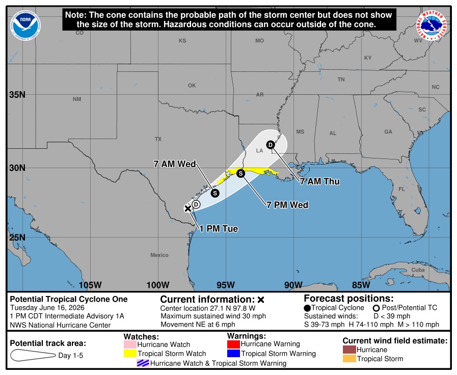
The low pressure system that has been over northeastern Mexico for the past few days has now moved into southern Texas. While the system is producing widespread rain and thunderstorms, it still lacks a well-defined center. Most of this morning’s forecast guidance suggests it will move offshore tonight, with winds increasing to tropical-storm-force on Wednesday. With this in mind, the National Hurricane Center has begun issuing advisories on Potential Tropical Cyclone One. (A potential tropical cyclone is a weather disturbance that has not yet officially formed into a tropical depression or tropical storm but poses a threat of bringing tropical-storm or hurricane-force winds to land areas within 72 hours).
The upper-level environment is not particularly conducive for this system to intensity very much. However, there is enough support in the upper atmosphere to cause large-scale deepening, so some intensification is expected.
As of 1 pm CDT, the low pressure area was centered about 55 miles southwest of Corpus Christi. The system was moving toward the northeast near 6 mph, and this general motion with an increase in forward speed is anticipated over the next couple of days. The disturbance should move offshore the Texas coast tonight or early Wednesday, move roughly parallel to the upper Texas coast later on Wednesday, and move back inland in extreme eastern Texas or southwestern Louisiana late Wednesday or early Thursday.
- Maximum sustained winds are currently near 30 mph with higher gusts. The disturbance is forecast to gradually strengthen and could become a tropical storm early on Wednesday. Weakening is anticipated on Thursday after the system moves back on land.
- A Tropical Storm Watch has been issued for the northwestern Texas Gulf Coast from Sargent, Texas, to Morgan City, Louisiana. A Tropical Storm Watch means that tropical storm conditions are possible within the watch area, in this case, within 24 to 36 hours.
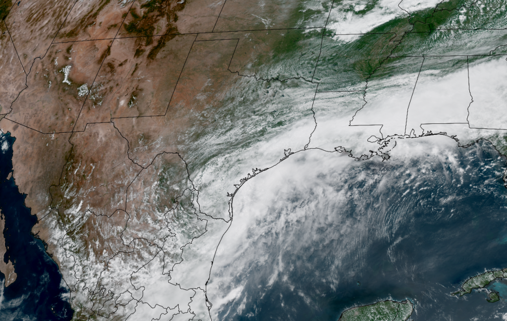
NOAA/Colorado State University/CIRA 06/16/26 12:50 pm
This system is not expected to have any direct impact on the weather across the Hill Country or the Austin/Central Texas area. While some light to moderate rain showers may spread north into the area Tuesday afternoon, rain amounts are forecast to remain below a half inch.
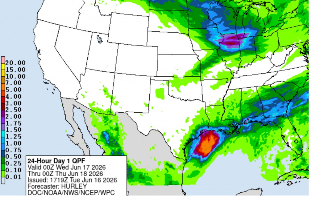
The main impacts from this system are expected to occur across the coastal region–Gonzales, Lavaca, Fayette, Washington Counties, and areas south to the coast. Periods of moderate to heavy rain are forecast across this area Tuesday through Wednesday, with the chance for rain decreasing on Thursday. A Flood Watch has been posted this region through Thursday morning. Rain amounts through Thursday are forecast to be in the range of 4-8 inches. Some isolated totals up to 12 inches will be possible towards the coast. Southerly winds with gusts to around 25/30 mph are forecast Tuesday night through Wednesday.
NWS Rainfall Forecast Valid through 7 pm Thursday:
Bob
Social Media