

No Break from the Hot and Dry Pattern Expected Anytime Soon
AUG. 7, 2026
Our region remains in the grips of a very persistent hot and dry weather pattern thanks to the presence of a broad ridge of high pressure, or heat dome, covering the southwestern and south-central U.S. Friday’s weather maps showed the center of the heat dome located just west of the Four Corners. Sinking air underneath the heat dome is keep the weather dry and quite hot across all of Texas.
With the strongest part of the heat dome currently located over the Desert Southwest, conditions have recently become a little more favorable for a few rain showers and isolated thunderstorms to develop along the sea breeze front in the afternoon and early evening. A low probability for spotty rain showers and isolated thunderstorms is forecast for the coastal plains extending inland to near Interstate 35 Friday afternoon through Monday afternoon. The probability for rain will only be near 20-30 percent, and most areas will likely see little to no rain. Totals, if any, should average less than a quarter inch. Locations along and to the west of Interstate 35 will likely stay dry through early next week.
Little change in the temperature is forecast through the weekend.
- Daily high temperatures are forecast to be in the mid and upper 90s across the Hill Country, the upper 90s to 101 degrees across Central Texas, and in the mid-90s across the coastal plains
Next week, the Desert Southwest heat dome is forecast to weaken significantly. At the same time, though, a new heat dome is forecast to develop across the southeastern U.S. and the western Gulf. This heat dome will quickly cover most of Texas and produce more sunny, dry, and very hot weather. With the heat dome setting up closer to our area, the possibility for sea breeze showers is forecast to diminish beginning Tuesday.
- High temperatures next week are forecast to be in the upper 90s across the Hill Country and coastal regions, and near 100-102 degrees across Central Texas
Longer-range forecasts looking out into the week of August 17th call for few changes. The center of the heat dome is predicted to set up over Texas, causing continued hot and dry weather.
Tropical Weather Outlook
Weather conditions remain very quiet across the tropical Atlantic and tropical cyclone development is not expected through early next week.
It’s interesting to note some of the global dynamical models are suggesting the possibility of a tropical system developing across the far eastern Atlantic sometime next week. However, some of the newer AI models are less confident on anything developing. Environmental conditions across the tropical Atlantic remain generally unfavorable for tropical development at this time. Stay tuned for further updates.
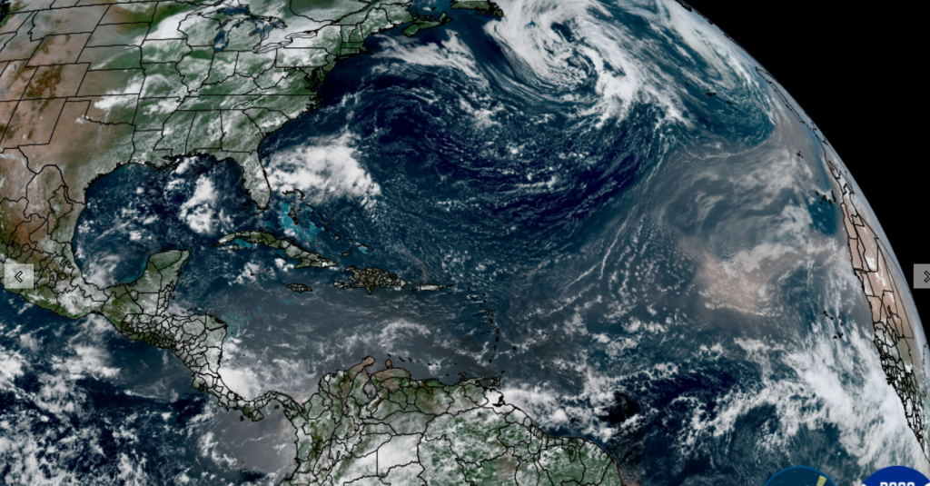
NOAA/Colorado State University 08/07/26 12:00 pm CDT
Perseid Meteor Shower Next Week
Mark your calendar for the mornings of August 12th and 13th. One of the best meteor showers of the entire year, the Perseids, will be at peak. The best time to watch the Perseid meteor shower will be midnight through dawn on August 12 and 13. The sky will be moon-free. And since the Perseids are often bright, you might see between 50 and 100 meteors per hour. Remember, even one bright meteor can make your night!
The August Perseid meteor shower is rich and steady, from early August through the peak. The meteors are colorful and many of them are bright. And they frequently leave persistent trains. All of these factors make the Perseid shower perhaps the most beloved meteor shower for the Northern Hemisphere.
Have a great weekend! Remember to stay cool and hydrated!
Bob
Social Media