

Monday Update on Potential Tropical Cyclone Five
AUG. 31, 2026
The disturbance over the northern Gulf showed modest signs of organization overnight and this morning. Coastal radars indicate the system is producing a large area of showers and thunderstorms offshore of the Texas and Louisiana coasts. Satellite data from overnight indicated the circulation still lacked definition on the western side, and recent surface observations from the Air Force Hurricane Hunters suggest the center is still elongated and ill defined. However, given the expectation the system will become a tropical cyclone, and the risk of tropical storm conditions for portions of the northwestern Gulf Coast, the NHC has begun issuing advisories for Potential Tropical Cyclone Five.
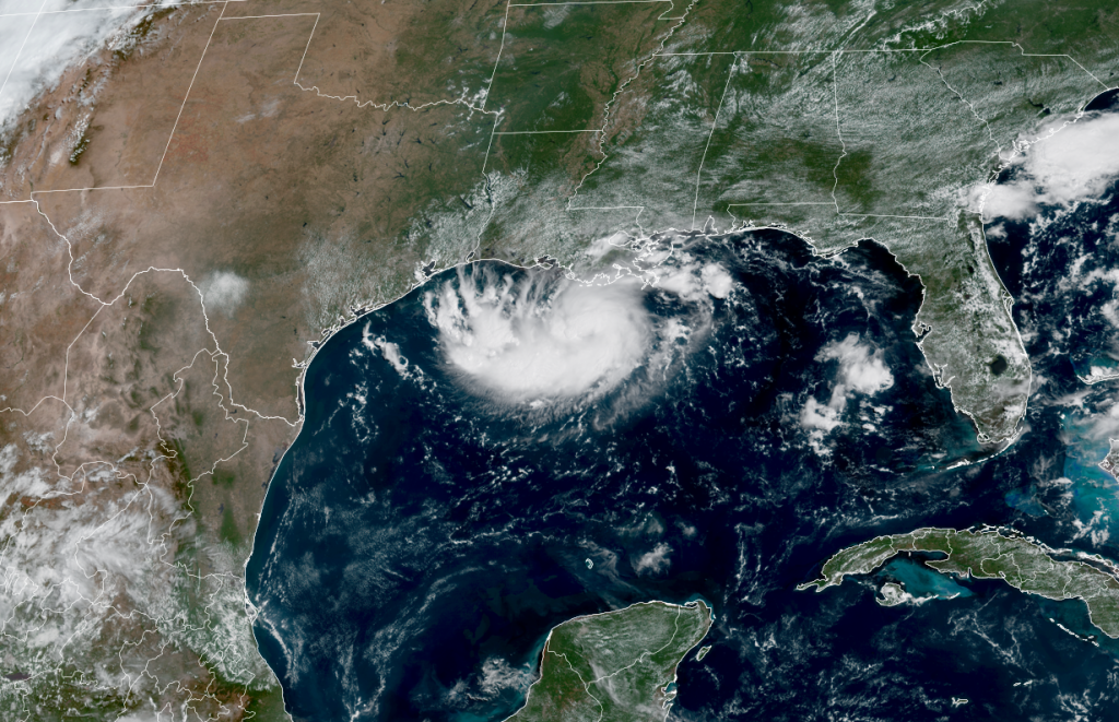
NOAA/Colorado State Universiy/CIRA 08/31/2026 11 am CDT
As of 10 am CDT, the disturbance was centered near over the northwestern Gulf, about 230 miles southeast of Port Arthur, Texas. The system is being steered to the west-northwest at about 5 mph by the large heat dome centered over the Middle Mississippi Valley. This general motion is expected to continue into Tuesday. NHC forecasters are calling for the system to make landfall along the upper Texas coast, just east of Galveston Bay, sometime Tuesday afternoon.
- A Tropical Storm Warning has been issued for the northwestern Gulf Coast from Port Bolivar, Texas, to the Vermilion/Cameron Parish Line in Louisiana.
Maximum sustained winds are currently near 35 mph with higher gusts. Additional strengthening is expected Monday afternoon, with the system forecast to become a tropical storm by Monday night. (the next name on the list is Edouard)
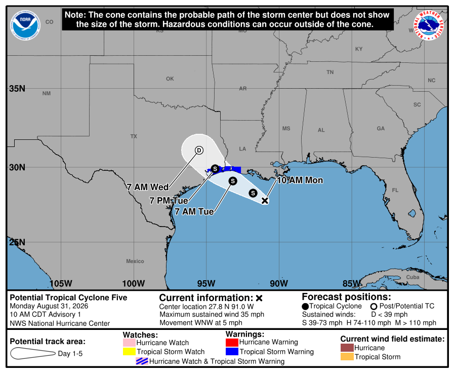
- This tropical system is not expected to have any significant impact on the weather across the Hill Country or the Austin/Central Texas region
The heaviest rains associated with the tropical system are forecast to occur over southeast Texas, generally along and just to the east of Interstate 45. Some showers and scattered thunderstorms associated with the disturbance are expected to spread over the middle Texas coast, including Fayette County, beginning Tuesday night, continuing through Wednesday. The probability for rain here will be near 40-50 percent, with rain amounts generally in the range of 0.25 to 0.5 inches. A few spotty, light showers may extend as far west as the I-35 corridor on Wednesday.
NWS Rainfall Forecast Valid through 7 am Thursday:
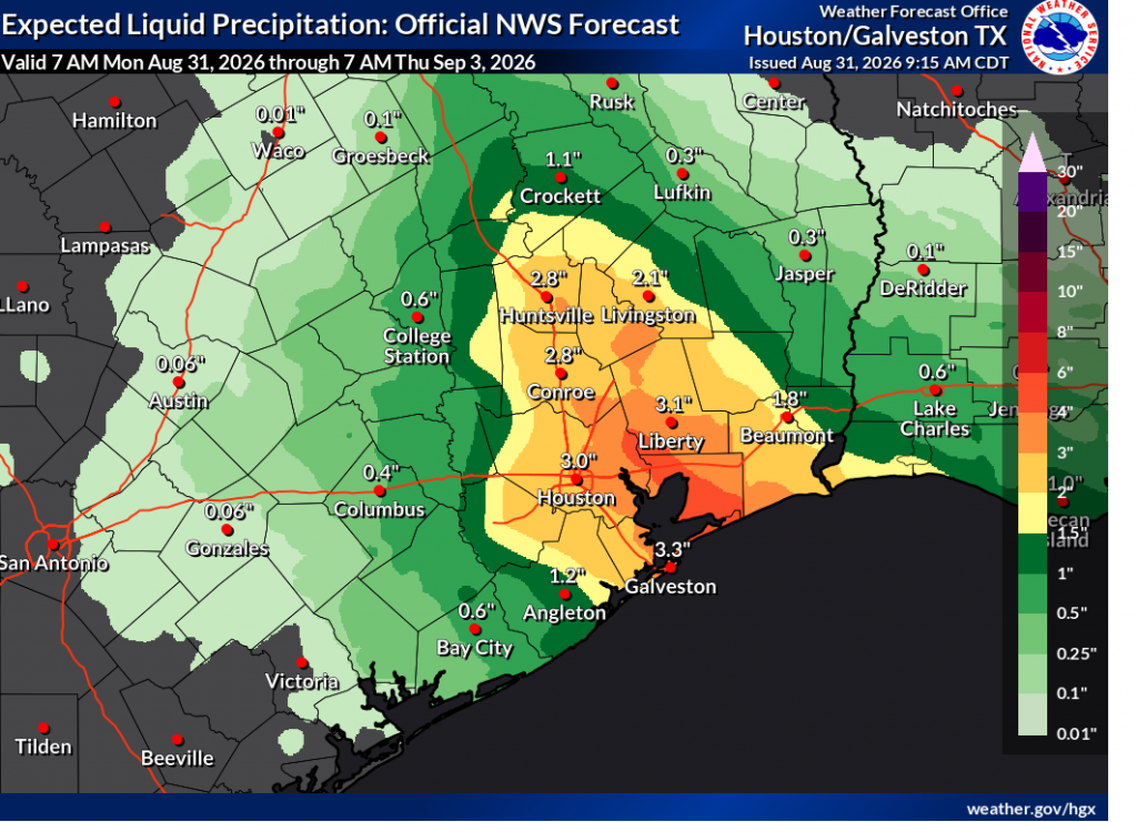
Once inland, the storm’s remnant center is forecast to slowly move northwest across East Texas, arriving near the Dallas/Fort Worth Metroplex on Thursday. The system is forecast to pull an area of higher moisture inland all the way to the I-35 corridor for Thursday and Friday. As a result, there will be a slight chance for scattered afternoon rain showers for the area east of Interstate late week.
This weekend, the center of the heat dome is forecast to move back to the southern Plains, ending the chances for rain while at the same time, keeping high temperatures close to the century mark.
Bob
Social Media