

A Line of Strong to Severe Storms Will Spread Over the Area Tuesday Night
May 26, 2026
Forecasters are closely monitoring a line of thunderstorms across West Texas that as of 1 pm stretched from Big Spring, to Ozona, to northwest of Del Rio. The line of storms is moving steadily to the east and is expected to reach the western counties of the Hill Country between 3 pm and 6 pm. The storms are predicted to spread across the eastern Hill Country and the Interstate 35 corridor this evening and toward midnight, and locations east of I-35 between midnight and 6 am Wednesday. The storms should push off the middle Texas coast around daybreak Wednesday.
Some of the storms withing this line may be strong to severe—especially across the Hill Country region.
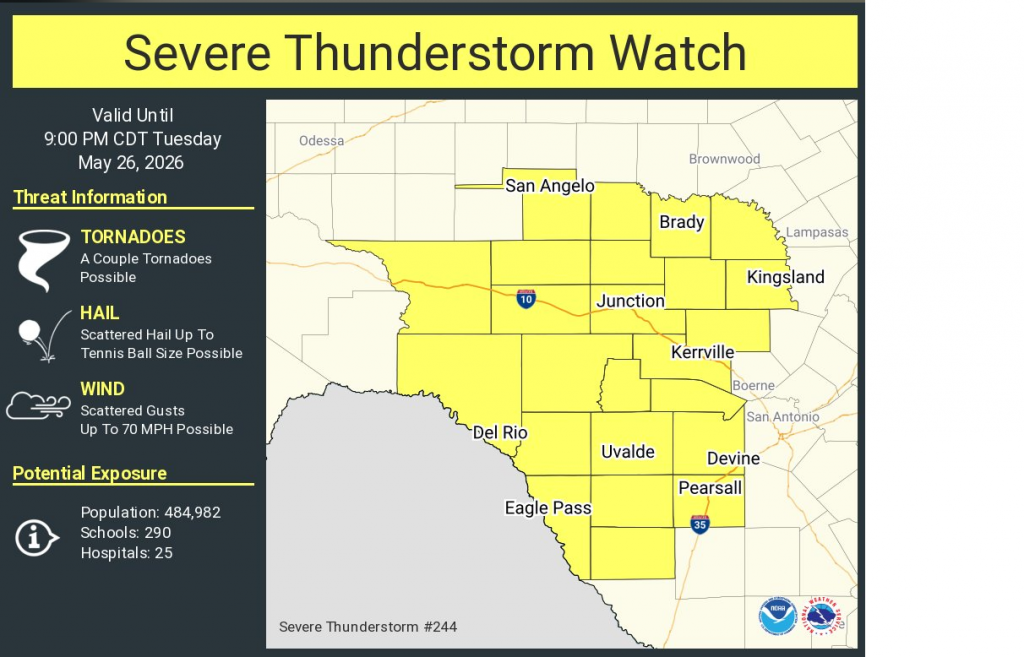
With this in mind, the Storm Prediction Center has posted a Severe Thunderstorm Watch for the western and central counties of the Hill Country through 9 pm. Very large hail, damaging winds to near 75 mph, and deadly lightning will be the primary severe weather threats.
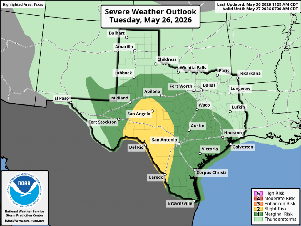
The Storm Prediction Center has placed the eastern Hill Country and the remainder of the region under a 1 out of 5 risk for severe storms this evening and overnight.
The area of rain and storms is expected to bring widespread, soaking rains to much of the region. Since the ground is still wet from recent rains, any additional rain is expected to runoff quickly. Because of this, the NWS has posted a Flood Watch for the Hill Country and the Austin/Interstate 35 corridor through Wednesday morning. Totals of 1-3 inches with isolated pockets of 5 inches are predicted for areas within the Flood Watch.
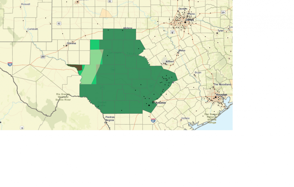
Flood Watch through 8 am Wednesday Morning for Counties Highlighted in Green:
Totals through Wednesday across the rest of the region morning are forecast to generally be between 1 and 2 inches with isolated heavier totals.
A chance for additional showers and scattered thunderstorms will continue Wednesday afternoon through Thursday, but rain amounts are expected to average less than a half inch.
I urge everyone to stay weather aware this afternoon and overnight. Have multiple methods to receive severe weather warnings and alerts from the National Weather Service.
Bob
Social Media