

A Slight Chance for Showers and Storms through the Weekend. No Break from the Heat
SEPT. 3, 2026
Although Tropical Storm Edouard dissipated Wednesday, the remnants of this system along with an enhanced area of moisture flowing inland from the Gulf are expected to bring scattered rain showers and thunderstorms to much of the region through Labor Day, and possibly all the way to the middle of next week. The temperature looks to stay quite hot over the upcoming week, but fewer triple-digit temperatures are expected.
As of early Thursday afternoon, the remnants of Tropical Storm Edouard were located across north Texas, over the area between Bryan and Corsicana. Edouard’s remnants and area of enhanced tropical moisture have run into a zone of very weak steering currents and are predicted to remain nearly stationary through Thursday evening. Thursday night through Friday, Edouard’s remnants and associated moisture are forecast to weaken while at the same time drift slowly to the west across the northern counties of Central Texas and the Hill Country. The storm remnants are forecast to dissipate completely across southwest Texas on Saturday.
- For Thursday afternoon and Thursday night, there will be a 20-30 percent chance for scattered rain showers and thunderstorms across the entire region due to the proximity of the remnant low and high atmospheric moisture levels. For areas that see rain, totals are predicted to generally average between 0.25 and 0.5 inches. Isolated totals to around an inch will be possible.
- Do note, some of the high-resolution forecast solutions show the possibility for more widespread and heavier rains developing across the northern Hill Country and northern counties of Central Texas, including the Austin metro, late Thursday night into Friday morning, generally north of a line stretching from La Grange, to New Braunfels, to Llano. Across this general area, slow-moving storms will have the potential to produce totals of 1-3 inches.
- For Friday morning and Friday afternoon, forecasts show a 40-50 percent chance for scattered rain showers and thunderstorms as the remnant area of tropical moisture covers the area and slowly drifts to the west. Rain amounts are forecast to generally average between 0.25 and 0.5 inches, with isolated totals to near 1 inch. With a partly to mostly cloudy sky in place, expect high temperatures to be in the mid-90s
Saturday through next Tuesday, forecasts call for a slight chance for scattered mainly afternoon and evening showers and thunderstorms across Central Texas and the middle Texas coast as a very moist flow continues off the Gulf and the sea breeze remains active. Spotty totals to around a quarter inch will be possible each day. Expect a mostly sunny sky through the period. Daily high temperatures are predicted to hold mostly in the upper 90s.
Looking out into the second half of next week and next weekend, forecasts call for few changes as the heat dome remains over the region. Little to no rain is forecast. Daily high temperatures look to continue near 98-100 degrees.
Tropical Weather Outlook
Weather conditions are quiet across the tropical Atlantic and tropical cyclone development is not forecast over the next seven days. According to climatology, the peak of the hurricane season occurs on September 10th.
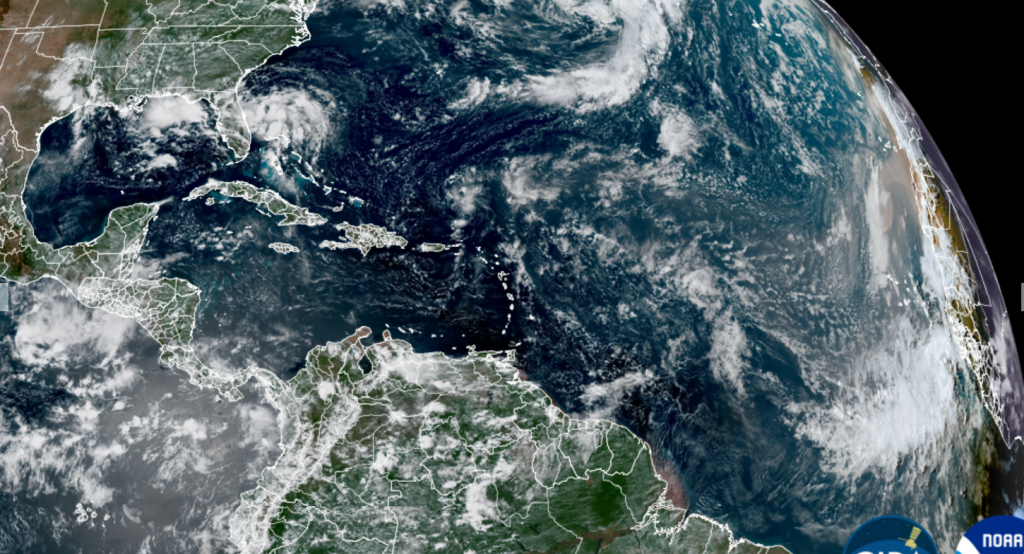
NOAA/Colorado State University/CIRA 09-03-26 1:20 pm CDT
A Very Hot August
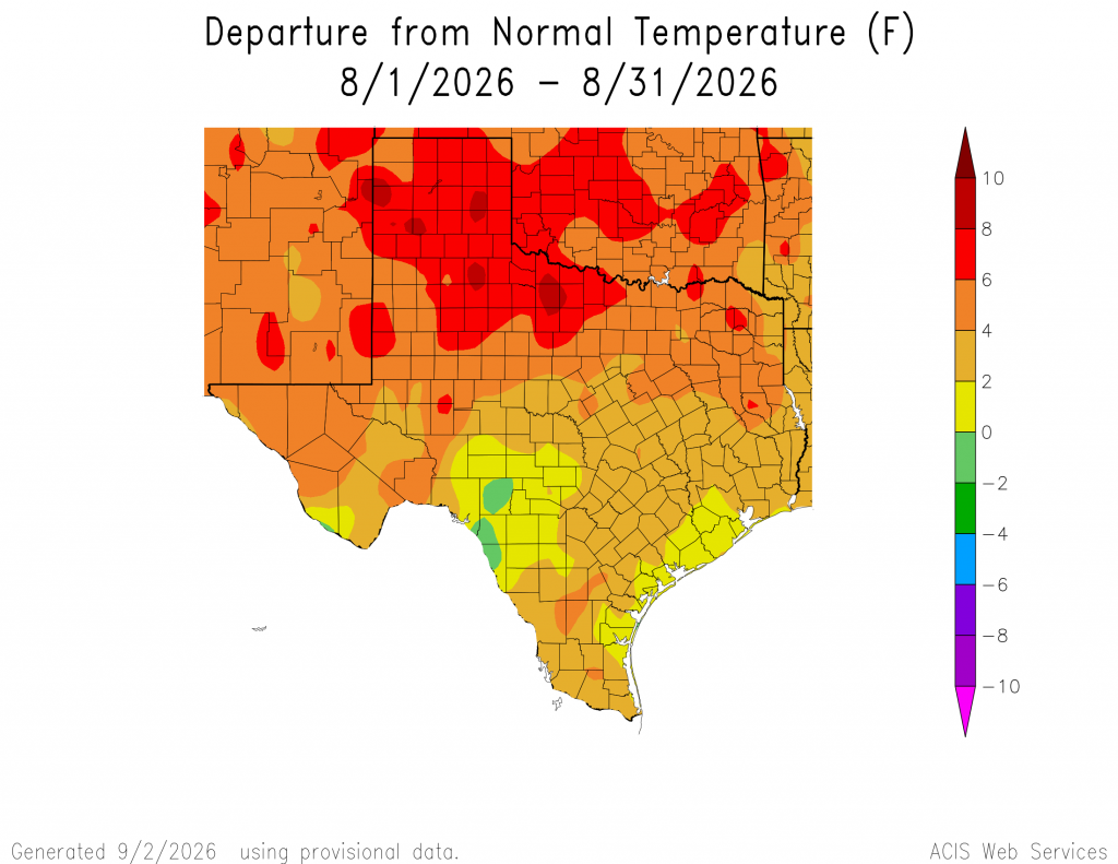
August was a miserably hot month across Texas and the Colorado river basin, with the temperature averaging between 2 and 4 degrees above normal. In Austin, Camp Mabry recorded an average temperature of 89.4 degrees, which was 2.9 degrees above normal. The average high temperature was 102.1 degrees! 29 of the 31 days recorded high temperatures at or above 100 degrees. August 2026 ranked as the 5th hottest August on record, dating back to 1897.
Wishing everyone a safe and relaxing Labor Day weekend!
Bob
Social Media