Colder Temperatures Expected this Weekend with Milder Readings Returning Early Next Week
JAN. 30, 2026
After a nice warmup Thursday afternoon, colder temperatures returned to the region Thursday night behind a strong cold front. A second surge of even colder, arctic air is predicted to spread south through the area Friday night and remain in place through the weekend. Hard freezes are predicted for Friday and Saturday nights, with Saturday being the coldest night. Fortunately, the weather pattern will remain dry through the weekend. Considerable middle and high-level clouds will be in place Friday afternoon. These clouds will clear Friday night, followed by a generally clear sky through the weekend.
Northerly winds are forecast to increase to a range of 10-15 mph with occasional gusts to 25 mph late Friday night and continue through Saturday afternoon. Wind speeds should decrease to 5-10 mph Saturday night through Sunday.
The National Weather Service has posted a Cold Weather Advisory for the entire region beginning late Friday night, continuing through late morning Saturday. The combination of the chilly air and gusty winds is expected to cause wind chill temperatures to fall between 13- and 20-degrees Saturday morning.
- Lows Saturday morning are forecast to be in the mid-20s across the Hill Country and Central Texas regions, and in the upper 20s to low 30s across the coastal plains
- Lows Sunday morning are predicted to be in the lower 20s across the Hill Country and Central Texas, with mid and upper 20s across the coastal plains
- Lows Monday morning will generally be in the mid-30s, with upper 30s across the coastal plains
- High temperatures Saturday are forecast to be in the low and mid-40s
- High temperatures Sunday will generally be in the mid and upper 50s
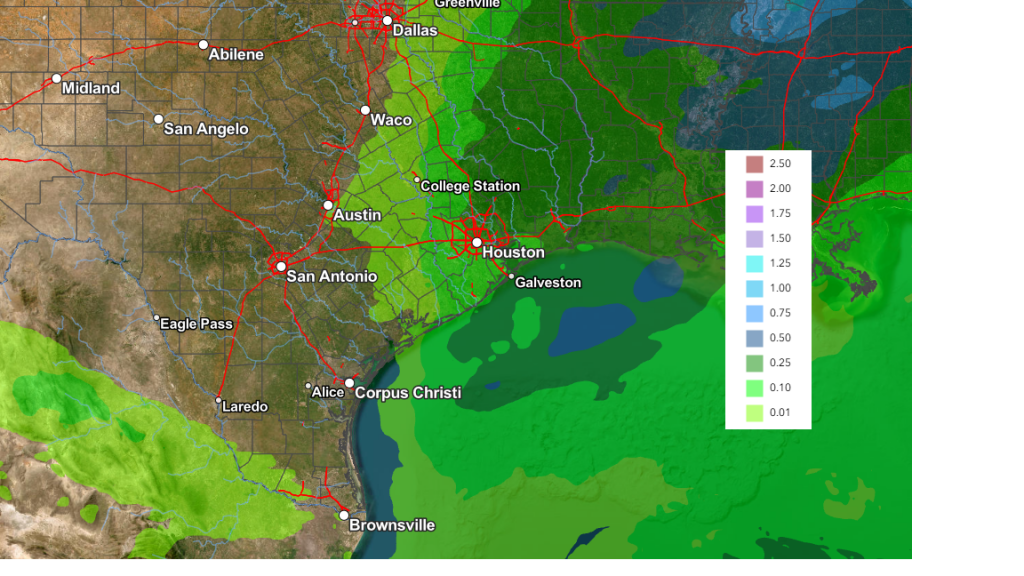
For next week, the arctic air is predicted to quickly move off to the east Monday as southerly breezes return to Texas. Milder temperatures will develop and they look to persist through late week. The sky will be sunny on Monday, but will trend mostly cloudy on Tuesday. Forecasts call for a weak trough of low pressure to push east from the Desert Southwest late Tuesday into Wednesday, pulling a meager amount of Gulf moisture north into the eastern half of Texas. There will be a slight chance for the development of a few light rain showers for locations along and east of Interstate 35 Tuesday night into Wednesday morning. Rain amounts, if any, are forecast to total well below a quarter inch. Mostly sunny and dry weather will follow Wednesday afternoon through Friday.
High temperatures Wednesday through Friday are forecast to generally be in the low and mid-60s. Readings will warm to the low 70s next weekend. Lows Thursday and Friday mornings will be in the mid and upper 30s. Lows next week are forecast to be in the 40s.
Looking out into the second week of February, a mild weather pattern looks to continue with highs in the 60s and low 70s. Lows will remain mostly in the 40s. There are some indications we could see a chance for rain develop during the second half of the week.
February Full Moon
February’s full moon will occur Sunday, February 1 at 4:09 pm CST. The moon will appear bright and full both Saturday and Sunday nights.
The February full moon is often called the “Snow Moon”, in reference to the heavy snowfall that often coats the ground this time of the year across northern locations.
Have a great weekend!
Bob
Social Media