Dry and Cooler this Weekend. Monitoring Another Chance for Rain Late Week
May 1, 2026
Wet and unsettled weather is in place across the region on this Friday as an overrunning pattern continues. Since early Thursday, waves of rain showers and scattered thunderstorms have spread from southwest to northeast across much of the state due to an approaching trough of low pressure. Totals through 7 am Friday have been highest along and just north of the Interstate 10 corridor, where widespread 3-4 inches amounts were recorded. Across the rest of the region, totals have generally averaged between 0.5 and 2 inches. As of 7 am, locations near the coast had only received a few hundredths of an inch.
NWS Estimate of Rain Falling Between 7 am Thursday and 7 am Friday:
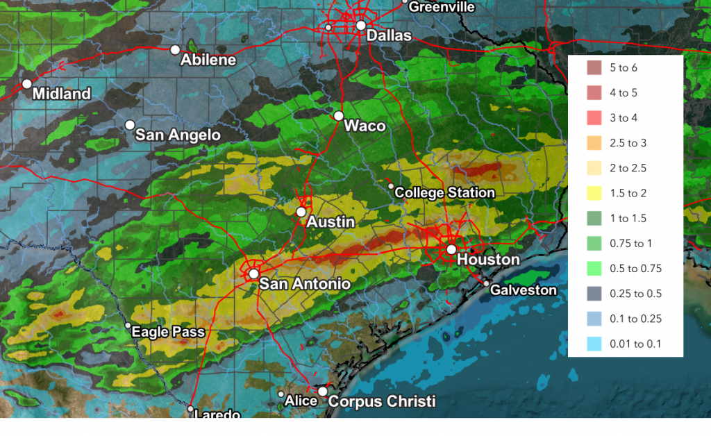
Courtesy West Gulf River Forecast Center
Additional waves of rain showers and thunderstorms can be expected Friday afternoon into Friday evening as a large trough of low pressure slowly pulls north from northern Mexico through the Texas Panhandle. Small waves of low pressure rotating around the main trough will continue pull Gulf moisture up and over a stalled cold front located along the Texas coast, resulting in additional rounds of moderate to heavy rain showers and scattered thunderstorms. Some of the rain may at times be locally heavy. The National Weather Service has posted a Flood Watch for the Hill Country, Central Texas and coastal region through Friday evening.
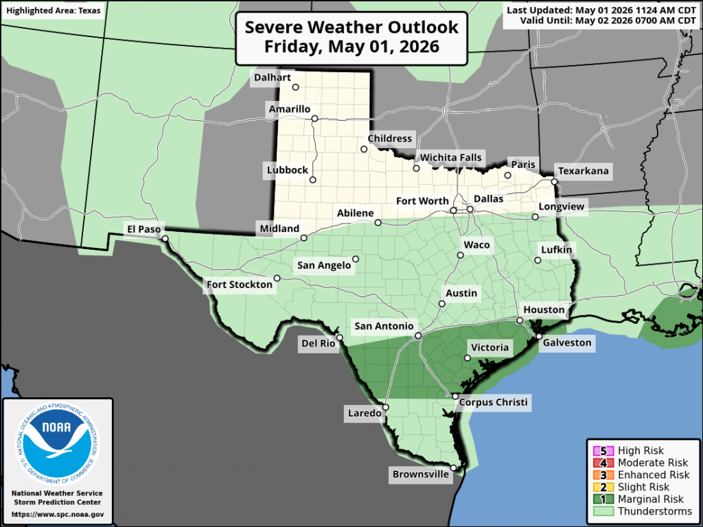
Do note that some of the storms across the coastal plains region will have a low chance for becoming strong to severe. The Storm Prediction Center has placed this region under a Marginal Risk for severe storms through Friday evening. The primary severe weather threats will be large hail and damaging winds, although a weak tornado cannot be ruled out. Elsewhere, the threat for severe storms through Friday evening will be low.
Forecasts call for the rain to taper off from west to east Friday evening as the upper trough tracks northeast of our region. All of the rain should be east of our region by about midnight. Additional rain amounts through Friday evening are predicted to average between 1 and 1.25 inches across the Hill Country, between 1 and 2 inches across Central Texas, and between 1 and 3 inches across the coastal region. The coastal area could see some isolated totals to near 5 inches.
Breezy and cooler conditions can be expected late Friday afternoon into Friday evening as a second cold front presses south through the area. Expect northeasterly winds with speeds of 10-20 mph and occasional gusts to near 35 mph Friday evening and Friday night. Clouds should clear Friday night. This will be followed by a mostly sunny sky Saturday and Sunday.
- Lows Saturday morning will generally be in the low and mid-50s
- High temperatures Saturday are forecast to be in the low 70s
- Lows Sunday morning will generally be near 48-50 degrees
- High temperatures Sunday will generally be in the mid-70s
- Lows Monday morning are forecast to be in the upper 50s
For next week, forecasts call for mostly sunny to partly cloudy and dry weather Monday and Tuesday. Warmer readings can be expected. Highs Monday are predicted to be in the low 80s. Highs Tuesday are predicted to be near 88-90 degrees.
The forecast for Wednesday calls for just a slight chance for showers and thunderstorms across the region when a weak cold front presses south and stalls across North Texas. A somewhat better chance for rain is forecast Thursday when a stronger cold front tracks south across the region. A chance for rain showers and thunderstorms looks to continue Friday into next weekend as another trough of low pressure approaches from the southwest. High temperatures late week into next weekend are predicted to fall to the upper 70s to low 80s.
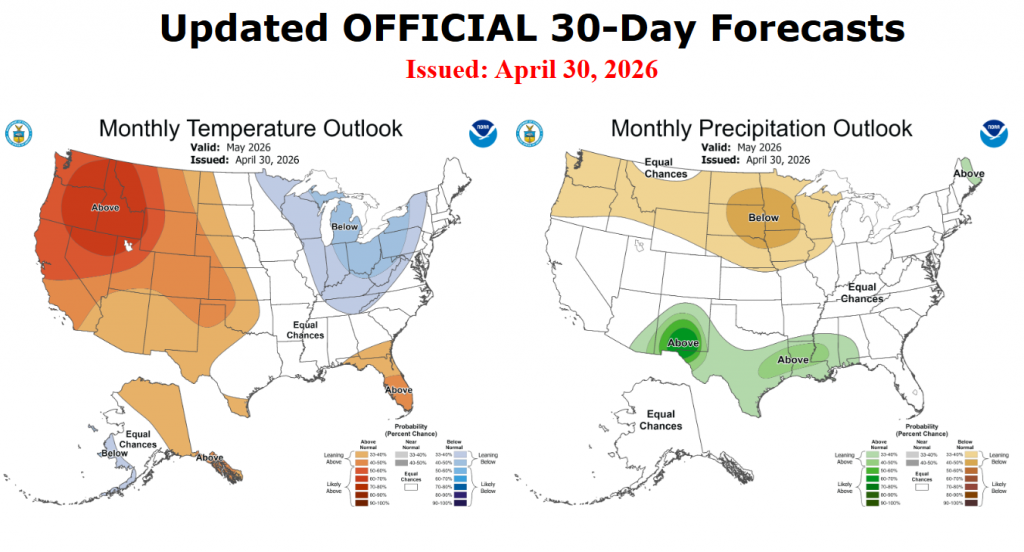
Above Normal Rainfall Predicted for May
On Thursday, NOAA’s Climate Prediction Center issued an updated outlook for the month of May. For Texas, the outlook leans toward above normal rainfall, with no clear trend for temperature. The wet pattern we saw in April is expected to continue into May. Additional cold fronts are forecast at least through the first half of the month.
Have a great weekend!
Bob
Social Media