Heavy Rain Possible Friday Evening and Friday Night
June 5, 2026
Midday forecast solutions have trended noticeably wetter for much of the area Friday evening through Friday night. A trough of low pressure lifting northeast out of northern Mexico is expected to cause the development of showers and thunderstorms across the region beginning late Friday afternoon, with the activity continuing Friday evening through Friday night. High resolution forecasts indicate developing showers and thunderstorms will be moving slowly and have the potential to move over the same area.
With the ground still wet from recent rains and an unusually moist atmosphere in place, there will be a potential for pockets of heavy rain producing significant totals, leading to excessive runoff.
The National Weather Service has posted a Flood Watch for most of Central Texas, including the Austin metro, along with Burnet County through 1 am Saturday morning.
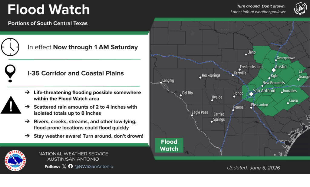
NWS forecasts call for scattered pockets of 2–4-inch totals across the watch area. Isolated totals of 6-8 inches will be possible with some of the storms that happen to train over the same area.
For the Hill Country and coastal regions, a there will also be a threat for moderate to heavy rain Friday evening and Friday night. Totals through Saturday morning are forecast to generally average between 1 and 3 inches.
The forecast for Saturday and Saturday night calls for a 50 percent chance scattered showers and thunderstorms across the region as the upper trough slowly exits to the northeast. Rain amounts are predicted to average around a half inch. The chance for rain will drop to 30 percent Sunday while the moist air mass remains across the area. Rain amounts should average less than a quarter inch.
The outlook for next week calls for mostly sunny and dry weather with daily high temperatures mostly in the low 90s.
Bob
Social Media