

Monitoring a Tropical Disturbance Over the Northern Gulf
AUG. 30, 2026
For the past couple of days, forecasters have been monitoring a strong tropical wave located over the northern Gulf, to the south of the Florida Panhandle and Mississippi. Sunday’s satellite imagery and satellite wind data indicate the system has become better organized since Saturday. Deep convection has developed near and just south of the broad circulation located over the northern Gulf.
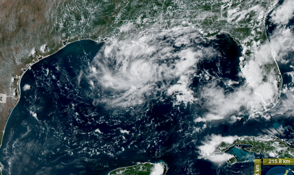
NOAA/Colorado State University/CIRA 08/30/2026 2:30 pm CDT
The National Hurricane Center indicates atmospheric conditions over the northern Gulf currently feature a low amount of wind shear and additional development of the low pressure system will be possible over the next couple of days. The probability for development is now at 50 percent. The NHC states a short-lived tropical depression or tropical storm could form before the system reaches the upper Texas or southwestern Louisiana coasts Tuesday or Tuesday evening.
The low pressure system is expected to be guided to the west by the flow along the southern periphery of a large heat dome covering most of the south central and southeastern U.S. The center of the heat dome recently shifted from Oklahoma to the middle Mississippi Valley. Most of Sunday’s forecast solutions call for the system to track to the west, eventually pushing inland somewhere over southeast Texas. The system is then forecast to curve northwest around the back side of the heat dome, reaching north central Texas mid to late week. I will caution that as the heat dome slides a little farther to the east this week, steering winds may slacken and this could result in the low pressure area drifting further west toward Central Texas. It’s very early and there’s still a bit of variance in forecasted outcomes.
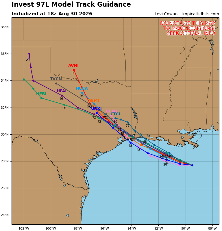
Based on the latest forecast guidance, the main impacts from this system are expected to be felt along the upper Texas coast and across southeast Texas. For the middle Texas coastal region, plus Fayette County, there will be a 40-50 percent chance for showers and thunderstorms late Tuesday through Thursday. Further inland, expect just a 20 percent chance for showers across the Austin/Central Texas area Wednesday into Thursday.
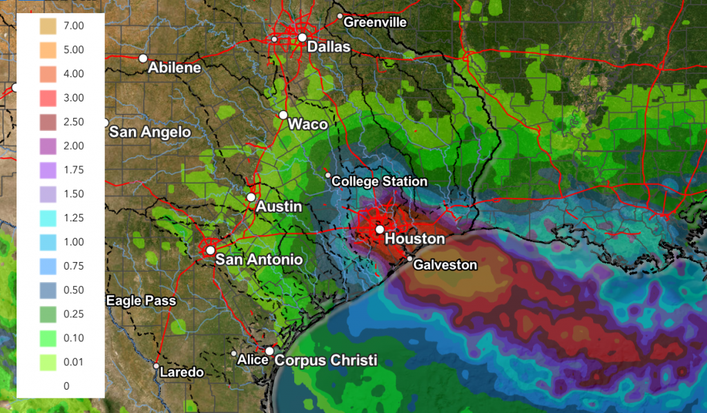
Forecasted rain amounts from this system are noted to be heaviest around the Houston/Galveston area. For the middle Texas coast, the National Weather Service is forecasting rain amounts between 0.25 and 1 inch.
NWS Rainfall Forecast Valid through 7 pm Thursday:
Stay tuned for additional updates as more atmospheric data is collected and analyzed and forecasts are generated.
Bob
Social Media