

Quiet Weather with Warming Temperatures
OCT. 19, 2026
Fall-like weather finally arrived across Texas over the weekend thanks to Friday’s cold front. For most, it was the first opportunity to wear a light jacket since last spring. Sunday morning saw the chilliest temperatures this period, with readings dropping into the 30s and 40s across the Hill Country, the 40s across Central Texas, and the low 50s across the coastal region. LCRA’s lowest gauged temperature that morning was 33 degrees, at a gauge located along Sandy Creek, in southern Llano County. In Austin, Camp-Mabry recorded a of 47 degrees while Austin-Bergstrom Airport recorded a low of 42.
Quiet weather is in place across the region as we start off the new week. A weak wave of low pressure tracking east across southern Texas out of Mexico is generating scattered middle and high-level clouds across the southern half of the state, making for a mostly sunny to partly cloudy sky. Additional scattered clouds are forecast through Monday night as the trough slowly tracks to the east.
In the upper atmosphere, the south-central U.S. has come under the influence of a large and stable ridge of high pressure that stretches from southern Mexico to Oklahoma. The ridge is forecast to remain over Texas through late week, then slowly start to move off to the east. A mostly sunny sky is forecast to develop Tuesday and continue through the late week. After being out of the north over the weekend, surface winds have now shifted back to the south and southeast. Light southeasterly breezes are forecast to remain in place throughout the week, with speeds staying generally in the range of 5-10 mph.
Afternoon temperatures will slowly trend warmer this week thanks to the southeasterly breezes. Fortunately, no 90-degree readings are forecast. Nighttime temperatures look to stay pleasant.
- High temperatures Monday are predicted to be in the mid and upper 70s, warming to the low 80s Tuesday, and the middle 80s Wednesday
- High temperatures Thursday and Friday are predicted to be in the mid and upper 80s.
- Low temperatures Tuesday through Friday morning will generally range from the mid-50s across the Hill Country to the low 60s across the coastal plains
For the upcoming weekend, few changes are expected. Mostly sunny and warm weather is expected to continue, with highs in the mid and upper 80s, and lows in the low 60s.
Looking at next week, forecasts call for mostly sunny and dry weather for Monday and Tuesday. A chance for scattered rain showers is expected to develop the second half of next week as the ridge over Texas decreases and a series of low pressure troughs begin to move in from the west. High temperatures are predicted to be mostly in the low 80s, with lows in the low and mid-60s.
Tropical Weather Outlook
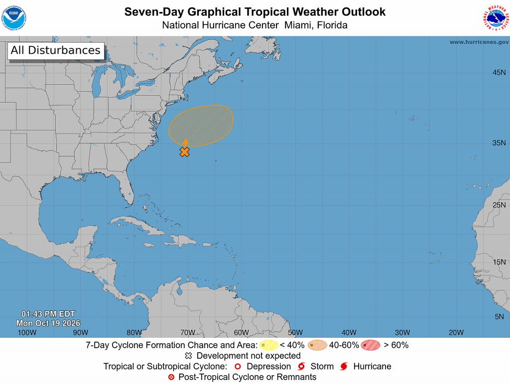
Weather conditions are quiet across the Gulf, the Caribbean Sea, and the tropical Atlantic. There are no systems in place which pose a threat for tropical development over the next seven days.
Off the East Coast of the United States, a storm-force, non-tropical low pressure area is located along a frontal boundary a few hundred miles off the southeast coast of the United States. This low is likely to move slowly north-northeastward over the next couple of days. If the low remains over the Gulf Stream and becomes detached from the front, it could briefly acquire some subtropical cyclone characteristics during the middle to latter portions of the week. The system is expected to move northeastward, away from the eastern United States later this week, and environmental conditions are expected to become unfavorable for development by the weekend.
National Hurricane Center forecasters are giving this system a 40 percent chance for tropical development over the next seven days.
Updated Seasonal Drought Outlook
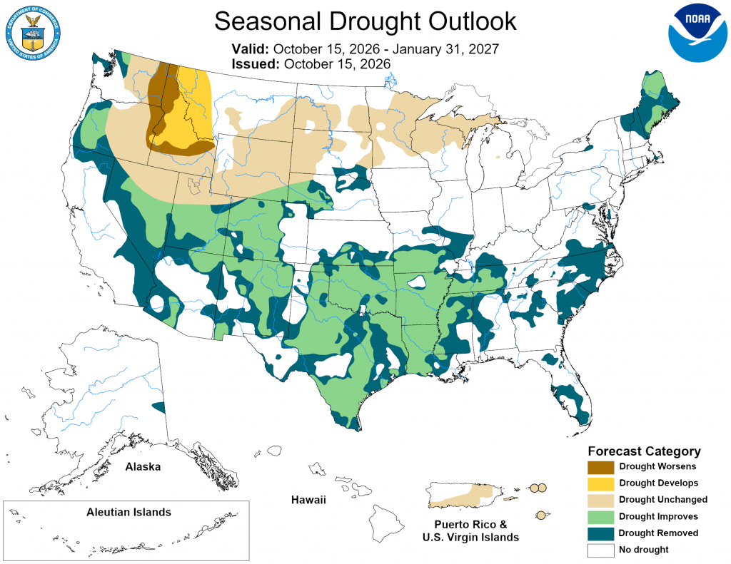
NOAA’s Climate Prediction Center’s updated winter outlook issued last Thursday included a drought outlook covering the period from late October through the end of January. The outlook calls for drought conditions to improve or end by the end of January across all of Texas. An active subtropical jet stream is forecast to develop across the southern U.S. beginning in early November. Numerous storm systems moving along the jet stream are forecast to bring frequent periods of clouds and rain that will help to improve or end drought conditions currently in place.
Have a great week!
Bob
Social Media