Summer-Like Weather With Just a Few Isolated Thunderstorms into Early Next Week
April 24, 2026
Warm and humid weather has returned to our region following the cool and wet spell earlier this week. In fact, the weather this weekend into next week going to feel a bit like early summer as afternoon temperatures climb to around 90-92 degrees.
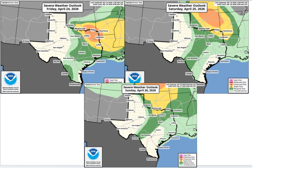
For Friday through Monday, generally quiet, dry, and warm weather is forecast. However, a few isolated, mainly afternoon and evening thunderstorms will be possible across the region as the atmosphere remains quite moist and potentially unstable. Friday’s weather maps showed the southern branch of the jet stream flowing from southern California to the southern Plains, then north to the Great Lakes. The jet stream is forecast to stay in roughly this same configuration through the weekend, keeping the greatest threat for thunderstorms well to our north across Oklahoma and the Red River Valley. Across the Hill Country, Central Texas, and coastal regions, a couple of isolated thunderstorms will be possible each afternoon and evening as weak disturbances pass over the region from the west. Lift from the these passing disturbances will likely be offset by a strong stable layer, or cap, in the middle atmosphere covering the region. However, should this stable layer happen to weaken, atmospheric conditions are primed for rapid strong to severe thunderstorm development. The probability for this occurring at any given location will at best only be 20 percent.
Another feature which could spark the development of a few isolated thunderstorms, mainly across the Hill Country, will be the West Texas dry line. Forecasts call for the dry line to push east to Edwards Plateau and Concho Valley regions each afternoon. The boundary could potentially weaken the stable layer enough to cause the development of a few scattered thunderstorms that will then spread to the east. These thunderstorms could also quickly become strong to severe. The probability for storms will at best be near 20 percent.
The Storm Prediction Center has placed most of the region under a Marginal Risk (a 1 out of 5 risk) for severe thunderstorm development Friday. For Saturday and Sunday, only the Hill Country continues under the Marginal Risk. Should thunderstorms develop, the primary severe weather risks will be large hail and damaging downburst winds.
Aside from this slight chance for thunderstorms, the weekend weather will feature widespread nighttime and morning clouds, followed by a partly cloudy sky in the afternoon.
- High temperatures Friday through Sunday are predicted to be near 90-92 degrees across the Hill Country and Central Texas regions, and near 88-90 degrees across the coastal region
- Lows will be in the upper 60s to low 70s
Looking ahead to next week, no significant change in the weather is expected Monday through Wednesday. A couple of isolated thunderstorms will be possible—mainly across the Hill Country in the vicinity of the dry line. The warm temperatures look to continue, with highs near 90-92 degrees.
There will be an increased chance for rain showers and thunderstorms Thursday afternoon into Thursday evening when a strong cold front pushes south through the area. An area of rain and storms is predicted to develop along and just behind the boundary. Rain amounts with the front are forecast to be somewhere in the range of 0.25 to 0.5 inches.
The front is expected to bring a blast of noticeably cooler air that will last through next weekend. Expect high temperatures next Friday through Sunday to be in the 70s, with lows in the 50s and 60s. Dry weather is predicted Friday through next weekend.
Have a great weekend!
Bob
Social Media