The Heat Dome Will Keep Conditions Hot and Dry through the Holiday Weekend
June 29, 2026
The month of June is ending dry and quite hot! Ever since our spring wet pattern ended about ten days ago, there hasn’t even been a hint of rain around the area. Monday’s weather maps showed a broad area of high pressure in the middle and upper atmosphere, or heat dome, stretching from northern Mexico to the Great Lakes region. The dome was centered over western Tennessee. Forecasts for this week call for the heat dome to expand and cover most of the eastern U.S., causing a major, record-breaking heat wave to develop. Meanwhile across Texas, little day-to-day change in the weather is predicted through Friday as the center of the heat dome remains well to the northeast. Some late night and morning low clouds will give way to a mostly sunny sky and hot temperatures in the afternoon.
There will not be any break from the heat this week.
- High temperatures Monday afternoon through Thursday are forecast to generally be in the mid-90s across the Hill Country and Central Texas regions, and in the low to mid-90s across the coastal region
- High temperatures Friday are forecast to be in the upper 90s across the Hill Country and Central Texas regions, and in the low to mid-90s across the coastal plains
Heat indices will remain elevated due to the hot temperatures and high relative humidity levels. Expect peak afternoon readings to generally be in the range of 100-105 degrees.
Winds are expected to remain strong and gusty through Tuesday, with occasional gusts to near 25/30 mph. Wind speeds are forecast to decrease some Wednesday through Friday, with speeds staying generally in the range of 10-15 mph.
Fourth of July Weekend
Few if any changes in the weather are predicted for the holiday weekend. Mostly sunny and dry weather will continue. Expect high temperatures to remain in the upper 90s, with lows in the mid and upper 70s. Breezy conditions look to continue.
Next Week
More sunny, hot, and rain-free weather is forecast across the region throughout the week as the center of the heat dome relocates to northern New Mexico and southern Colorado. The heat dome will continue to be the main feature influencing our weather. While a couple of isolated rain showers will be possible across the coastal region each day, the remainder of the region will stay dry.
Temperature forecasts show readings staying very consistent, with highs generally in the upper 90s. A few Hill Country locations could reach 100 degrees. The coastal area will continue with low and mid-90s.
Long-range forecasts show the hot and dry pattern persisting beyond the middle of the month.
Tropical Weather Outlook
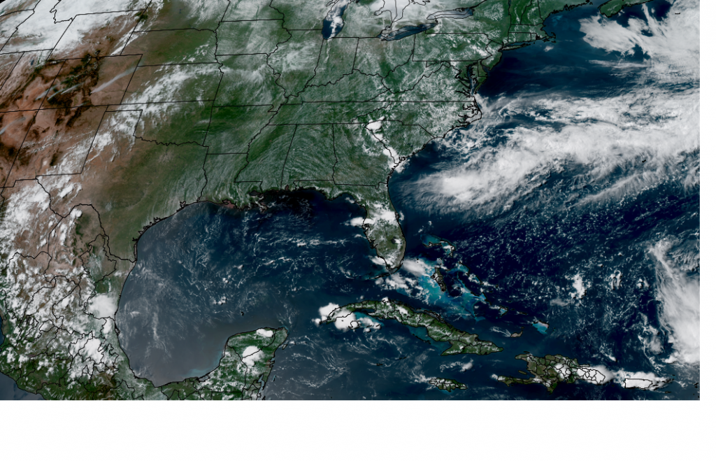
Weather conditions are currently quiet across the Gulf of Mexico, the Caribbean Sea, and the tropical Atlantic.
Offshore of the Southeastern U.S. Coast, the National Hurricane Center is monitoring an area of disorganized showers and thunderstorms associated with an area of low pressure along a stalled frontal boundary. Environmental conditions appear only marginally favorable for some tropical development over the next day or two as the system drifts southward and then westward before conditions become even less favorable for development later this week. NHC forecasters are giving this system just a 10 percent chance for tropical development over the next seven days.
NOAA/Colorado State University/CIRA 06/29/26 3:00 pm CDT
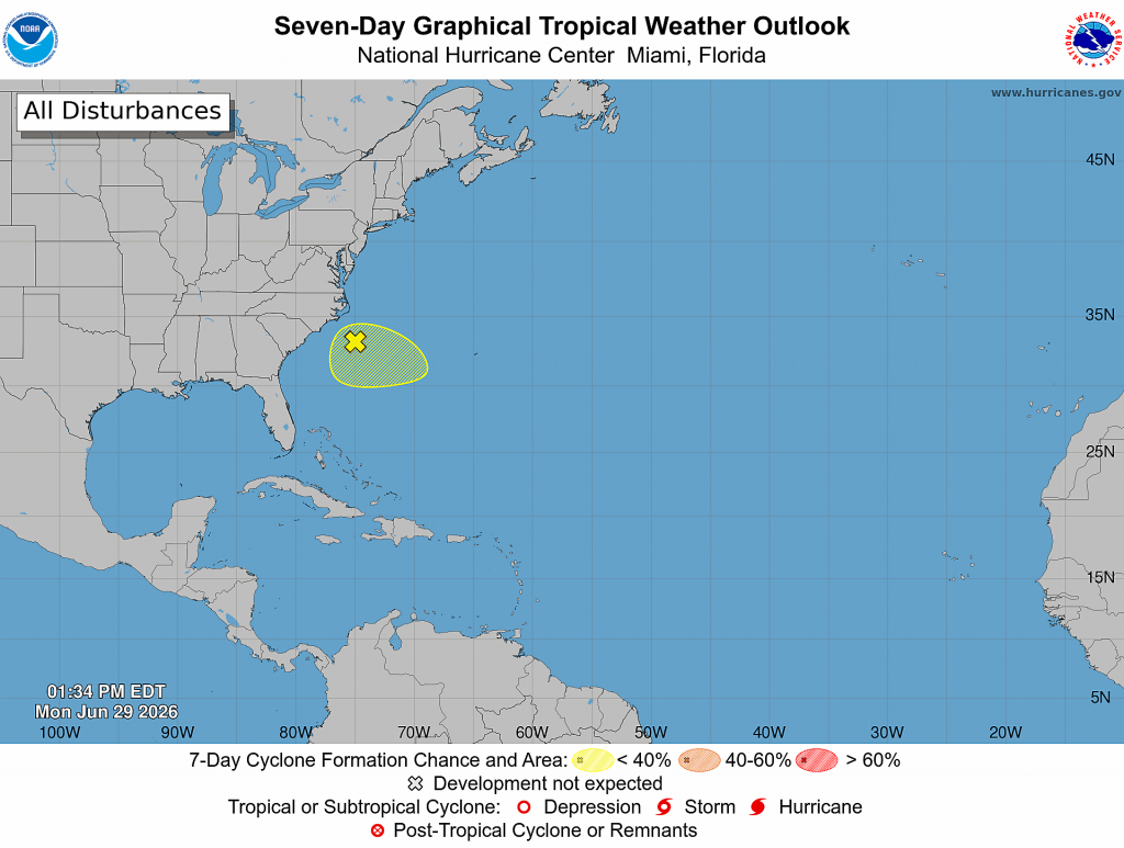
Elsewhere, tropical cyclone development is not expected over the next week.
The June Full Moon
The June full moon will occur at 6:57 pm CDT Monday evening. That’s when the lunar disk will pass opposite the sun in Earth’s sky, appearing fully lit by the sun’s rays.
This month’s full moon is also known as the “Strawberry Moon,” reflecting the time of year when Native American tribes harvest the ripened fruit. It is also the first full moon of summer, following soon after the June 21st summer solstice, which marks the astronomical start of the season and the longest day of the year.
June’s full moon tracks the lowest path of any full moon throughout the year, and that’s thanks to its proximity to the summer solstice — when the sun is at its highest in the daytime sky.
Have a great week!
Bob
Social Media