The Summer Pattern is Setting Up. Hot and Dry Weather Expected through the End of the Month
June 22, 2026
A significant change in the weather pattern is currently taking place across Texas. The wet pattern which brought periods of soaking rain to much of our region since April and May, is quickly coming to a close. Monday’s weather maps showed a broad ridge of high pressure covering the southwestern U.S. and northern Mexico, with another broad ridge covering the Gulf of Mexico. Over the next few days, the ridge of high pressure over the southwestern U.S is forecast to spread over Texas. The strengthening ridge will likely shut off any additional cold fronts and waves of low pressure from making their way into Texas, with the storm track shifting north up to the central Plains. Summer is now definitely here across Texas! Expect temperatures to trend hotter over the next few days with little to no rain on the horizon.
Mostly sunny, hot, and humid weather will be in place this week, continuing through the upcoming weekend.
- High temperatures Monday through Wednesday are forecast to generally be in the low and mid-90s
- High temperatures Thursday through Sunday are predicted to be in the upper 90s across the Hill Country and Central Texas regions, but remain mostly in the low 90s across the coastal plains
The combination of hot temperatures and high relative humidity readings is expected to produce peak heat index readings in the range of 100-105 degrees through much of the week.
Looking ahead to next week, few changes can be expected as our region remains under the influence of the broad heat dome. Forecasts call for the center of the heat dome to set up somewhere over the Texas Panhandle or eastern New Mexico late next week. With the ridge center’s proximity getting closer, high temperatures are expected to trend even higher. Forecasts for next week call for daily high temperatures to be mostly in the upper 90s. Some triple digit temperatures will be possible—mainly across the Hill Country and Edwards Plateau regions.
Tropical Weather Outlook
Weather conditions are quiet across the tropical Atlantic and tropical cyclone development is not expected over the next seven days.
Updated Weather Outlook July through September
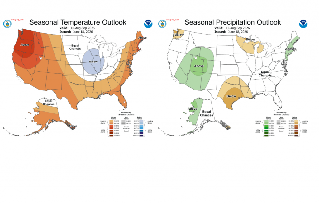
Last Thursday, NOAA’s Climate Prediction Center issued their monthly climate update. The updated outlook for July through September indicates the drier weather pattern we see setting up now may continue through the end of summer. The rainfall outlook leans toward below normal rainfall across all Central and South Texas. The temperature outlook leans toward above normal temperatures. The strengthening summer heat dome is expected to have a significant influence on our region’s weather, at least through August.
Have a good week. Stay cool and hydrated!
Bob
Social Media