

Weather Looks to Stay Dry and Warm into Early Next Week
OCT. 6, 2026
Gulf Low:
Satellite images and surface observations early Tuesday afternoon indicated the showers and thunderstorms over the southwestern Gulf were becoming better organized and s surface pressures were gradually falling. According to the National Hurricane Center, if these trends continue, this system will likely be upgraded to a tropical depression Tuesday afternoon or Tuesday night. (The NHC is putting the chances of tropical development at 100 percent).
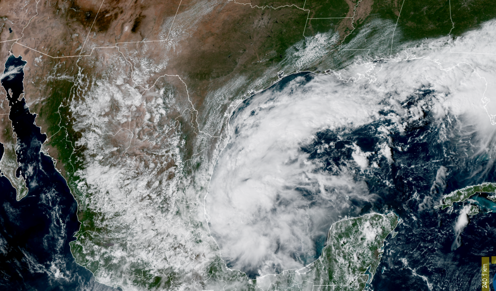
NOAA/Colorado State University 10/06/26 2:20 pm CDT
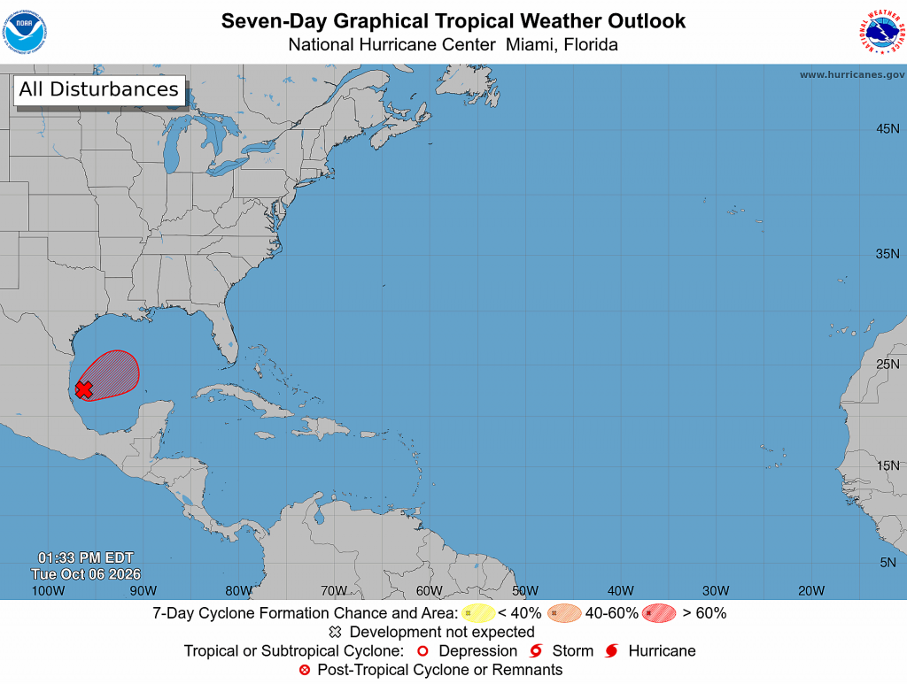
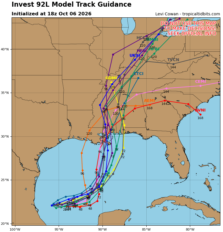
The disturbance is currently moving slowly to the east but is expected to turn to the north or northeast and track toward the northern Gulf Coast by the end of the week. This is due to a trough of low pressure dipping southeast out of Oklahoma and northeast Texas. Based on this, the tropical disturbance is not expected to have any significant impact on Texas weather. Persistent northeasterly winds along the coast will increase into late week and this will be a favorable setup for coastal flooding. Forecasted tides look to run 1-2 feet above normal by late week and minor coastal flooding will be possible at times of high tide Thursday through Saturday.
There is some disagreement on how fast the disturbance will track to the north. the slower end of the forecast guidance seems most accurate, calling for the system to drift slowly to the east for the next 24 hours before starting a more consistent motion to the north on Thursday, with the system accelerating northward Friday into Saturday.
Most of the computer-forecast solutions call for the system to approach the central Gulf coast sometime late Friday or on Saturday.
Weather Outlook into Next Week:
An area of high pressure centered over the Midwest is currently ridging into Texas bringing dry and slightly cooler air. These conditions are forecast to persist through late week. The high-pressure area will cause light east-northeasterly winds across the region through late week. The dry air will allow for sunny and warm afternoons and comfortable temperatures at night. Dry weather is forecast, although a couple of spotty rain showers will be possible towards the coast Thursday and Friday.
- High temperatures Wednesday through Friday will include the low to mid-80s across the Hill Country, the upper 80s to 90 degrees across Central Texas, and the lower 90s across the coastal plains
- Low temperatures Wednesday through Friday are forecast to be in the upper 50s to low 60s across the Hill Country, the low and mid-60s across Central Texas, and the upper 60s across the coastal region
Sunny weather will continue this weekend, although relative humidity levels do look to climb a little higher. High temperatures will remain in the 80s, to near 90 degrees, with lows in the mid and upper 60s.
The outlook for next week calls for continued sunny, warm, and dry weather Monday through Wednesday, with little change in the temperature. Late next week, forecasts call for a significant cold front to push south across the area sometime next Thursday or Friday, bringing a chance for showesr and a few thunderstorms. Dry weather looks to follow next weekend. The front is expected to bring noticeably cooler temperatures, with highs falling into the 70s, with lows falling to the mid-50s to 60 degrees.
Bob
Social Media