A Potential for More Heavy Rain Sunday
July 6, 2025
The weak area of low pressure largely responsible for all of the heavy rain across the Hill Country and Central Texas the past few days was centered Sunday morning over north Central Texas. A trough of low pressure in the middle atmosphere stretches southwest from the low, out to near Junction. Across the Hill Country and Central Texas, the atmosphere remains unusually moist and modestly unstable. As temperatures warm Sunday afternoon, rain shower and thunderstorm development is forecast to take place mainly along and to the west of the Interstate 35 corridor. The showers that do develop are predicted to be slow-movers and will have the potential to produce large amounts of rain in short periods of time. Showers and scattered thunderstorms can be expected Sunday afternoon through Sunday evening, with the probability for rain being near 50 percent.
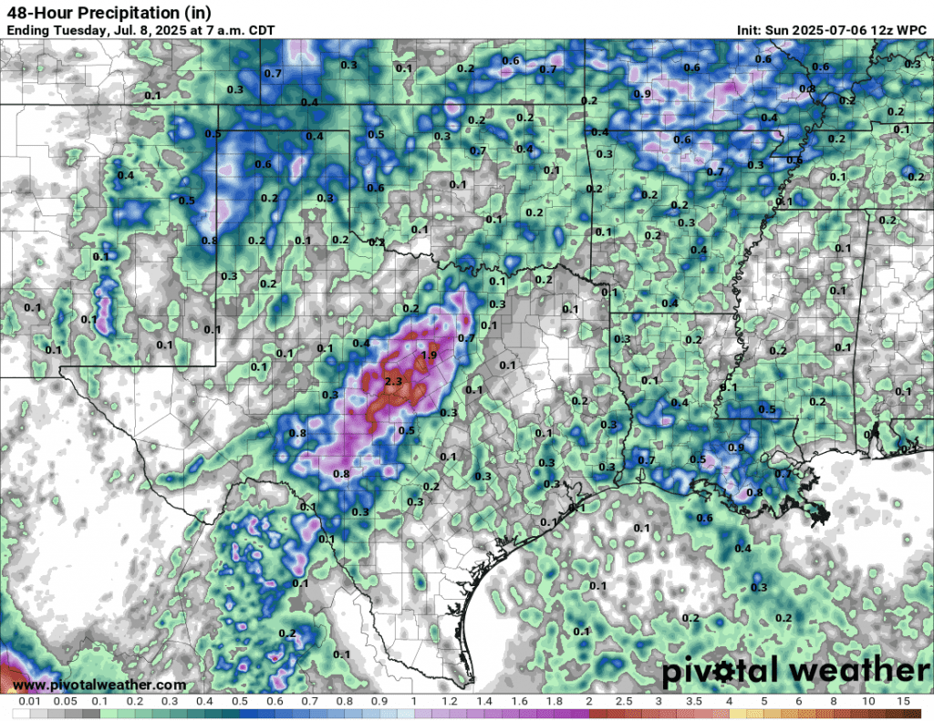
High resolution forecast show potential rain amounts through Sunday afternoon through Sunday evening to be between 1 and 3 inches, with isolated totals to near 7 inches possible. For areas east of Interstate 35, totals through Sunday evening are forecast to remain below a quarter inch.
NWS Rainfall Forecast Valid through 7 am Monday:
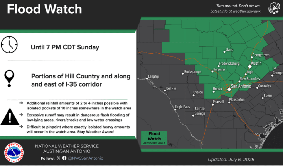
With area soils currently wet and saturated from recent rains, any additional rain Sunday afternoon will quickly runoff and aggravate ongoing flooding and fast-moving streams. Due to the threat for considerable runoff, the National Weather Service has posted a Flood Watch for the Hill Country and the Austin/Interstate 35 corridor through 7 pm Sunday.
Little rain is forecast across the region Sunday night as the remnant low pressure area finally moves away.
For Monday, there will be a 30 percent chance for scattered showers and thunderstorms for areas along and west of I-35 due to lingering moisture. However, the rain is not expected to be as intense of as focused as we’ve seen over the past few days. Rain amounts are forecast to average less than a half inch.
There will be a 30-40 percent chance for more scattered showers and thunderstorms across the entire region Tuesday and Wednesday as an enhanced area of tropical moisture spreads inland from the Gulf. However, heavy rain is not expected. Totals each day are forecast to only average around a quarter inch, or less.
Generally dry and sunny weather is forecast Thursday and Friday, continuing into next weekend as a summer pattern finally returns to the area. The temperature will trend warmer, with highs in the mid and upper 90s.
Bob
Social Media