Another Complex of Thunderstorms Expected Tuesday Night
June 10, 2025
Confidence is increasing for another complex of thunderstorms to move across the Hill Country and Central Texas regions late Tuesday night.
Tuesday’s analysis showed a trough of low pressure tracking east across northeastern Mexico and southern New Mexico. This feature is expected to cause the development of a large area of thunderstorms across Far West Texas and the Rio Grande Plains late this afternoon. With a moist and fairly unstable air mass in place, these thunderstorms are forecast to quickly become strong to severe, potentially causing damaging winds and large hail.
High resolution forecasts call for the area of thunderstorms to slowly move to the east, reaching the area between Ballinger, Junction, and Uvalde by about 11 pm. The area of storms is predicted to push east across the Hill Country between 11 pm and about 4 am, reaching the Austin/Interstate 35 corridor between roughly 4 am and 7 am Wednesday. The storms are forecast to push east of Interstate 35 after 7 am and weaken.
Do note some isolated thunderstorms could develop across parts of the Hill Country and the I-35 corridor after midnight, ahead of the main line of storms.
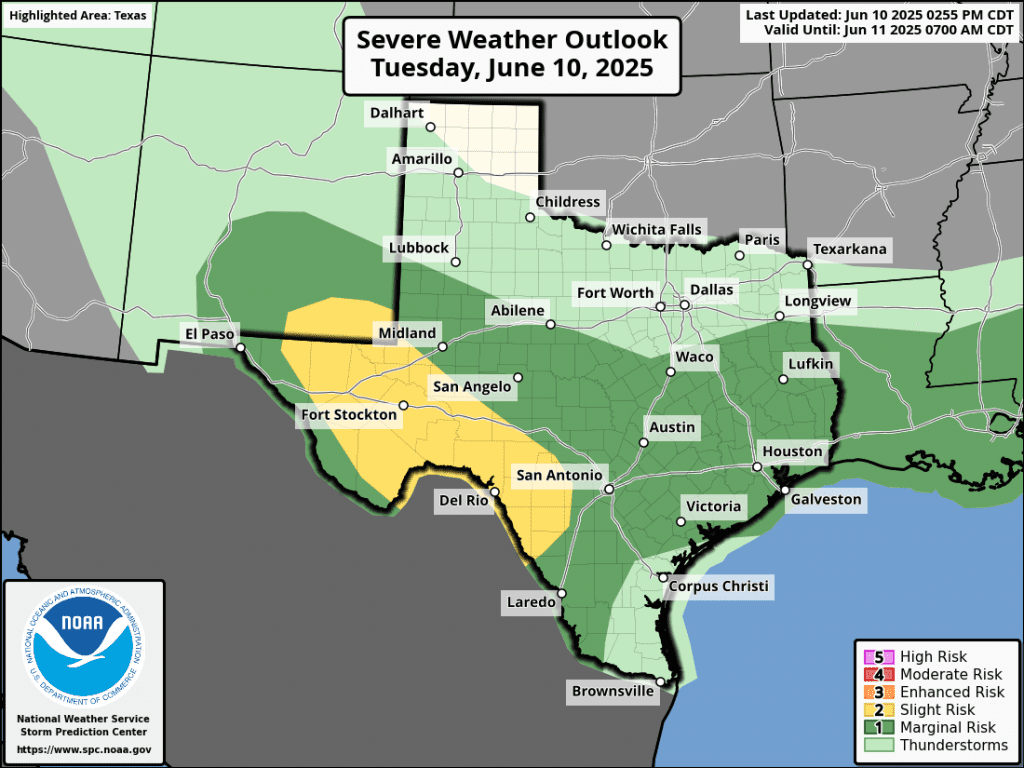
Some of the overnight storms could be strong to severe. The primary severe weather risks will be damaging winds and large hail. The Storm Prediction Center has placed the Hill Country, all of Central Texas, and the middle Texas coast under a 1 out of 5 risk for severe storms through Wednesday.
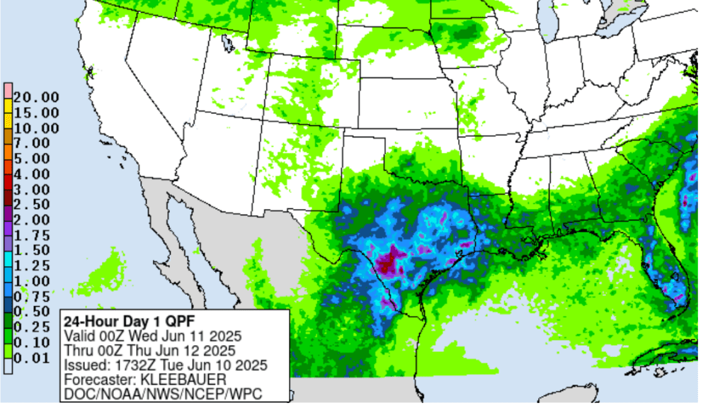
Rainfall from this complex of rain and thunderstorms is forecast to generally average around 1 inch, with isolated totals of 2-3 inches possible.
NWS Rainfall Forecast Valid through 7 pm Wednesday:
While this particular complex of storms is forecast to weaken after sunrise Wednesday, showers and thunderstorms are forecast to develop and increase in areal coverage across much of Central Texas and the middle Texas coast Wednesday afternoon and evening.
Forecasts call for additional waves of showers and thunderstorms to spread across the region Thursday through Saturday. The probability for rain will be near 70 percent Thursday, but decrease to around 40 percent for Friday and Saturday. This will be followed by just a slight chance for scattered showers Sunday and Monday.
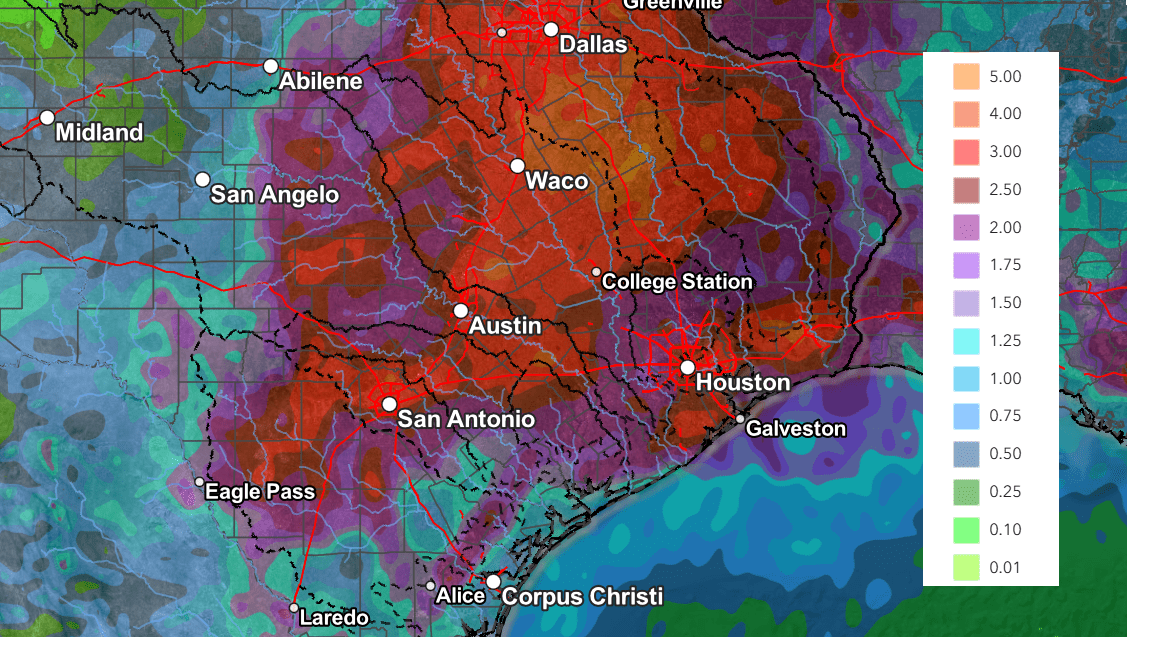
The National Weather Service’s cumulative rainfall forecast through Sunday evening calls for totals of 2-3 inches across the Hill Country and Central Texas, and around 2-2.5 inches across the middle Texas coast.
NWS Rainfall Forecast Valid through 7 pm Sunday:
Forecasts continue to point toward generally dry and warmer weather next week.
Bob
Social Media