Continued Hot with Isolated Rain Showers and Thunderstorms into Next Week
June 20, 2025
The summer solstice will occur Friday evening at 9:42 pm CDT. It’s no coincidence our weather over the next several days will be very summer-like as we remain under the influence of a broad ridge of high pressure in the middle and upper atmosphere. Unfortunately, the spring weather pattern, which helped bring numerous waves of rain and storms to our area beginning in late April, appears to have come to an end. Forecasts call for only limited amounts of rain across the area over the next couple of weeks as the summer pattern gets going in earnest. Fortunately, no extreme temperatures are predicted as the center of the dreaded heat dome looks to stay either to the east or to the west of our region for the next couple of weeks.
Friday’s weather maps showed a broad ridge of high pressure covering the southern and south central U.S. The ridge was centered over northeastern Texas and eastern Oklahoma. Over the next couple of days, the center of the ridge is predicted to shift northeast to the Ohio Valley, and looks to bring the first summer heat wave to much of the eastern and northeastern U.S. Meanwhile, Texas will remain on the western periphery of the ridge, meaning continued sunny and hot weather, with little overall change in the temperature.
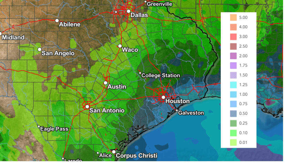
Breezy, moist southerly winds are predicted for the next several days due to a moderate pressure gradient. These winds will likely help to push the sea breeze front north across the coastal plains and inland to near the Intestate 35 corridor each afternoon. From Friday afternoon through late next week, a few scattered afternoon and evening rain showers and isolated thunderstorms may accompany the sea breeze as it tracks to the northwest. The probability for rain will be near 30 percent across the coastal plains region, and 20 percent across Central Texas. No rain is forecast across the Hill Country. Rain amounts, if any, are forecast to average less than a quarter inch.
A slightly higher probability for showers and isolated thunderstorms is forecast next Wednesday through Friday as an enhanced area of moisture is expected to spread west off the Gulf. The probability for rain will range from 50 percent across the coastal plains region, to 30 percent along the Interstate 35 corridor. Daily rain amounts are forecast to remain well below a quarter inch. No rain is forecast across the Hill Country.
- High temperatures this weekend and next week are forecast to be in the low and mid-90s across the Hill Country, in the mid-90s across Central Texas, and be around 90-92 degrees across the coastal plains.
Looking out into the week of June 30th, forecasts call for few changes in the weather pattern. The center of the heat dome is predicted shift back west to the Four Corners region, but it is not expected to set up directly over Texas. There will be a slight chance for scattered afternoon showers for areas along and east of I-35, and staying generally dry for areas to the west. High temperatures are forecast to hold in the mid to upper 90s.
NWS Rainfall Forecast Valid through 7 am Friday, 6/27
Tropical Weather Outlook
Weather conditions remain quiet across the Atlantic basin and atmospheric conditions appear unfavorable for tropical cyclone development for at least the next seven days.
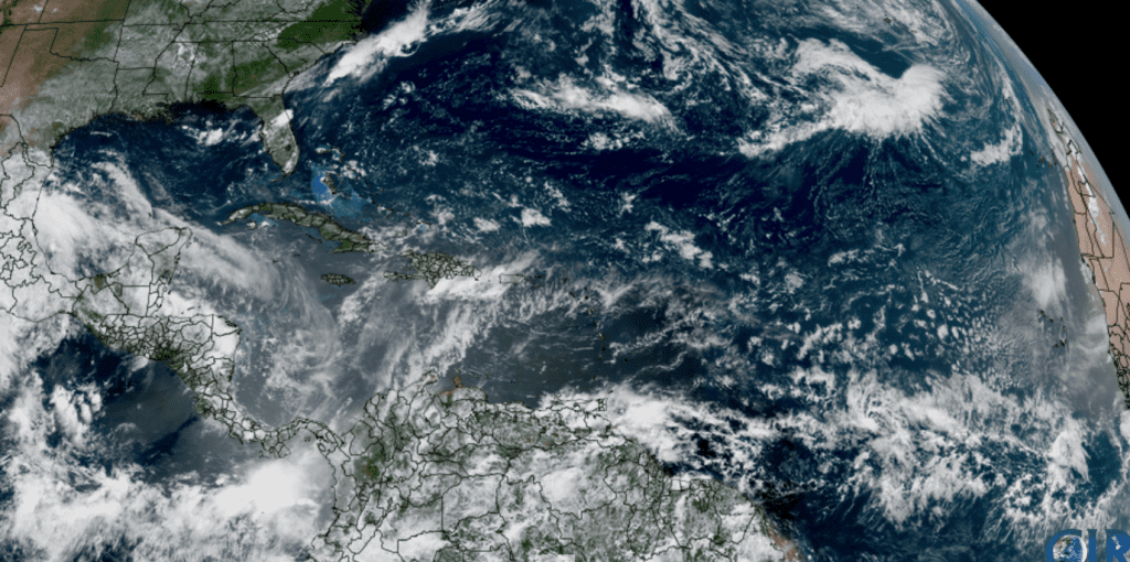 NOAA/Colorado State University/RAMMB 06/20/2025 12:10 pm CDT
Enjoy this first weekend of summer and stay cool!
Bob
Social Media