Despite there being a widespread, slow rain across the region last weekend, totals were just not enough to make dent in the growing drought. Even with the rain, November totals across the Hill Country and Central Texas were generally 1-2 inches below normal. Totals in October were between 2 and 5 inches below normal.
November Rainfall–Departure from Normal:
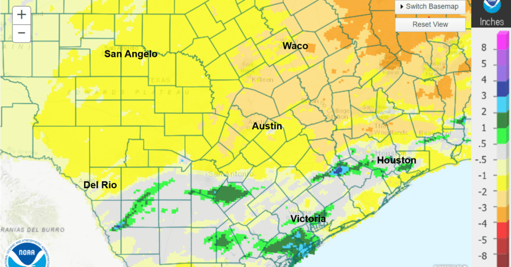
Data courtesy National Weather Service West Gulf River Forecast Center
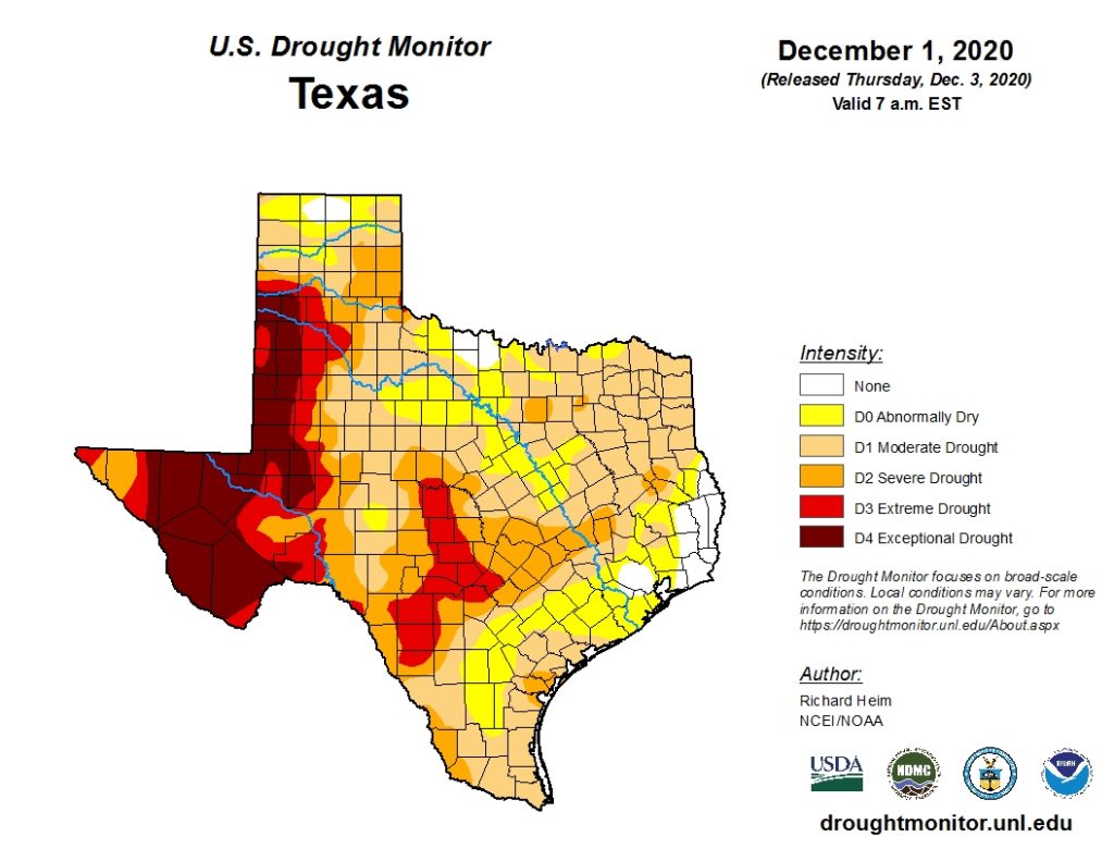
Well below normal rainfall over the past couple of months, very low soil moisture levels and stressed vegetation are all signs the current drought is increasing in intensity.
Thursday’s updated National Drought Monitor showed the worst of the drought to be across the Hill Country, where a large area of extreme drought, the third of four possible drought levels, covers the area from Brady, south through the Fredericksburg area, to just north of San Antonio. The eastern Hill Country and all Central Texas EW are shown be in severe drought, the second of four levels of drought. Weekend rains were heavy enough to cause drought improvement across the middle Texas coast. Most areas south of Interstate 10 are depicted as “Abnormally Dry”, which is not an actual drought category. This classification refers to drought improvement, although some lingering impacts from the drought remain.
Prospects for rain over the next 1-2 weeks are not very good as the storm track is forecast to stay the north of our area. And with a moderate La Niña in place, December, January and February are all forecast to have below normal rainfall. If this occurs, drought conditions will likely worsen before they get any better.
Bob
Social Media