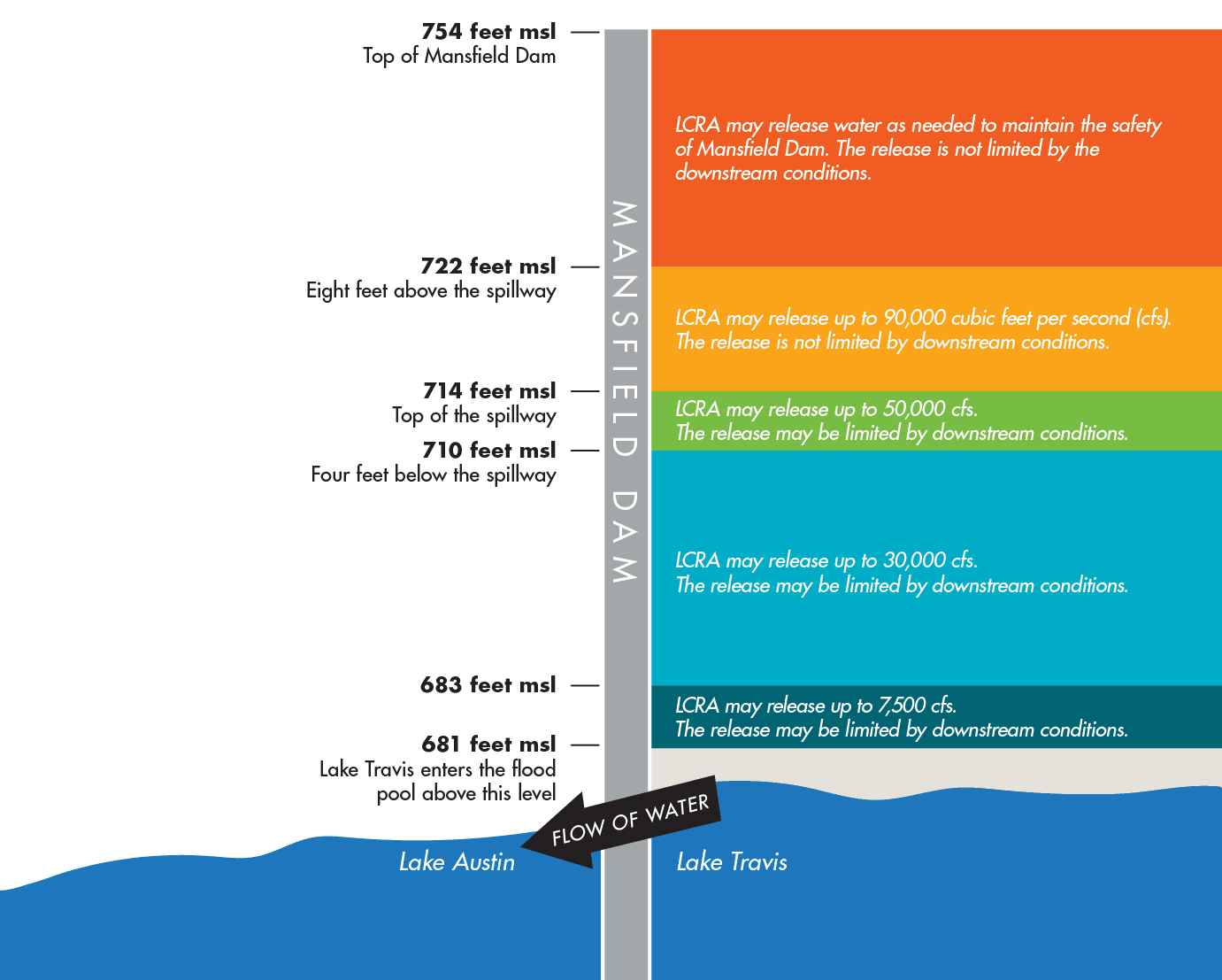
Mansfield Dam Flood Operations
When the elevation of Lake Travis exceeds or is projected to exceed 681 feet above mean sea level (feet msl), LCRA can begin floodgate releases. LCRA makes controlled releases of floodwater through Mansfield Dam using any combination of three hydroelectric generating units and 24 floodgates. Under USACE protocol, the amount of water LCRA releases from Mansfield Dam is determined based on how much water is in the Lake Travis flood pool, downstream river conditions and the amount of projected inflows into the lake. Releases from the dam generally increase as Lake Travis is projected to rise, but flood releases may be halted or reduced depending on flood levels measured at three river gauges downstream of the dam, at Austin, Bastrop and Columbus. Water would flow over the spillway of Mansfield Dam should Lake Travis rise above 714 feet msl.

Guide to the numbers:
681 feet msl: Lake Travis is considered full for water supply purposes at 681 feet msl. (At this level Lake Travis holds about 1.1 million acre-feet, the amount of water it would take to fill more than 1.1 million acres to a depth of 1 foot or about 363 billion gallons.)
681 to 683 feet msl: When Lake Travis is forecast to rise to between 681 and 683 feet msl, LCRA may release up to 7,500 cubic feet per second (cfs), if even with the releases, the river stays below specified levels at three control points on the Colorado River downstream of the dam.
683 to 710 feet msl: When Lake Travis is forecast to rise to between 683 and 710 feet msl, LCRA may release up to 30,000 cfs, if even with the releases, the river stays below specified levels at three control points on the Colorado River downstream of the dam.
| When Lake Travis is forecast to rise to between 681 and 710 ft msl, releases from Mansfield Dam may be reduced or stopped if the releases, when combined with local inflows below the dam, are forecast to cause stage or streamflow at Austin, Bastrop or Columbus to exceed the following levels: |
||
| Location | Control Stage (feet) | Control Flow (cfs) |
|---|---|---|
| Austin | 33.0 | 30,000 |
| Bastrop | 27.2 | 45,000 |
| Columbus | 35.5 | 50,000 |
710 to 714 feet msl: When Lake Travis is forecast to rise to between 710 and 714 feet msl, LCRA may release up to 50,000 cfs if even with the releases, the river stays below specified levels at the three downstream control points on the Colorado River. Releases from Mansfield Dam may be reduced or stopped if the releases, when combined with local inflows below the dam, are forecast to cause streamflow at Austin, Bastrop or Columbus to exceed 50,000 cfs.
714 to 722 feet msl: Water flows over the spillway of Mansfield Dam when Lake Travis rises above 714 feet msl. If Lake Travis is forecast to rise to between 714 and 722 feet msl, LCRA may release up to 90,000 cfs, including any flow over the spillway. Releases are not limited by downstream conditions.
722 to 754 feet msl: If the elevation of Lake Travis is forecast to rise between 722 to 754 feet msl, LCRA determines the amount of water to be released considering the dam’s structural integrity. Releases are not limited by downstream conditions.
754 feet msl: This is the top of Mansfield Dam.


Social Media