Forecasters Beginning to Monitor the Gulf
July 23, 2025
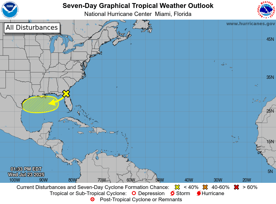
National Hurricane Center forecasters are currently monitoring a disorganized area of low pressure located just off the coast of the southeastern U.S. In a pattern somewhat similar to what happened a week ago, this system is producing scattered showers and thunderstorms across Florida, southern Georgia, and southern Alabama. This feature is predicted to cross over Florida and enter the eastern Gulf late Wednesday. Thursday into Friday, this system is forecast to move west-southwestward into the north-central Gulf, where atmospheric conditions are predicted to be somewhat favorable for some slow tropical development. The National Hurricane Center currently is giving this system just a 10 percent chance for tropical development over the next 48 hours. While most of the computer forecasts are not all that bullish for tropical cyclone development, additional weather balloon and forecast data coming in this morning will give NHC forecasters a better idea on the possibility for development.
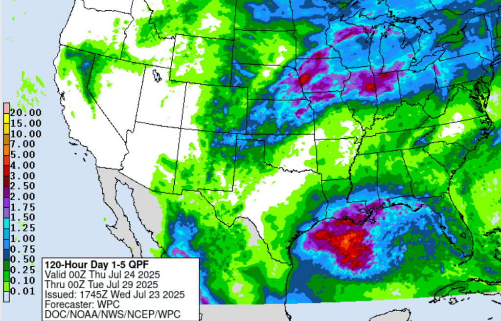
Regardless of tropical development, the system is expected to bring a surge of deep tropical moisture into Southeast Texas and the middle Texas coast Friday through Sunday. Forecasts call for a 50 percent chance for rain and thunderstorms across the coastal Plains region all three days. In addition, some of this moisture is also predicted to spread into Central Texas and the eastern Hill Country regions Saturday and Sunday. Here, the probability for rain will be near 40 percent Saturday and 20 percent on Sunday.
Rainfall from this system and its tropical moisture is forecast to be heaviest across the coastal region, while lower totals are expected further inland. The National Weather Service’s 5-day rainfall forecast through 7 am Monday calls for widespread totals to near a half inch across the coastal plains, and totals near a quarter inch or less across Central Texas and the Hill Country. Keep in mind, any surge of tropical moisture brings with it the risk of heavy rainfall.
I urge everyone to keep an eye on weather developments over the next few days for any changes.
Bob
This page was prepared on Wednesday, 07/23. For the latest weather information and forecasts, please consult the National Weather Service at weather.gov/ewx weather.gov/hgx and weather.gov/sjt
Social Media