Scattered Showers Expected Wednesday and Again this Weekend
July 9, 2025
As of late Wednesday morning. Doppler radar was showing the development of showers and isolated thunderstorms across the eastern Hill Country, including Burnet and Llano Counties. Other showers were developing across Central Texas and the middle Texas coast. LCRA’s Hydromet gauge located at Smithville, in Bastrop County, recorded 0.35 inches in 15 minutes from one of these passing showers around 11 am.
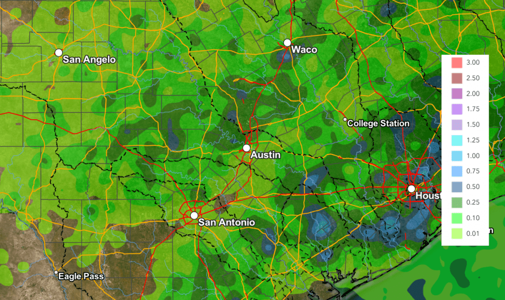
We’ll be looking at a 40-50 percent chance for more scattered rain showers and thunderstorms across the entire region Wednesday afternoon into Wednesday evening. This chance for rain will includes the Kerr County area. A trough of low pressure sinking south out of North Texas along with abundant moisture flowing north from the Gulf is expected to help in the development the rain. Today’s rain is not expected to be as focused nor as heavy as we saw over the holiday weekend. However, a few isolated heavy downpours will be possible. In general, most totals should average under a half inch, but some isolated totals of 1-2 inches will be possible. Totals are forecast to be a little higher across the coastal plains region. With area soils still very wet from recent rains, this additional rain will runoff quickly. Today’s activity is expected to diminish around sunset as temperatures begin to cool.
NWS Rainfall Forecast Valid through 7 am Thursday:
The outlook for Thursday and Friday calls for sunny and dry weather as some drier air works into the area. High temperatures are predicted to be in the upper 80s to low 90s. There will be a 30 percent chance for scattered rain showers across the coastal region on Friday.
A chance for scattered rain showers and thunderstorms will return to the forecast this weekend, continuing into Monday as an enhanced area of moisture is drawn into Texas off the Gulf. Forecasts call for a 40-50 percent chance for afternoon and evening rain showers across the region on both days. Heavy rain is not expected. Rain amounts each day are forecast to average close to a quarter inch, with isolated totals to near 1 inch possible. High temperatures will continue to be mostly in the low 90s.
Bob
Social Media