Showers With Possible Heavy Rain will Continue through Friday Evening
July 4, 2025
An area of low pressure over West Texas (part of the remnants of Tropical Storm Barry) and an unusually moist atmosphere caused the development of heavy to very heavy rain across parts of the Hill Country Thursday night into Friday morning. Some of the highest totals of rain fell over the area between San Angelo, Mason, and San Saba, and also over western Kerr County where totals between 4 and over 12 inches of rain were observed. One of the highest rain totals recorded occurred in northwestern Mason County, where an LCRA Hydromet gauge has recorded a 24-hour total of 15.56 inches( as of 11:30 am). Here’s a view of the estimated rain falling over the past 24 hours:
NWS Estimate of rain falling between 7 am Thursday and 7 am Friday:
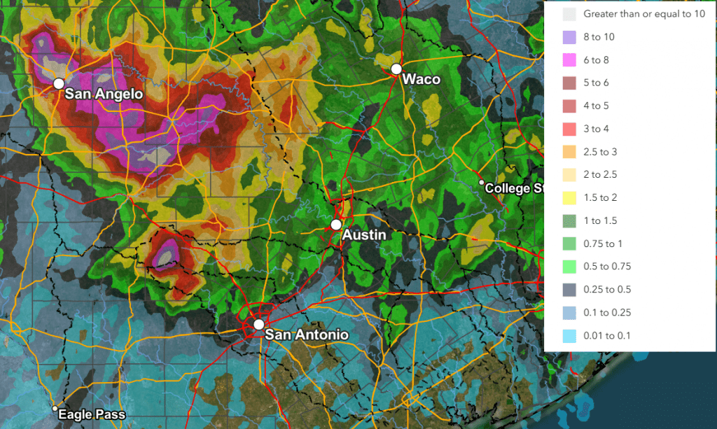
Data courtesy of the NWS West Gulf River Forecast Center
As of late Friday morning, satellite images showed the area of low pressure was still centered over the northern Hill Country. Satellite and radar imagery clearly shows a cyclonic circulation associated with the area of low pressure, but this is not a tropical cyclone. High resolution forecasts call for the area of low pressure to remain somewhat stationary this afternoon, then weaken and slowly drift to the south late Friday afternoon into Friday night. Meanwhile, an unusually moist atmosphere remains in place across the region and atmospheric conditions remain favorable for the development of more moderate to heavy rain across the Hill Country and parts of Central Texas (including the Austin area) this afternoon into this evening. The probability for rain will be near 100 percent across the Hill Country, 50 percent along the I-35 corridor, and near 30 percent at most other locations. The chance for rain is expected to decrease to around 30 percent overnight Friday night.
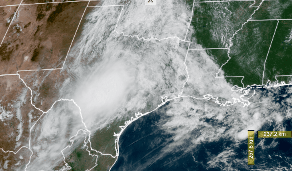
NOAA/Colorado State University/RAMMB 07/04/2025 11:10 am CDT
The Weather Prediction Center has outlooked the Hill Country region, from Brownwood to Kerrville, with a moderate risk for excessive rainfall this afternoon through 7 am Saturday. Surrounding the moderate risk area, a slight chance for excessive rain covers the Austin/Intestate 35 corridor and the western Hill Country.
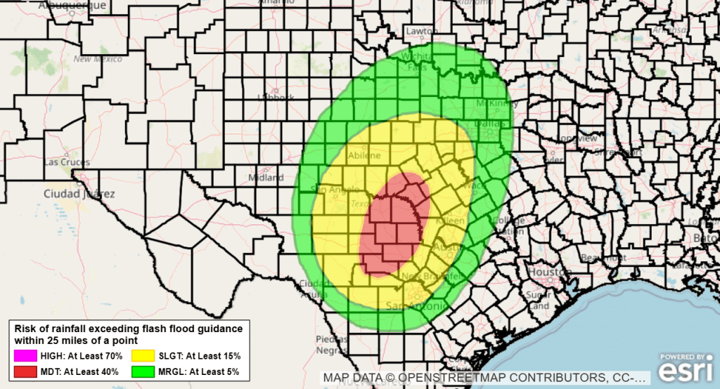
Rain forecasts show a potential for an additional 1-3 inches of rain across the Hill Country and the Austin/I-35 corridor through Friday night. Isolated totals to near 5 inches will be possible.
The outlook for Saturday calls for a much smaller coverage of rain across the area as the low weakens and a ridge of high pressure over Arizona begins to spread over Texas. Expect a 30 percent chance for rain and thunderstorms cross the Hill Country and the I-35 corridor. Rain amounts should average less than a half inch.
The outlook for Sunday calls for generally sunny and dry weather, with just a couple of isolated rain showers and thunderstorms.
Have a safe and happy Fourth of July and holiday weekend!
Bob
Social Media