La Niña conditions have come to an end! That’s the latest word from NOAA’s Climate Prediction Center. The moderate La Niña which developed late last summer persisted through the winter and into April. This feature helped cause a pattern of drier than-normal weather across most of Texas through the fall and winter months.
Observations in late April showed sea surface temperatures across the tropical Pacific Ocean had warmed and were now near-average, to slightly below-average between the coast of South America and the International Date Line.
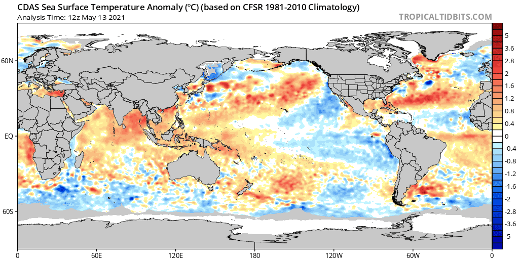
History has shown us ENSO (El Niño/Southern Oscillation) is more than just the ocean surface temperature anomaly (the difference from the long-term mean). The atmospheric component is just as important, as it serves to reinforce the surface temperature anomaly and transmit ENSO’s impacts across the globe. Over the past few weeks, atmospheric conditions over the tropical Pacific no longer resemble a circulation pattern we generally find during La Niña. Other factors, such as stronger-than-average trade winds, have also diminished across most of the Pacific Ocean in the past month. The Southern Oscillation Index and Equatorial Southern Oscillation Index, both of which measure the atmospheric component of ENSO also indicate neutral conditions. With most all indicators showing neutral, CPC’s ENSO forecast team has concluded La Niña is over.
So the big question now is what will happen ENSO-wise this summer and fall. Most of the long range ocean/atmosphere models predict a continuation of ENSO-neutral conditions through the upcoming summer. In fact, CPC forecasters state there’s a 67 percent chance the Pacific will remain ENSO-neutral from June through the end of August. While Texas sees little influence from the tropical Pacific during the summer months, ENSO has a strong relationship with the Atlantic hurricane season (June–November). El Niño tends to lead to a reduced number of tropical storms and hurricanes, while La Niña tends to enhance the season. ENSO-neutral conditions tend to promote near-normal to slightly above-normal number of tropical storms and hurricanes.
The outlook for the upcoming fall and winter is more unclear. Many of the computer forecast models are suggesting we may see a second-year La Niña develop this fall, a fairly common occurrence in the historical record. But this is far certain. It’s important to note ENSO forecasts made in the spring months tend to be less skillful than forecasts made in other times of the year and this reduces the confidence in the forecast solutions. The CPC forecaster consensus calls for the tropical Pacific to begin trending toward cooler conditions as fall approaches. As of now, the chance for a return to La Niña in the late fall and winter are around 50-55 percent, which is just slightly above the forecast for continued ENSO-neutral. The chances for El Niño this fall and winter are low–hovering around 10 percent.
And note, CPC and the National Hurricane Center will be releasing their outlook for the Atlantic hurricane season next Thursday, May 20th.
Bob
Social Media