Quiet weather continues across the state as we close out the work week. That beautiful fall weather we experienced early in the week has unfortunately gone away. A strengthening flow off the Gulf of Mexico this afternoon and over the weekend is expected to bring the return of summer-like conditions, with warm temperatures and high humidity levels. Friday’s weather maps showed Texas was under the stable influence of a broad ridge of high pressure covering much of the southwestern U.S. and northern Mexico. The ridge is forecast to remain in place through Tuesday, causing more quiet and warm weather.
This afternoon, a mostly sunny sky is forecast. Temperatures are predicted to reach mid and upper 80s. Winds will be light. The sky will become cloudy overnight, with areas of dense fog expected to develop across the coastal plains. Lows Saturday morning will range from the low 60s across the Hill Country to the mid-60s across Central Texas to the upper 60s near the coast.
Mostly sunny and warm weather looks to continue Saturday. However, much of Southeast Texas, including the middle Texas coast, is forecast to see a 30-40 percent chance for scattered showers and isolated thunderstorms as an enhanced area of moisture gets pulled inland. For locations that do happen to see a shower, totals should average less than a quarter inch. High temperatures will again be in the mid and upper 80s. Lows Sunday morning will range from the low 60s out west to the upper 60s near the coast.
Mostly sunny, dry and warm weather will continue Sunday, Monday, and Tuesday. High temperatures are predicted to be in the upper 80s Sunday, warming to near 90 degrees Monday and Tuesday. Lows Monday and Tuesday mornings will include the mid to upper 60s across the Hill Country and in the low 70s across Central Texas and the middle Texas coast.
Forecasts call for a Pacific cold front to sweep southeast across the state late Tuesday into Wednesday morning. There looks to be enough moisture and instability in place for an area of showers and scattered thunderstorms to develop along and just behind the front. The probability for rain will be near 20 percent across the Hill Country and near 30 percent across Central Texas and the coastal region. Rain amounts are expected to be low—generally around a quarter inch, with isolated totals just over a half inch possible. The chance for rain should end from west to east late Tuesday night to sunrise Wednesday.
Sunny, drier and slightly cooler weather will follow the cold front on Wednesday. High temperatures are forecast to be in the low and mid-80s. Lows Thursday morning will range from the 50s across the Hill Country to the upper 50s near the coast.
Sunny, mild and more fall-like weather is predicted late week into next weekend as Texas becomes sandwiched between a large ridge of high pressure over the western U.S. and a deep trough of low pressure over the eastern U.S. Daily high temperatures are forecast to be around 80-82 degrees, with low temperatures in the 50s.
Sunny and slightly cooler weather is predicted for the first few days of November as another cold front sweeps through the area. High temperatures will lower into the 70s, with low temperatures remaining in the 50s.
No significant rain is on the horizon through early November.
Tropical Weather Outlook
Weather conditions remain quiet across the tropical Atlantic, the Caribbean Sea and the Gulf of Mexico. There are no systems in place which pose a threat for tropical development over the next 5 days.
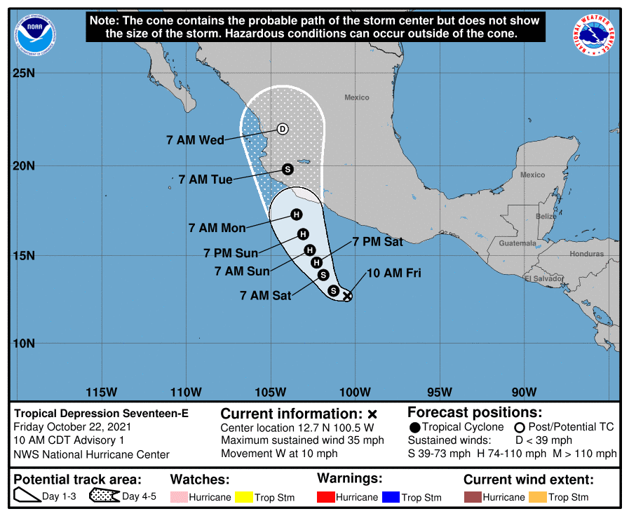
In the eastern tropical Pacific, a new Tropical Depression has formed southwest of southern Mexico.
As of 10 am CDT, the center of Tropical Depression Seventeen-E was located about 505 miles south-southeast of Manzanillo, Mexico. The depression was moving toward the west near 10 mph. A slowing of forward speed followed by a turn to the northwest is expected by tonight. A turn to the north-northwest should occur late this weekend. On the forecast track, the system would be approaching the coast of southwestern Mexico early next week. Maximum sustained winds are near 35 mph with higher gusts. Strengthening is forecast, and the depression is expected to become a tropical storm by tonight, and a hurricane over the weekend.
Moisture from this tropical cyclone is forecast to remain to the south of Texas.
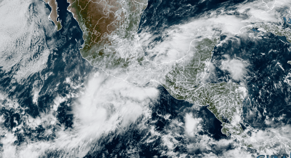
NOAA/Colorado State University/RAMMB 10/22/21 12:30 pm CDT
Have a good weekend.
Bob
Social Media