Heatwave Continues into Monday. Turning Less Hot the Middle of Next Week
May 16, 2025
Despite the calendar showing it only being the middle of May, summer’s heat and humidity arrived with a vengeance this week. Unfortunately, these uncomfortable conditions aren’t expected to change all that much over the next couple of weeks. If there’s any good news here, it’s from the long-range forecast solutions telling us the current heatwave and high humidity should moderate down some starting the middle of next week, with slightly lower temperatures continuing through the end of the month. Unfortunately, no widespread or heavy rain is showing up on the weather horizon.
Friday afternoon through Monday, no significant change in the temperature is predicted. The current heat wave looks to continue. Near-record or record high temperatures are forecast through Monday. In addition, high relative humidity levels/muggy conditions can also be expected for the eastern Hill Country, Central Texas, and coastal regions. Breezy southerly winds with speeds of 10-15 mph with gusts to 25 mph are predicted Friday through Monday.
- Daily high temperatures are forecast to be in the upper 90s across the Hill Country and Central Texas regions, and in the low to mid-90s for areas south of Interstate 10
- Daily low temperatures will range from the low 70s across the Hill Country, to the upper 70s across the coastal plains
Within this hot pattern, there will also be a slight chance for a few scattered rain showers and thunderstorms across the Hill Country and the Intestate 35 corridor late Friday through Monday as a series of weak disturbances push the dry line eastward out of West Texas.
Late Friday afternoon into Friday evening, there will be a 20-30 percent chance for the development of scattered rain showers and thunderstorms across the northern Hill Country, extending east to just north of Austin as a weak boundary sinks to the south. Should thunderstorms develop, they’ll have the potential to become strong to severe, producing large hail and damaging winds.
Saturday’s forecast calls for a 40 percent chance for the development of isolated to scattered thunderstorms across the Hill Country Saturday afternoon as the dry line pushes to the east. There will be a 20 percent chance for some of these storms to reach the Austin/Interstate 35 corridor by Saturday evening. The atmospheric setup will be favorable for some of the storms to become severe, capable for producing large hail and damaging winds.
Sunday’s outlook calls for just a slight chance for scattered thunderstorms across the western half of the Hill Country as the dry line doesn’t get much of a push to the east.
The most favorable period for rain showers and thunderstorms is expected to take place late Monday afternoon through Tuesday morning across the Hill Country and the Austin/Central Texas region. Forecasts call for the dry line to push east into the Hill Country Monday afternoon in advance of a Pacific cold front dropping south out of Northwest Texas. The probability for rain will be near 30-40 percent. The atmospheric setup appears favorable for developing storms to have the potential to become strong to severe. Note, the exact timing and coverage of rain and storms remains uncertain at this point due to the uncertain timing of the cold front. Rain amounts are forecast to remain below a quarter inch.
The cold front is expected to most likely sweep south across the region Tuesday morning into Tuesday afternoon. The front may bring a few showers to parts of the coastal plains region Tuesday afternoon, but rain amounts will be low. The chance for rain should end from west to east Tuesday afternoon as drier and slightly cooler air spreads in behind the cold front.
For next Wednesday through Friday, the weather is expected to be mostly sunny, dry, and not quite as hot. High temperatures are forecast to be in the low to mid-90s, with lows generally in the low and mid-60s.
The next chance for rain is expected to take shape on or just after Memorial Day.
Tropical Weather Outlook
Although the Atlantic hurricane season doesn’t officially start until June 1st, the National Hurricane Center has begun issuing daily tropical weather outlooks.
Very quiet conditions are currently in place across the tropical Atlantic and tropical cyclone development is not forecast over the next seven days.
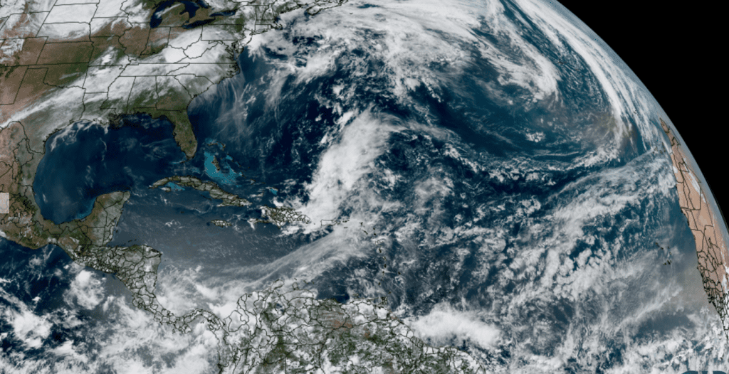
NOAA/Colorado State University/RAMMB 05/16/25 12:40 pm CDT
Have a great weekend!
Bob
Social Media