A Threat for Severe Thunderstorms Thursday and Thursday Night
March 15, 2023
Although the weather is quiet across the region this afternoon, a chance for strong to severe thunderstorms is forecast for most of the area Thursday afternoon and Thursday night. This period of active weather is expected to take place as a strong trough of low pressure pushes east out of the central and southern Rockies. The West Texas dry line is predicted to push east across the Hill Country and into Central Texas Thursday afternoon ahead of the approaching trough. With a moist and fairly unstable atmosphere in place, forecasts call for the development of isolated to scattered thunderstorms ahead of and along the dry line Thursday afternoon. Thursday’s atmospheric setup will be favorable for some of the thunderstorms to become severe. The primary severe weather threat will be large hail. However, damaging downburst winds and an isolated tornado or two cannot be ruled out.
Thursday’s weather will be partly to mostly cloudy, breezy, and warm. Expect southerly winds in the range of 15-20 mph, with occasional gusts to 35 mph. Thursday’s high temperature is predicted to be around 80-82 degrees.
A second round of strong to severe thunderstorms is forecast to develop Thursday evening into Thursday night when a strong Canadian cold front sinks southeast through the area. Forecasts call for a line of thunderstorms to develop just ahead of and along the cold front when it moves across the area. Once again, the atmosphere setup is expected to be favorable for some of the storms to become strong and severe. The primary severe weather threat from these storms will be damaging winds and large hail. However, an isolated tornado or two cannot be totally ruled out. An area of light rain is forecast behind the cold front.
High resolution forecasts call for the cold front to reach the northern Hill Country between 7 and 10 pm, the Austin area between about 10 pm and 1 am, the La Grange/Columbus area between 1 am and 4 am, and the middle Texas coast before sunrise.
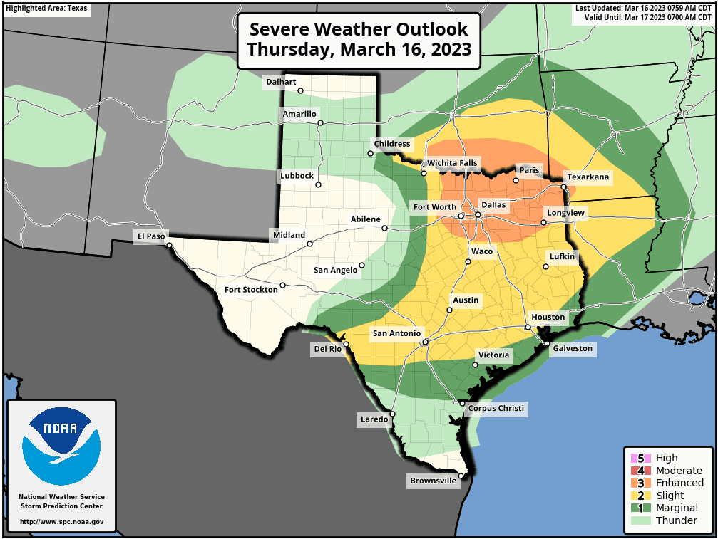
The Storm Prediction Center has placed the eastern half of the Hill Country and all of Central Texas under a Slight Risk (a 2 out of 5 risk) for severe thunderstorms through Thursday night.
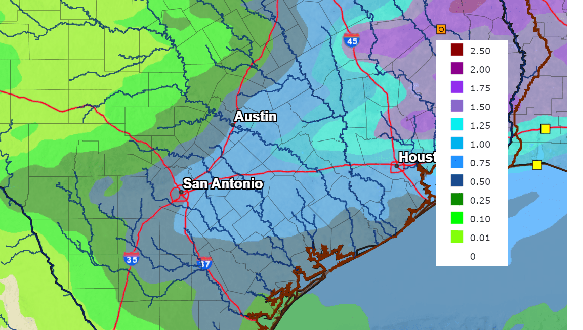
Rain amounts Thursday through Thursday night are forecast to be heaviest over areas along and east of Interstate 35, and lower out across the Hill Country. Totals are predicted to generally range between 0.25 and 0.5 inches across the Hill Country, and between 0.5 inches across Central Texas and the middle Texas coast.
NWS Rainfall Forecast for the Period 7 pm Wednesday through 7 pm Friday:
The rain is predicted to exit the region early Friday morning. Windy and much colder weather is predicted behind the cold front Friday into Friday night. Expect north and northeasterly winds at 15-25 mph, with gusts up to 45 mph through Friday evening. The cold temperatures are forecast to continue through the weekend. A light freeze will even be possible at a few isolated Hill Country locations.
- High temperatures Friday are forecast to only be in the low and mid-50s.
- Lows Saturday morning will include the midd-30s across the Hill Country, the upper 30s across Central Texas, and the low 40s across the coastal plains.
- High temperatures Saturday and Sunday are forecast to be in the mid-50s.
- Lows Sunday and Monday mornings will range from the upper 30s across the Hill Country to the mid-40s across the coastal plains.
A chance for rain is forecast to develop Sunday and continue through Monday night.
Bob
Social Media