Strong to Severe Thunderstorms Will Be Possible on Thursday
March 20, 2024
There will be two periods of possible strong to severe thunderstorms across our region Thursday as a remnant trough of low pressure over the Desert Southwest finally moves off to the east.
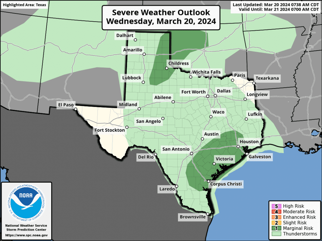
The first period for strong to severe storms looks to occur in a window roughly between 3 am and 8 am Thursday morning. This is when a small wave of low pressure ahead of the remnant trough is forecast to track east across South Texas out of Mexico. A warm front is forecast to spread inland across the coastal plains region tonight, bringing a return of warm, moist, and unstable air. With atmosphere lift increasing, high resolution guidance indicates scattered strong to severe thunderstorms may develop over the area from just east of Interstate 35, southeast to the coast. The Storm Prediction Center has placed this area under a Marginal Risk, or 1 out of 5 risk, for severe thunderstorms. The primary severe weather threat will be large hail, followed by damaging downburst winds.
All of the early morning thunderstorm activity is predicted to exit the region by mid-morning Thursday.
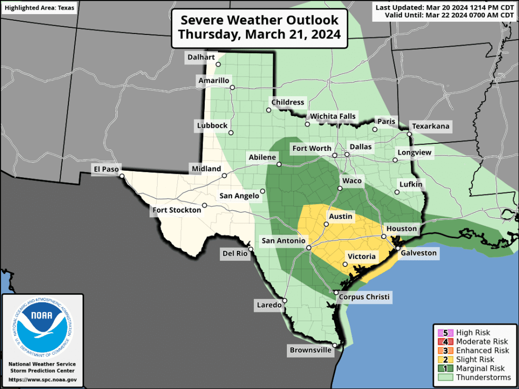
Attention then turns to Thursday afternoon and evening when the remnant trough of low pressure is forecast to track east across the northern half of the state. Forecasts call for an area of rain showers and thunderstorms to develop across the western Hill Country just after midday, with the area of rain and storms spreading to the east Thursday afternoon into Thursday evening. Once again, several ingredients are predicted to be in place that may allow some of the storms to become strong to severe. The Strom Prediction Center has placed most of the region under a Slight Risk, or a 2 out of 5 risk, for severe thunderstorms through Thursday evening. Large hail and damaging winds will be the primary severe weather threats. Some pockets of moderate to occasionally heavy will also be possible.
The probability for rain and storms Thursday afternoon will be near 80-90 percent.
The chance for rain is forecast to diminish after midnight Thursday night as drier air spreads behind the departing upper trough.
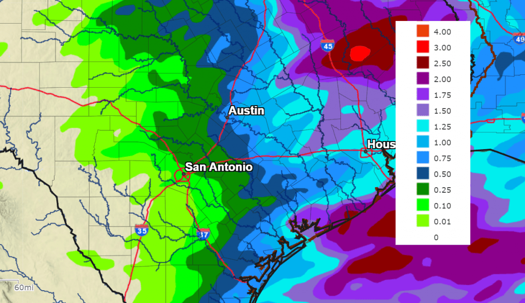
Rainfall Thursday through Thursday evening is forecast to be heaviest for areas located east of Interstate 35. Forecasts call for totals to average less than a tenth of an inch across the western Hill Country and be between a quarter and a half inch across the eastern Hill Country. For Central Texas and the middle Texas coast, totals are predicted to range between 0.5 and 1.5 inches.
NWS Rainfall Forecast for the Period 7 pm Wednesday through 7 pm Friday:
A mostly sunny sky is predicted for Friday and Saturday. Expect high temperatures both days to be in the 70s. Clouds will increase on Sunday. Another chance for rain and storms is forecast for Monday.
Bob
Social Media