Highland Lakes and Dams
LCRA operates six dams on the lower Colorado River in Central Texas: Buchanan, Inks, Wirtz, Starcke, Mansfield and Tom Miller. These dams form the six Highland Lakes: Buchanan, Inks, LBJ, Marble Falls, Travis and Austin. Two of the Highland Lakes – Buchanan and Travis – are the region’s water supply reservoirs to serve more than 1 million people as well as businesses, industries, the environment and agriculture in the lower Colorado River basin.
Each of the dams was built to help manage floods and generate hydroelectric power. The dams in the Highland Lakes chain have hydroelectric generation stations that contribute to the Central Texas energy supply. Together, the hydroelectric plants at the dams can provide more than 295 megawatts of power.
Read more about LCRA's hydroelectric generation
LCRA moves water downstream to meet water supply needs through hydroelectric turbines, creating power along the way. Power generation at LCRA’s six dams along the Highland Lakes was once the major source of LCRA’s electric generation capacity, but LCRA now releases water solely to generate electricity only when directed to do so by the Electric Reliability Council of Texas. Hydroelectric generation is a small portion of the power LCRA produces today, but it remains an important part of the Texas power grid.
LCRA is in the midst of a multi-year rehabilitation program to increase the useful life, generating capacity and production efficiency of the dams.
Buchanan Dam and Lake Buchanan
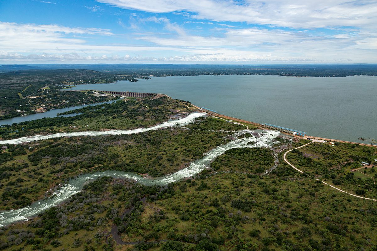
Primary purpose: Water supply, hydroelectric power
Location: Burnet and Llano counties
Owner: LCRA
Buchanan Dam and Lake Buchanan were the first completed in the Highland Lakes chain. They are named for U.S. Rep. J.P. Buchanan, who helped secure federal funds to complete the project after the original builder declared bankruptcy.
In 2021, LCRA completed a $51.1 million project to upgrade and strengthen the floodgates, hoists and other facilities at the dam.
Read more about Buchanan Dam and Lake Buchanan
Buchanan Dam
Dimensions
145.5 feet high, 10,988 feet long
Generating capacity
54.9 megawatts
Top of dam
1,025.5 feet above mean sea level (feet msl)
Overflow spillway elevation
1,020.35 feet msl
Floodgates
37
Discharge capacity
348,000 cubic feet per second (cfs):
- 7 large floodgates at 18,800 cfs each
- 30 small floodgates at 7,030 cfs each
- 2 turbines at 2,090 cfs each
- 1 turbine at 1,760 cfs
Original name
Hamilton Dam
Lake Buchanan
Lake area
22,452 acres
Water supply storage capacity
286.9 billion gallons
Elevation when full
1,020 feet msl
Volume when full
880,356 acre-feet
Historic high
1,021.4 feet msl on Dec. 20, 1991
Historic low
983.7 feet msl on Sept. 9, 1952
100-year flood level at dam
1,021 feet msl
Dimensions
30.65 miles long, 4.92 miles at widest point
Lowest Lake Buchanan Elevations
| Rank | Drought | Date | Height* (feet msl) |
|---|---|---|---|
| 1 | 1947-57 | Sept. 9, 1952 | 983.70 |
| 2 | 2008-16 | Sept. 20, 2013 | 985.27 |
| 3 | 1963-64 | Sept. 20, 1964 | 986.63 |
| 4 | 1983-84 | Oct. 7, 1984 | 987.97 |
| 5 | 1999-2000 | Oct. 15, 2000 | 994.73 |
| 6 | 2005-06 | Jan. 1, 2007 | 997.97 |
Inks Dam and Inks Lake
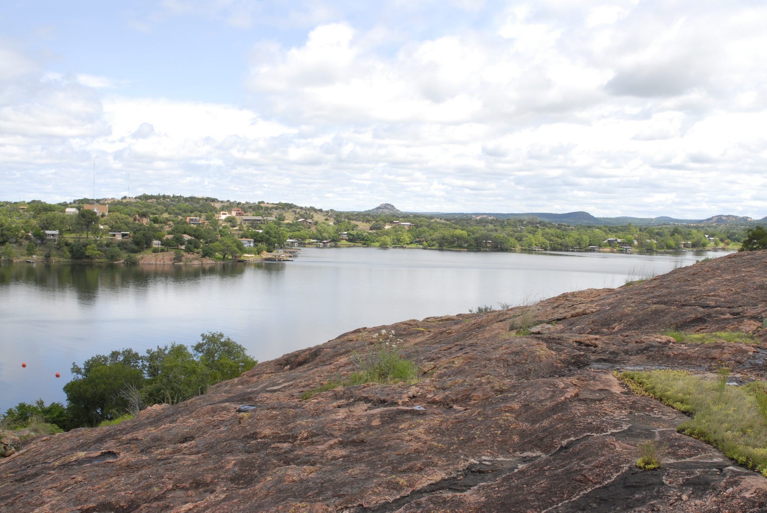
Year completed: 1938
Primary purpose: Hydroelectric power
Location: Llano and Burnet counties
Inks Dam has no floodgates, and the power plant is the smallest in the Highland Lakes chain. Inks Dam works in tandem with Buchanan Dam. A small amount of water can be released through hydroelectric generation, but the bulk of floodwaters pass over an uncontrolled spillway.
The lake and dam are named for Roy B. Inks, one of the original members on the LCRA Board of Directors.
Read more about Inks Dam and Inks Lake
Inks Dam
Dimensions
96.5 feet high, 1,547.5 feet long
Generating capacity
13.8 megawatts
Top of dam
922 feet msl
Floodgates
None
Overflow spillway elevation
888.32 feet msl
Discharge capacity
3,380 cubic feet per second (cfs):
- 1 turbine at 3,380 cfs
Original name
Arnold Dam
Inks Lake
Lake area
798 acres
Elevation when full
887.7 feet msl
Volume when full
13,772 acre-feet
Historic high
902.8 feet msl on July 25, 1938
Historic low
877.1 feet msl on Dec. 6, 1983
Target operating range
886.9 to 887.7 feet msl
100-year flood level at dam
901.7 feet msl
Dimensions
4.2 miles long, 3,000 feet at widest point
Wirtz Dam and Lake LBJ
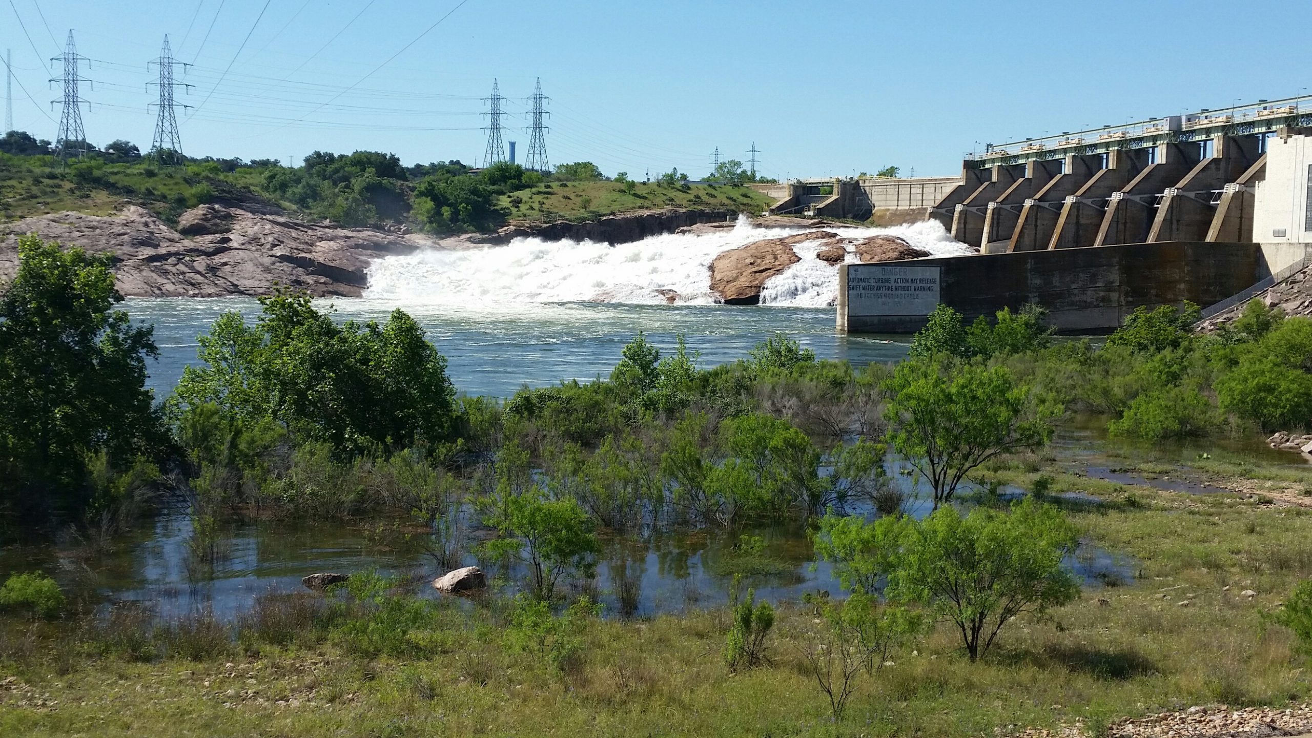
Year completed: 1951
Primary purpose: Hydroelectric power, cooling reservoir for Thomas C. Ferguson Power Plant
Location: Burnet and Llano counties
Wirtz Dam was built in tandem with Starcke Dam downstream. The dam was named in 1952 for Alvin J. Wirtz who was instrumental in LCRA’s creation and served as its first general counsel. The lake was named in 1965 for another advocate of LCRA, President Lyndon B. Johnson.
As part of a $76 million project, LCRA is replacing Wirtz Dam’s 10 floodgates and hoist bridge sections. Read more.
Read more about Wirtz Dam and Lake LBJ
Wirtz Dam
Dimensions
118.3 feet high, 5,491.4 feet long
Generating capacity
60 megawatts
Top of dam
838.5 feet msl
Overflow spillway elevation
835.5 feet msl
Floodgates
10
Discharge capacity
319,000 cubic feet per second (cfs):
- 10 floodgates at 30,800 cfs each
- 2 turbines at 5,250 cfs each
Original name
Granite Shoals Dam
Lake LBJ
Lake area
6,432 acres
Elevation when full
825 feet msl
Volume when full
131,618 acre-feet
Historic high
836.2 feet msl on Sept. 11, 1952
Historic low
793.8 feet msl on Nov. 16, 1970
Target operating range
824.4 to 825 feet msl
Dimensions
21.15 miles long and 10,800 feet at widest point
100-year flood level at dam
828.1 feet msl
Original name
Lake Granite Shoals
Starcke Dam and Lake Marble Falls
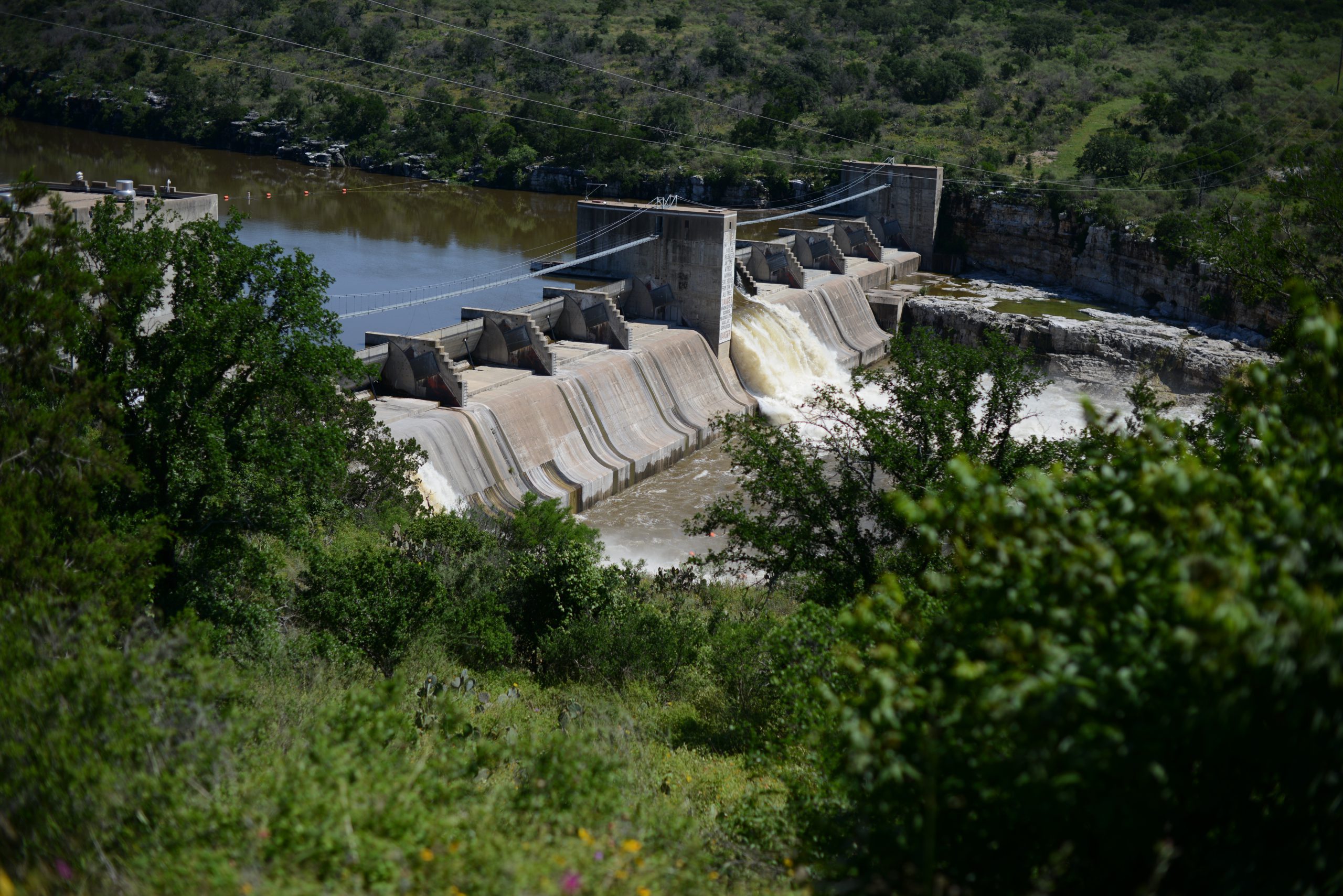
Primary purpose: Hydroelectric power
Location: Burnet County
Starcke Dam is the smallest in the Highland Lakes chain, and the last one completed. The dam was renamed in 1962 for Max Starcke, LCRA’s second general manager, who served from 1940 to 1955.
Read more about Starcke Dam and Lake Marble Falls
Starcke Dam
Dimensions
98.8 feet high, 859.5 feet long
Generating capacity
41.4 megawatts
Top of dam
761.5 feet msl
Floodgates
10
Discharge capacity
101,000 cubic feet per second (cfs):
- 10 floodgates at 9,020 cfs each
- 1 turbine at 5,500 cfs
- 1 turbine at 5,200 cfs
Original name
Marble Falls Dam
Lake Marble Falls
Lake area
613 acres
Elevation when full
737 feet msl
Volume when full
7,597 acre-feet
Historic high
756.3 feet msl on Sept. 11, 1952
Historic low
715 feet msl on Oct. 4, 1983
Target operating range
736.2 to 737 feet msl
100-year flood level at dam
754.3 feet msl
Dimensions
5.75 miles long and 1,080 feet at widest point
Mansfield Dam and Lake Travis
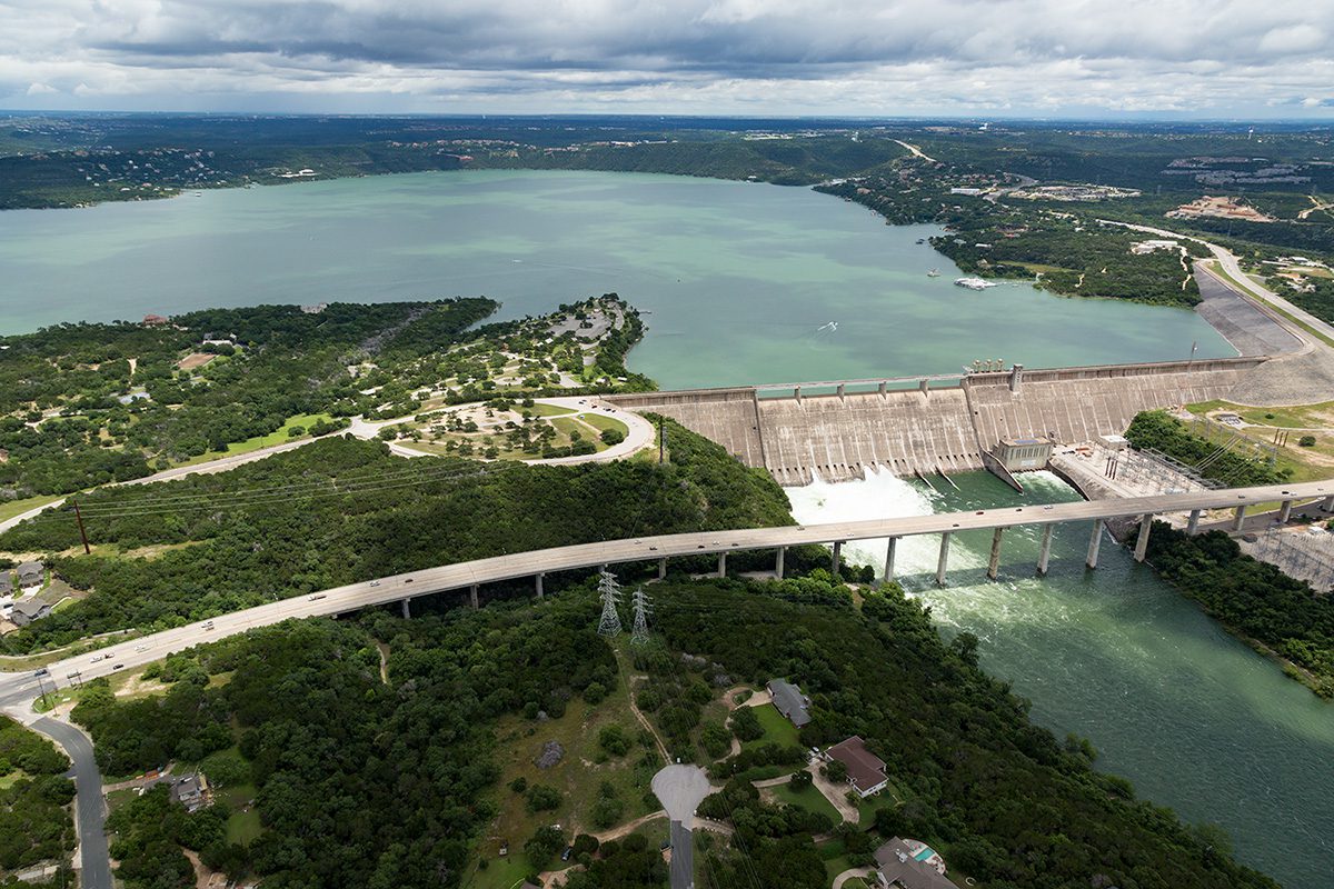
Primary purpose: Flood management, water supply storage, hydroelectric power
Location: Travis and Burnet counties
LCRA and the U.S. Bureau of Reclamation built Mansfield Dam from 1937 to 1942. The dam was built across a deep canyon at Marshall Ford, a long-time river crossing and settlement. After a severe flood in July 1938, LCRA raised the height of the dam to add storage capacity for floodwaters.
Lake Travis is the only lake in the Highland Lakes chain specifically designed to hold back floodwaters. Lake Travis is considered full for water supply purposes at 681 feet msl. At that level, the lake contains 1.1 million acre-feet of water. Lake Travis is designed to hold an additional 776,062 acre-feet of floodwaters in what is referred to as the flood pool.
LCRA is engaged in a multi-year, multi-million dollar renovation project to rehab and restore the dam’s floodgates to their original condition. Read the floodgate renovation project fact sheet.
Read more about Mansfield Dam and Lake Travis
Mansfield Dam
Dimensions
278 feet high, 7,089 feet long
Generating capacity
108 megawatts
Overflow spillway elevation
714 feet msl
Top of dam
750 feet msl
Floodgates
24
Discharge capacity*
*When at 681 feet msl. Discharge capacities increase as the lake level rises.
More than 131,000 cubic feet per second (cfs):
- 23 floodgates at more than 5,250 cfs each
- 1 variable discharge gate at 2,290 cfs
- 2 turbines at 2,530 cfs each
- 1 turbine at 2,520 cfs
Original name
Marshall Ford Dam
Lake Travis
Lake area
19,044 acres
Water supply storage capacity
363.3 billion gallons
Elevation when full
681 feet msl
Volume when full
1,115,076 acre-feet
Historic high
710.44 feet msl on Dec. 25, 1991
Historic low
614.18 feet msl on Aug. 14, 1951
100-year flood level at dam
722 feet msl
Top 10 highest levels for Lake Travis
| Rank | Date | Height* (feet msl) |
|---|---|---|
| 1 | Dec. 25, 1991 |
710.44 |
| 2 | May 18, 1957 |
707.38 |
| 3 | June 26, 1997 |
705.11 |
| 4 | Feb. 8, 1992 |
704.83 |
| 5 | Oct. 20, 2018 | 704.39 |
| 6 | July 6, 2007 | 701.52 |
| 7 | Nov. 24, 2004 |
696.70 |
| 8 | June 14, 1987 |
693.48 |
| 9 | July 7, 2002 |
693.47 |
| 10 | June 7, 2016 | 692.70 |
Lowest Lake Travis Elevations
| Rank | Drought | Date | Height* (feet msl) |
|---|---|---|---|
| 1 | 1947-57 | Aug. 14, 1951 | 614.18 |
| 2 | 1963-64 | Nov. 8, 1963 | 615.02 |
| 3 | 2008-16 | Sept. 20, 2013 | 618.56 |
| 4 | 1983-84 | Oct. 7, 1984 | 636.58 |
| 5 | 1999-2000 | Oct. 15, 2000 | 640.24 |
| 6 | 2005-06 | Dec. 13, 2006 | 643.55 |
*Based on daily readings at 8 a.m.
Tom Miller Dam and Lake Austin
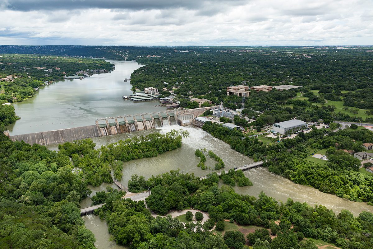
Year completed: 1940
Primary purpose: Hydroelectric power, water supply
Location: Travis County
LCRA built Tom Miller Dam on property leased from the City of Austin. Named for an Austin mayor, the dam was built atop the remains of two earlier structures, both called Austin Dam. The first was built from 1890 to 1893, and the other from 1912 to 1915. Massive floods destroyed the first dam and heavily damaged the second.
In October 2020, LCRA completed a major project to replace the original floodgates on Tom Miller Dam to help maintain continued reliability and safety of the dam for generations to come. The $10.8 million project continues LCRA’s investment in the dam and marks the dam’s second extensive renovation since it was completed in 1940.
Read more Tom Miller Dam and Lake Austin
Tom Miller Dam
Dimensions
100.5 feet high, 1,590 feet long
Generating capacity
17 megawatts
Top of dam
517 feet msl
Overflow spillway elevation
492.8 feet msl
Floodgates
9
Discharge capacity
108,000 cubic feet per second (cfs):
- 4 large floodgates at 15,300 cfs each
- 5 small floodgates at 8,580 cfs each
- 1 turbine at 1,970 cfs
- 1 turbine at 1,750 cfs
Lake Austin
Lake area
1,830 acres
Elevation when full
492.8 feet msl
Volume when full
24,644 acre-feet
Historic high
495.2 feet msl on May 25, 1981
Historic low
474.3 feet msl on Feb. 17, 1963
Target operating range
491.8 to 492.8 feet msl
100-year flood level at dam
493 feet msl
Dimensions
20.25 miles long, 1,300 feet at widest point
Original name
Lake McDonald


Social Media