Forecasters continue to monitor a storm system late week that will likely bring showers, thunderstorms, and a risk for severe weather to our region. A large trough of low pressure is predicted to move from the Four Corners region to northern Texas and southern Oklahoma on Friday, then exit to the northeast Friday night into Saturday. The trough will help push a Pacific cold front across Texas Friday and Friday night. The latest forecast solutions show the timing on the frontal passage has sped up a bit. The front is now forecast to reach the northern Hill Country early Friday afternoon, the Austin and Interstate 35 corridor between roughly 5 and 7 pm, and the coastal region shortly after midnight.
In advance of the cold front, isolated to widely scattered rain showers and thunderstorms are forecast Friday morning and Friday afternoon. However, the most significant rain and thunderstorm activity is forecast to occur along and just behind the cold front. With abundant moisture in place and plenty of atmospheric instability aloft, conditions will be favorable for the development of numerous showers and thunderstorms. In addition, it appears atmospheric conditions will be favorable for some of the storms to become strong and severe. The primary severe weather parameter will be damaging straight-line winds. However, there will also be some concern for large hail and tornadoes.
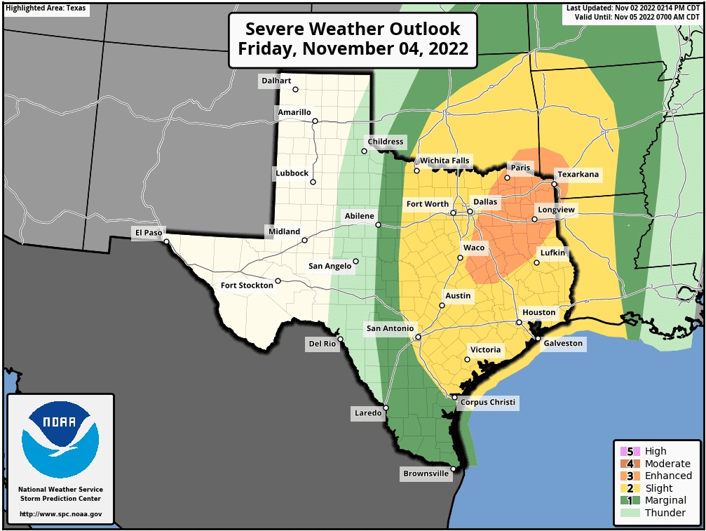
The Strom Prediction Center has placed the central and eastern Hill Country, all of Central Texasm and the middle Texas coast under a Slight Risk (a 2 out of 5 risk) for severe thunderstorms for severe between 7 am Friday and 7 am Saturday.
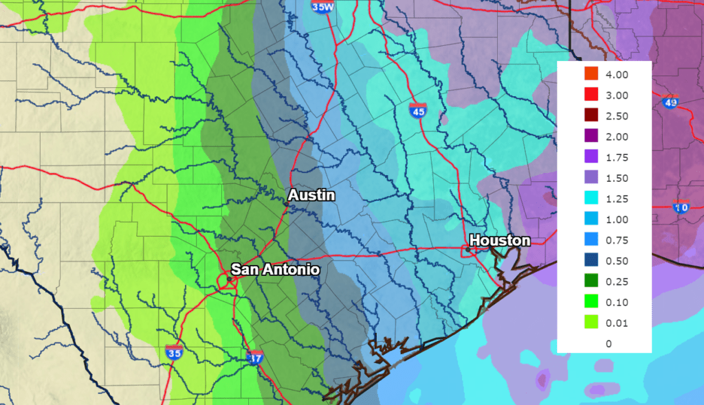
The rain is forecast to taper off from west to east Friday night, with all of the rain exiting our region before daybreak Saturday. Due to the very progressive nature of the line of storms, rain amounts are not predicted to be all that high. National Weather Service forecasts call for totals to range from less than a quarter inch across the western Hill Country, to around 1-1.25 inches for the area between La Grange and Matagorda Bay.
NWS Rainfall Forecast for the Period 7 pm Wednesday through 7 pm Saturday:
Sunny, breezy and slightly cooler weather will follow this weekend. Expect high temperatures in the 70s, with lows in the upper 40s to upper 50s.
Bob
Social Media