In the wake of a fairly wet spring, weather conditions trended much drier during the month of June as the spring weather pattern faded and the summer pattern arrived a few weeks early. There was little to no rain during the first half of the month, while periods of rain and thunderstorms became more frequent during the second half. Despite the scattered rains, totals for the month ended up below normal at most locations across the Hill Country and Central Texas. Rainfall of 5 to 10 inches occurred across Wharton, Matagorda and southern Colorado Counties, boosting totals there to well more than 2 inches above normal.
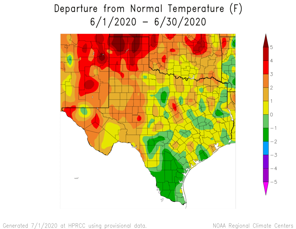
At Austin-Camp Mabry, the average temperature was 83.2 degrees, which was 1.0 degrees above normal. June 2020 ranks as the 31st warmest June on record dating back to 1897.
At Austin-Bergstrom, the average temperature was 81.5 degrees, which was 0.5 degrees above normal. June 2020 ranks as the 40th warmest or the 30th coolest June on record dating back to 1942.
June Rainfall Departure from Normal
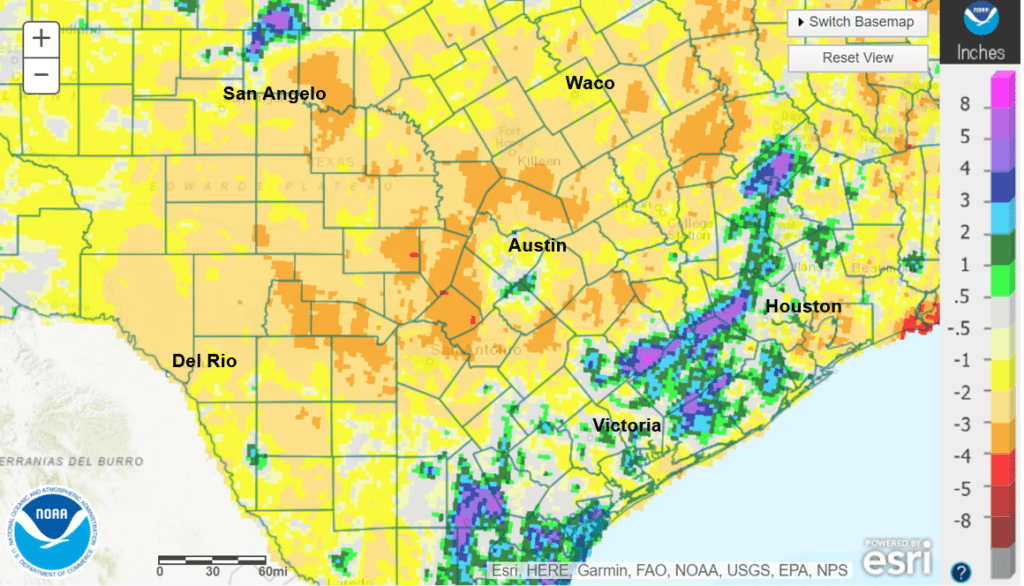
Data courtesy NOAA-National Weather Service
June temperatures averaged near normal to slightly below normal across the region. The hottest temperatures occurred during the first ten days of the month while readings trended slightly below normal toward the end of the month.
At Austin-Camp Mabry, rainfall totaled 2.67 inches, which was 1.66 inches below normal. June 2020 ranks as the 59th wettest or the 65th driest June on record dating back to 1897.
At Austin-Bergstrom, rainfall totaled 2.72 inches, which was 1.91 inches below normal. June 2020 ranks as the 40th driest or the 35th wettest June on record dating back to 1942.
The National Weather Service’s updated outlook for the month of July calls for increased odds temperatures will average above normal across all of Texas. The rainfall outlook is a bit more complicated. The outlook shows increased odds rainfall will average below normal across all of West Texas, including the western and northern Hill Country. The outlook calls for rainfall to average above normal across the coastal plains region. In between West Texas and the coastal plains, the outlook shows no clear trend. There are equal chances for rainfall to average above, below or near normal.
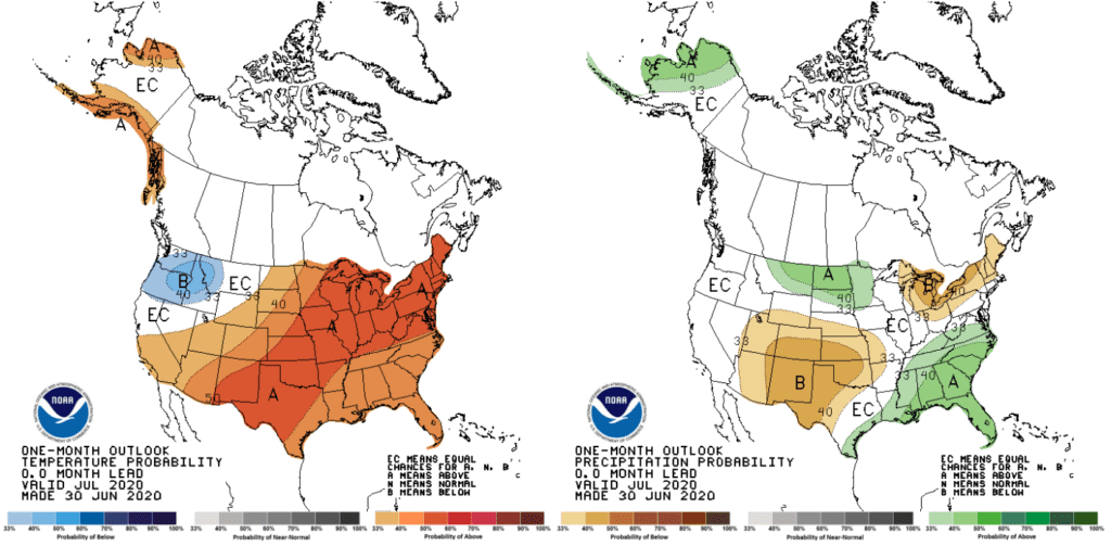
Keep in mind, the month of July is typically the driest or second driest month of summer. July is when the high pressure ridge begins to set up over Texas, keeping most of the storm systems away from our area. The tropics are also typically fairly quiet. At the same time, this is when temperatures begin to trend noticeably hotter. And true to form, medium-range forecast solutions are calling for a stretch of triple-digit temperatures to develop beginning late next week.
So buckle up and grab a lot of water. Summer 2020 is here and will be really cranking up in another week or so. Unfortunatley, don’t expect a lot of change going into August.
Bob
Social Media