A trough of low pressure moving east across Texas on Tuesday brought widespread rain to much of the state. The rain was very welcome! For the Hill Country, Central Texas, and the middle Texas coast, this was the first significant rain to occur since December 19th. For the most part, the rains weren’t heavy enough to cause a change in the status of the ongoing drought, but they did provide a much needed boost to the soil moisture and vegetation.
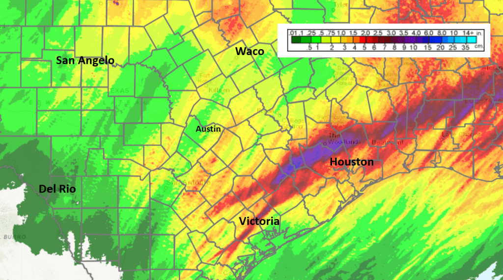
Doppler radar estimates show most of the Hill Country saw 48-hour totals between 0.25 and 0.5 inches. However, parts of Burnet, Blanco, and Kendall Counties saw totals between 1 and 1.5 inches.
Across Central Texas, most totals averaged between 0.5 and 1 inch. Parts of Bastrop, Caldwell, Lee, and Fayette Counties did see totals some between 1 and 2 inches.
But the heaviest rain occurred across the coastal plains, along and just south of Interstate 10. Here, radar estimates and surface reports show a large area of 4-6 inch totals stretching from Hallettsville, to Eagle Lake, to just northwest of Houston. LCRA’s highest gauged total was 4.68 inches at a location just west of Eagle Lake. Interestingly, most of Matagorda County saw totals of only between 0.25 and 0.5 inches.
NWS Estimate of Rain Falling Between 9 am Monday and 9 am Wednesday:
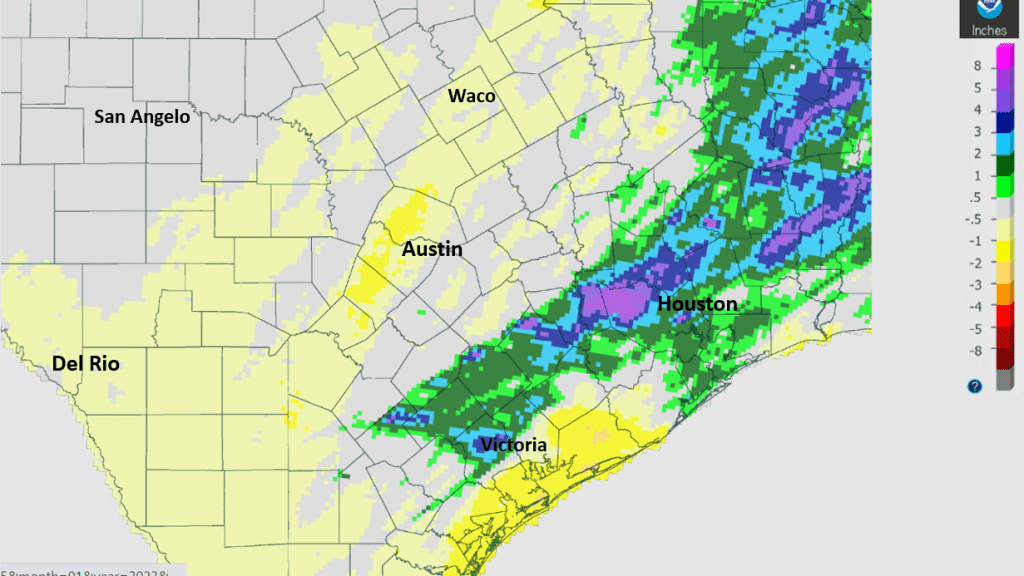
Despite Tuesday’s, totals for the month of January are still below normal across much of the Hill Country, along the Intestate 35 corridor, and close to the coast. But monthly totals across the coastal plains along and north of Highway 59 are actually running 1-2 inches above normal thanks to Tuesday’s rains.
Rainfall Departure from Normal, January 1-24 (West Gulf River Forecast Center)
All eyes are currently on La Niña. Forecasts continue to call for La Niña to weaken and dissipate this spring. Hopefully it’s demise will bring a return of near-normal to possibly above-normal rainfall by late spring or early summer.
Bob
Social Media