The strong tropical wave forecasters have been monitoring for the past few days has become better organized and upgraded to Tropical Depression Fourteen. This system will have a good potential to affect the Texas coast during the early and middle parts of next week.
Wednesday morning’s visible satellite images indicated the area of disturbed weather moving across the central Caribbean Sea has developed a closed surface circulation and thunderstorm activity appears to be increasing in organization. Based on these factors, the National Hurricane Center has begun issuing advisories on Tropical Depression Fourteen.
As of 10 am CDT, the center of Tropical Depression Fourteen was located near latitude 15.1 North, longitude 79.7 West, or roughly 235 miles east of the Nicaraguan/Honduras border. The depression is moving toward the west near 21 mph and a westward motion is expected to continue through this evening. A turn toward the west-northwest and northwest with a decrease in forward speed is forecast tonight and Friday, with a general northwest motion continuing through at least Sunday. Maximum sustained winds are near 35 mph with higher gusts. Strengthening is forecast during the next couple of days, and the depression is expected to become a tropical storm later today or tonight. The system could be near or at hurricane strength when it reaches the Yucatan Peninsula of Mexico late Saturday.
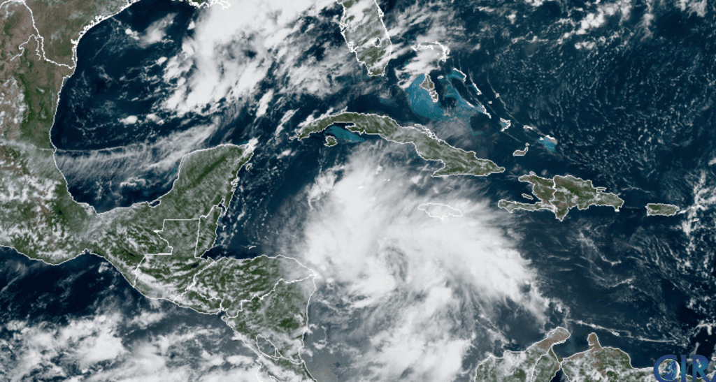
RAMMB-CIRA 08/20/2020 1:00 pm CDT
The latest National Hurricane Center forecast track calls for the system to move near or just north of the northeastern coast of Honduras and the Bay Islands on Friday and approach the east coast of the Yucatan Peninsula of Mexico on Saturday. The center is then expected to cross the Yucatan Peninsula Saturday night and move into the south-central Gulf of Mexico on Sunday.
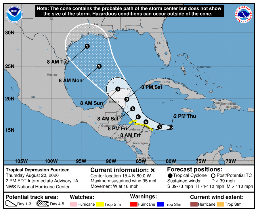
This weekend, the system is predicted to turn to the northwest into south-central Gulf of Mexico as it moves around the southwestern side of a building sub-tropical ridge over the southwest Atlantic Ocean. The latest computer-forecast solutions are starting to come into better agreement with the system tracking toward the northwest Gulf of Mexico by early next week. But note there is considerable uncertainty as to where this system will make landfall due to competing influences between a trough of low pressure off the Texas coast and that ridge of high pressure over the southwestern Atlantic. The National Hurricane Center’s cone of uncertainty for position at day 5 (Tuesday) stretches from Port Isabel, Texas to near Morgan City, Louisiana.
The forecast for landfall will narrow over the next few days the computer forecast solutions get a better handle on the steering currents. At this point a track toward the lower, middle or upper Texas are all possible—as well as a track toward Louisiana. Stay tuned for further updates later today and over the next few days,
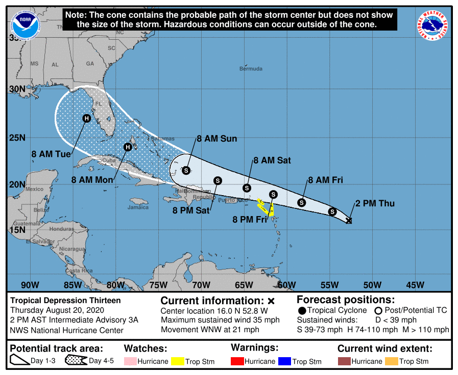
Do note another tropical depression (tropical depression 13) has formed about 750 miles east of the northern Leeward Islands. This system is forecast to become a tropical storm later today. The latest forecasts call for the system to track north of Hispaniola this weekend, reaching the eastern Gulf of Mexico early next week. As of now, this system appears to be a threat to Florida and the eastern Gulf but will need to be watched in case a it takes a more westerly path toward the western Gulf the second half of next week.
Bob
Social Media