I wanted to give everyone a heads up the threat for severe storms has expanded in areal coverage for Tuesday night. In addition to the Hill Country, the threat area now includes the Interstate 35 corridor and the Austin metro area.
A Pacific cold front is forecast to push into West Texas this evening and eventually move across the Hill Country, Central Texas and the middle Texas coast late tonight into Wednesday morning. An area of showers and thunderstorms is forecast to develop across the Concho Valley region late this evening and spread east with the cold front overnight. Atmospheric conditions are forecast to be favorable for some of the thunderstorms to become strong and severe. The Storm Prediction Center has placed all of the Hill Country and the Interstate 35 corridor, from San Antonio to Austin, to Waco under a Slight Risk (2 out of 5 risk) for severe thunderstorms late Tuesday night into early Wednesday morning. There will be a Marginal Risk (1 out or 5 risk) for severe thunderstorms for the area between Bastrop and La Grange.
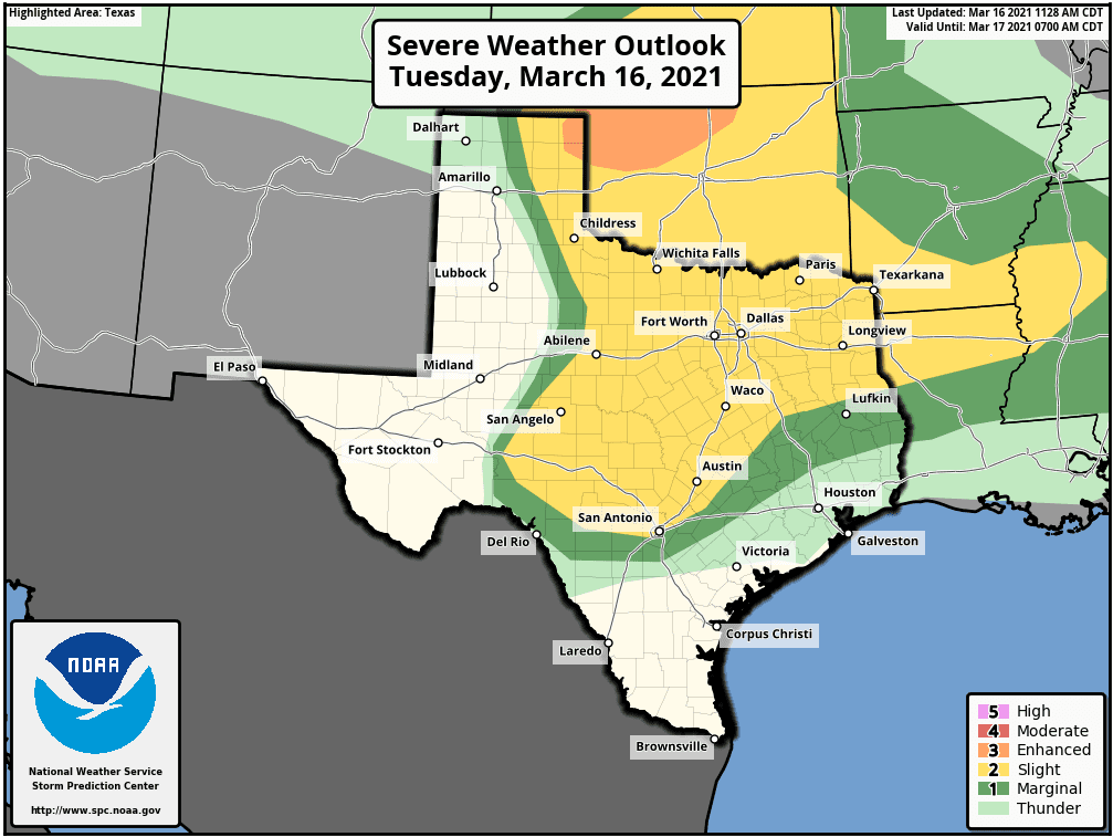
- The primary severe weather threats will include large hail and damaging straight-line winds in excess of 60 mph. There will also be a low threat for isolated tornadoes.
- The area of rain and storms is forecast to enter the northern and western Hill Country shortly after midnight and steadily march to the east and southeast. The storms are predicted to reach the Austin/I-35 corridor around 4 or 5 am and the La Grange area around am 9 Wednesday. Rain showers and scattered thunderstorms should push across the coastal plains region late morning into early afternoon Wednesday.
- Rain amounts are forecast to generally average between a quarter and a half inch across the Hill Country and Central Texas regions. Isolated totals to near one inch will be possible. Totals across the coastal plains are forecast to average around a quarter inch, or less.
Behind the cold front, clouds will clear from west to east Wednesday morning. Sunny and windy weather is expected late morning and through the afternoon. Expect westerly winds at 10-20 mph with occasional gusts to 30 mph. Temperatures will reach the low and mid-70s. Breezy conditions are expected to continue Wednesday night through Thursday as slightly cooler air arrives behind a Canadian cold front.
Bob
Social Media