Forecasters continue to keep a close watch on an area of disorganized showers and thunderstorms located over the Bay of Campeche and southern Mexico. This activity is associated with a broad low located over the region.
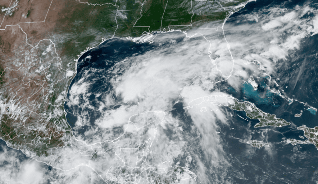
Colorado State University/RAMMB 06/16/2021 2:00 pm CDT
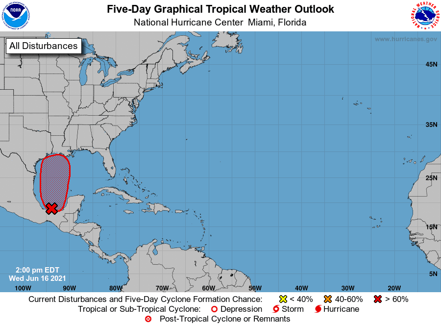
According to the National Hurricane Center, this system is not expected to move much through Wednesday night, and little if any development is expected during that time. However, the system should begin to move northward on Thursday, and a tropical depression is likely to form by late Thursday or on Friday when the low moves across the western Gulf of Mexico. NHC forecasters are giving this system a 70 percent chance for tropical development over the next 48 hours. An Air Force Reserve Unit reconnaissance aircraft is scheduled to investigate the area on Thursday.
The general consensus among the computer forecast solutions is for the tropical system to continue moving north across the western Gulf of Mexico Friday, with the system moving inland somewhere near the Sabine river, or southwest Louisiana on Saturday. Despite high chances for this system to become a tropical depression or tropical storm, any significant impacts should remain well to the east of Central Texas and the middle Texas coast, with our region staying on the dry side of the system.
The weekend outlook for the Hill Country and Central Texas calls for mostly sunny and continued hot weather, with high temperatures in the middle and upper 90s. There will be a 30 percent for scattered showers for the middle Texas coast, but rain amounts should average less than a quarter inch.
There are some hints the entire region will see a chance for rain develop next Monday through Wednesday when a cold front sags south into North Texas.
Bob
Social Media