To almost no surprise, data shows July’s average temperature so far has been among some of the warmest on record. Obviously, daytime temperatures have been sizzling, but nighttime readings have also been much warmer than normal.
An analysis of the departure from normal temperature through July 14th shows readings have been averaging between 4 and 6 degrees above normal across the Hill Country and a good part of Central Texas. Readings have averaged between 2 and 4 degrees above normal across the coastal plains.
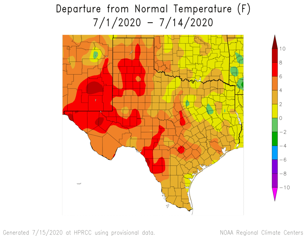
At Austin-Camp Mabry, the average temperature so far this month has been 89.5 degrees, which is 5.1 degrees above normal. The average temperature between July 1 and July 14 ranks as the second warmest such period on record. It is 0.1 degrees behind a similar period occurring in that very hot summer of 2009.
In addition to the very hot temperatures, there has been little to no rain in the rain gauge so far this month. Parts of the western and northern Hill Country received some nice rain early in the month, while there has been little to no rain at most other locations. Granted, July is typically the driest month of summer and for many locations, the driest month of the year. However, it is quite rare to go through the entire month with no rain.
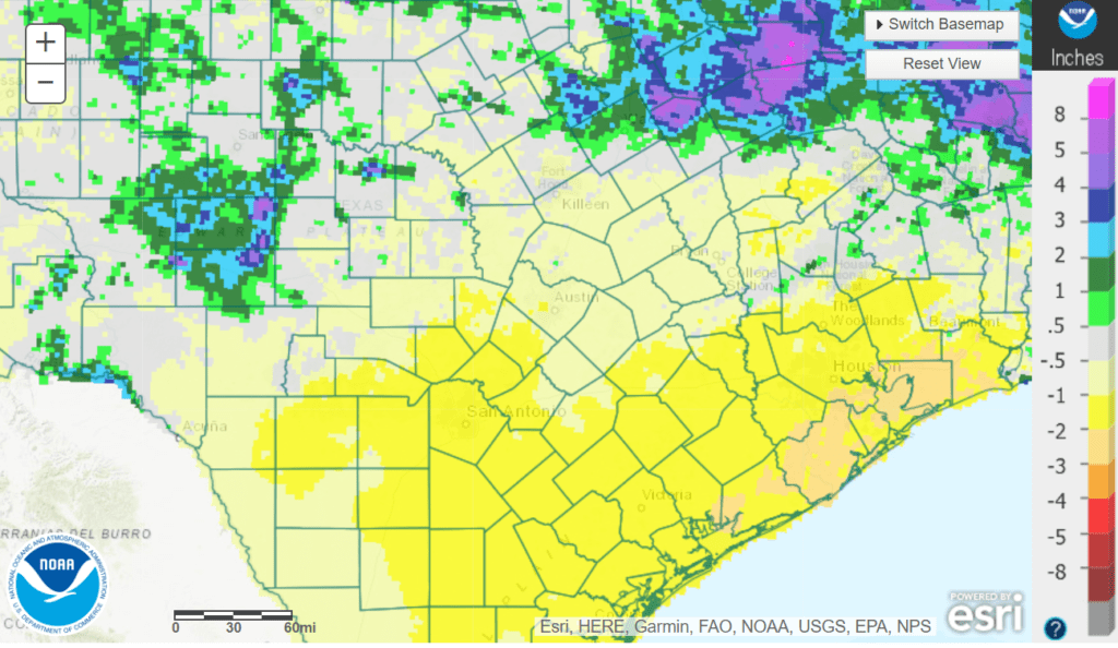
Rainfall Departure from Normal for the Period July 1-14. Data courtesy NWS West Gulf River Forecast Center.
Few changes in the hot and dry weather pattern are forecast for the remainder of this week and this weekend. Temperatures should trend down a few degrees from the record hot temperatures we saw on Monday Tuesday. Unfortunately, no rain is in the forecast. There are some hints for the development of a few scattered rain showers the second half of next week when the stagnant ridge of high pressure pulls further to the north.
Bob
Social Media