An area of disturbed weather which has drifted west and southwest this week across the western Gulf of Mexico appears to be organizing. A broad area of low pressure has recently developed over the southwestern Gulf of Mexico in connection with this area of low pressure. According to the National Hurricane Center (NHC), upper-level winds over this area are forecast to gradually become favorable for development and a tropical depression is likely to form late this week or over the weekend. NHC forecasters are giving this system a high chance, a 70 percent chance for development over the next 5 days.
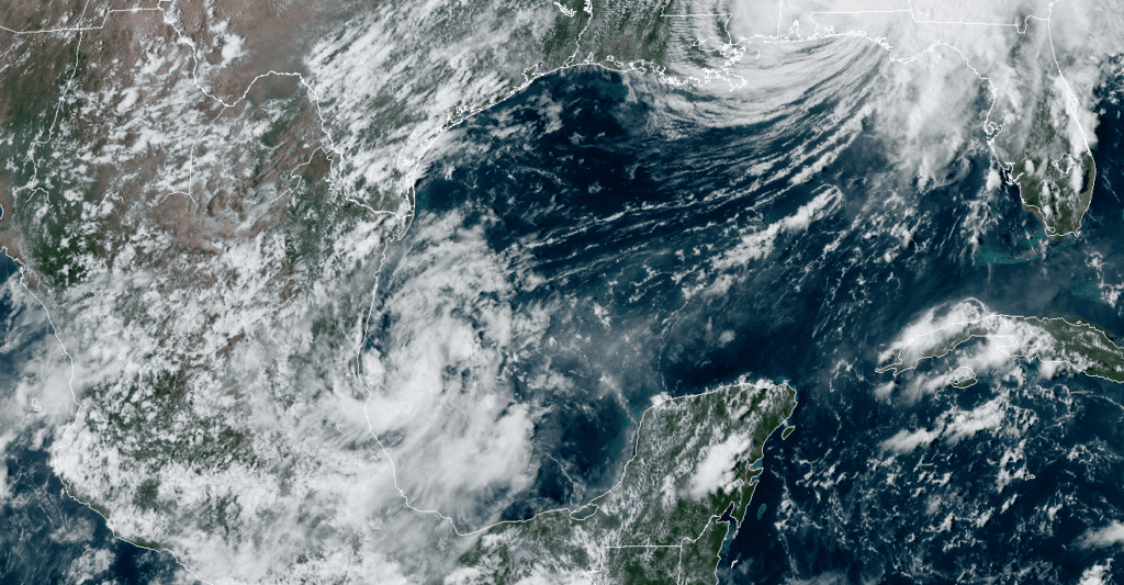
The low is located in an area with very weak steering currents and as a result, it is forecast to stay offshore and meander over the southern and southwestern Gulf of Mexico for the next several days. Forecasts call for a weak cold front to push out into the western Gulf of Mexico Wednesday night, followed by another cold front late Saturday into Sunday. Both of these fronts are expected to keep moisture associated with the low pressure area out over the Gulf waters through at least Sunday.
As of now, it is now clear where the disturbance will eventually make landfall. Wednesday’s computer-forecast solutions keep the system over the western Gulf of Mexico through next Monday.
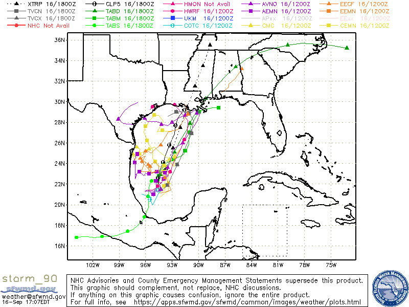
Stay tuned for further updates to see if the system develops and for more information on where it will eventually move to.
Bob
Social Media