As of late Thursday morning, Doppler radar showed a fairly solid area of rain and thunderstorms over Northeast Texas, with the leading edge stretching between Dallas and Huntsville. The activity was spreading to the southwest. The rain and storms are being generated by a trough of low pressure that is rotating around the large heat dome to our west.
High resolution forecasts indicated atmospheric conditions will be somewhat favorable for the area of rain and thunderstorms to hold together as they move southwest towards Central Texas and the Hill Country. Forecasts call for the rain and storms to reach the northern Hill Country and the Intestate 35 corridor sometime around 3-4 pm, with the activity spreading into the Hill Country and the coastal plains region in the late afternoon and early evening. Coverage of the rain and storms looks to be greater than what we have seen with the isolated storms over the past couple of days. The probability for rain is predicted to be at 50 percent. The showers and storms are forecast to diminish this evening as they push off to the southwest and weaken.
While widespread severe storms are not expected, a few of the storm may produce strong and gusty winds, along with dangerous cloud to ground lightning.
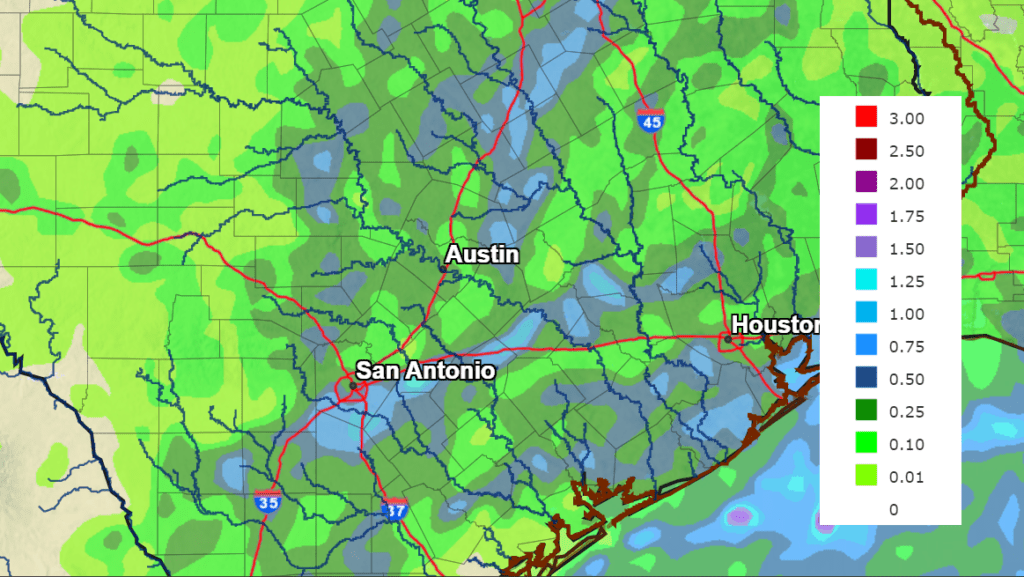
Rain amounts from today’s storms are forecast to generally average between 0.25 and 0.5 inches, with a few isolated totals to around 1 inch.
NWS Rainfall Forecast for the Period 7 am Thursday through 7 am Friday:
The rain and storms are forecast to arrive across the Austin/Interstate 35 corridor around the time of peak heating. Ahead of the storms, temperatures are forecast to reach close to 103-104 degrees across the Hill Country and most of Central Texas, and into the upper 90s across the coastal plains.
Sunny and dry weather is forecast Friday and this weekend. Temperatures will still be quite hot, with readings peaking around 102-103 degrees each day.
The tropics remain quiet and no tropical development is expected over the next 5 days.
An Historic Austin Heat Record
We all know it has been crazy hot lately. And for Austin, the recent spell of heat has been historic. The average temperature at Camp Mabry (highs and lows) over the past seven days (between 7/7 and 7/13) has been 92.9 degrees. According to Austin’s climate data base, this period has been the hottest 7-day stretch of temperatures on record, dating back to 1897. Not just for July, but for all time. It beat the previous 7-day stretch of temperatures recorded between August 27th and September 2nd, 2011, when the average temperature was 92.8 degrees.
Bob
Social Media