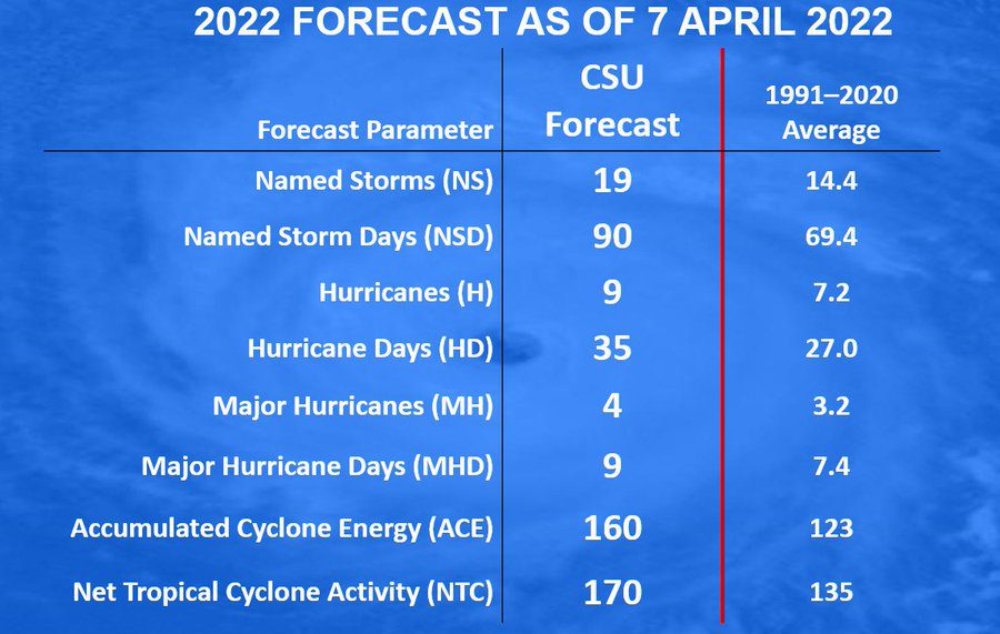
Phil Klotzbach and his forecast team at Colorado State University are calling for the seventh consecutive summer with above-average Atlantic hurricane activity. The outlook, released Thursday morning, calls for
- 19 named storms, (long-term average of 14)
- 9 hurricanes (long-term average of 7)
- 4 major hurricanes (long-term average of 3)
- Atlantic basin Accumulated Cyclone Energy (ACE) and Net Tropical Cyclone (NTC) activity to be approximately 130 percent of their long-term averages
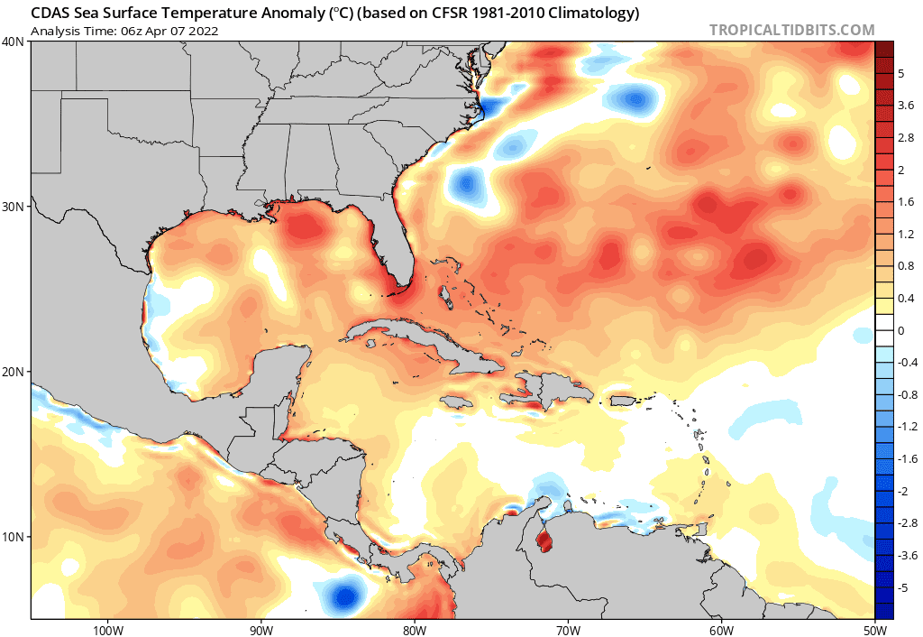
CSU forecasters noted the tropical Pacific is currently characterized by weak La Niña conditions. La Niña is characterized by cooler than-normal waters in the central and eastern tropical Pacific. La Niña tends to weaken high altitude winds in the tropical Atlantic that flow from west to east. This often reduces wind shear and helps storms develop and thrive. La Niña is predicted to fade this summer, with the Pacific returning to ENSO-neutral conditions by the fall. Sea surface temperatures in the eastern and central tropical Atlantic are currently near average. Meanwhile, sea surface temperatures, across the Caribbean and most of the subtropical Atlantic are warmer than normal. These unusually warm waters often translate into considerably more ocean heat content to fuel and strengthen tropical systems.
The CSU outlook indicated the risk for a major hurricane making landfall along the East and Gulf coasts and in the Caribbean is substantially elevated compared with the 1990 to 2020 average.
It is interesting to note La Niña conditions were present in both 2020 and 2021. The feature contributed to the development of very active hurricane seasons, with destructive Category 4 hurricanes such as Iota in 2020, which slammed Central America, and Ida in 2021, which caused widespread destruction along the Gulf Coast of the United States.
Bob
Social Media