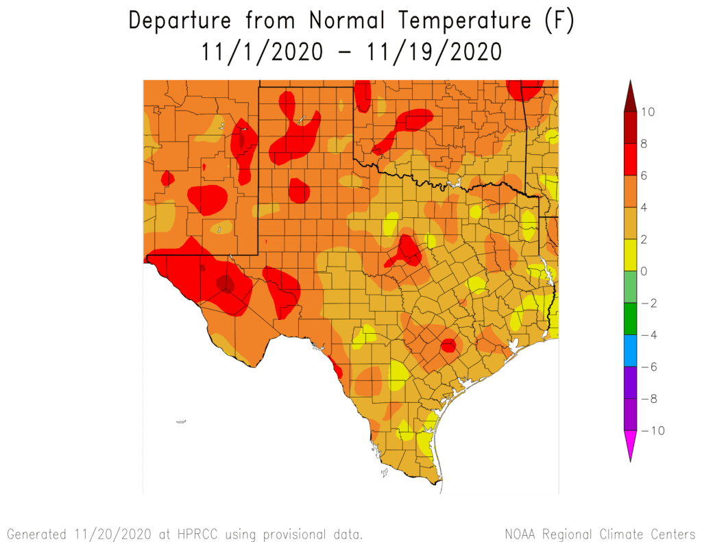
Quiet and unseasonably mild weather continues across Central and South Texas. If you’re thinking the recent weather doesn’t feel much like November, you’re right. Temperatures so far this month have averaged between 3 and 5 degree above normal. Austin-Camp Mabry’s average November temperature currently ranks as the 5th warmest on record. In addition to the unusually warm weather, rain has pretty much been a no-show so far this month, with most areas reporting zero or just a few drops.
Forecasts call for the mild weather pattern to continue across our region through the upcoming week as the jet stream remains primarily up to the north. A couple of waves of low pressure traveling along the jet will help push a couple of cold fronts into Texas, but only minor cool downs are expected behind the fronts. Unfortunately, the upcoming cold fronts are not forecast to bring much, if any rain.
The large area of high pressure which spread into Texas earlier this week bringing slightly cooler air, has shifted to the southeastern U.S. Circulation around the high is carrying warm and moist air from the Gulf of Mexico into Texas along nice southerly breezes. This pattern is predicted to continue into the weekend. This afternoon’s weather is shaping up to be mostly sunny and quite mild, with high temperatures in the upper 70s to low 80s. Lows Saturday morning will range from the mid-50s across the Hill Country to the low 60s across Central Texas and the middle Texas coast. Saturday is expected to start off cloudy with areas of fog developing between the coast and the Interstate 35 corridor. The clouds and fog should break late morning, with the sky becoming mostly sunny by afternoon. It will be another warm one, with high temperatures between 78 and 82 degrees. Lows Sunday morning will be in the upper 50s to low 60s.
On Sunday, a weak cold front is forecast to sag south out of North Texas in the afternoon, then pull up stationary along the Interstate 10 corridor Sunday evening. There will be a slight chance for a few rain showers to develop along the cold front over the Hill Country and Central Texas regions, but rain amounts, if any, should total less than a tenth of an inch. A partly to mostly cloudy sky is forecast Sunday afternoon. High temperatures will range from the low 70s north to around 80 degrees near the coast. It will be partly cloudy and slightly cooler Sunday night. Lows Monday morning will include the mid and upper 40s across the Hill Country with mid and upper 50s at most other locations.
Clouds will decrease Monday morning, with the sky becoming partly cloudy by the afternoon. High temperatures will be in the low and mid-70s. Lows Tuesday morning will be in the mid and upper 50s.
Another weak cold front is predicted to slide south across our region Tuesday night into Wednesday morning. Atmospheric conditions appear favorable for the development of a few showers along and behind the cold front Tuesday night into early Wednesday morning. Once again, rain amounts look to be quite low—generally around a tenth of an inch or less. A mostly sunny sky is forecast Wednesday afternoon. High temperatures Wednesday will be in the mid and upper 70s. Lows Thursday morning will include the mid-40s across the Hill Country, the upper 40s across Central Texas and the low to mid-50s near the coast.
Mostly sunny, dry and pleasant weather is forecast Thanksgiving Day and next Friday as our region remains under the influence of a weak ridge of high pressure. High temperatures Thursday and Friday will generally be in the upper 70s. Lows Friday morning will be in the 50s.
Longer-range forecasts are calling for some changes in the weather pattern beginning next weekend when a large trough of low pressure develops over the western and central U.S. A cold front associated with the trough is predicted to push south across Texas next Saturday and move into the Gulf of Mexico. Forecasts call for scattered showers to develop along and behind the cold front next Saturday and Sunday. As of now, totals are expected to generally be in the range of a quarter to half inch. A trend back toward dry weather is predicted for the first few days of December. Temperatures are predicted to turn cooler next weekend, with highs falling to the 60s and lows in the 40s. The long-range forecasts call for this cooler temperature pattern to persist through the first week of December.
Tropical Weather Outlook
Weather conditions have turned quiet across the tropical Atlantic following Hurricane Iota earlier this week. National Hurricane Center forecasters are monitoring the western Atlantic in the area near and north of Bermuda, where a non-tropical area of low pressure could possibly form early next week. This system will only have a short period of time to develop subtropical characteristics before it moves northeastward and merges with a cold front by the middle of the week. NHC forecasters give this system only a 10 percent chance for development over the next 5 days.
Elsewhere, there are no systems in place which pose a threat for tropical development over the next 5 days.
Winter Stars are Returning to the Evening Sky
Tonight, watch for the constellation Orion the Hunter, perhaps the easiest to identify of all constellations. Famous Orion is back in the evening sky, rising in the east around 9 pm. The most noticeable part of Orion is Orion’s Belt. The three stars in a row of his belt aren’t the brightest in the sky, but they’ll catch your eye. Orion appears to be lying on his side – with his Belt stars pointing upward – when he first ascends into our eastern sky in mid-evening at this time of year. Orion’s two brightest stars – Betelgeuse and Rigel – shine on opposite sides of the Belt. About hours after Orion comes up, watch for the brightest star in the sky, Sirius to rise above the eastern horizon.
Have a good weekend.
Bob
Social Media