The National Hurricane Center (NHC) is currently monitoring a tropical wave located over the central Caribbean Sea. According to the NHC, a broad area of low pressure is expected to form over the southwestern Caribbean Sea in a couple of days from this tropical wave and environmental conditions are forecast to be conducive for tropical development if the low remains over water.
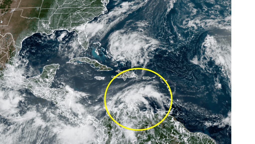
NOAA/Colorado State University/RAMMB 08/24/21 1:40 pm CDT
A tropical depression could form late this week or this weekend while the system moves northwestward over the northwestern Caribbean Sea and across the Yucatan Peninsula of Mexico. NHC forecasters are giving this system a medium chance (a 60 percent chance) for development over the next 5 days. The system is forecast to reach the southwestern Gulf of Mexico by Sunday. Tuesday’s forecast model solutions are in fair agreement this system will likely develop into some sort of tropical cyclone either late week or this weekend and there will be an increase in moisture over the western Gulf of Mexico by late week.
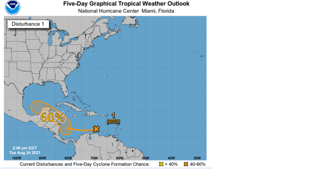
It’s too early to provide any specifics on the eventual track or intensity at this time. Tuesday’s forecast model solutions have generally trended northerly, with the system making landfall somewhere along the Texas coast next week, compared to Monday’s data. Fewer solutions are now showing a more southerly track into Mexico. But keep in mind, there is oftentimes low accuracy in model performance until there is an observed defined center of circulation. The bottom line is the track and forecast will remain changeable and uncertain until the system forms, which is not expected to occur until Friday at the earliest and possibly as late as over the weekend.
I’ll pass along additional updates over the next couple of days as the situation evolves.
Bob
Social Media