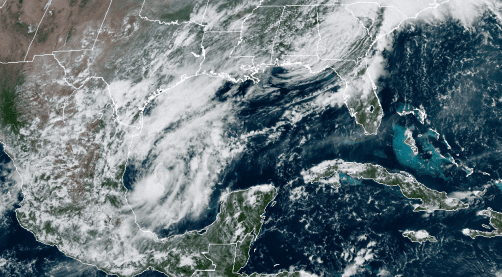
Thunderstorm activity has continued to increase and become better organized today in association with a well-defined low pressure system located over the southwestern Gulf of Mexico, just east of the eastern Mexican coast. According to the National Hurricane Center, upper-level winds are gradually becoming more favorable for tropical development and, if this recent development trend continues, a tropical depression or a tropical storm could form within the next day or so. The National Hurricane Center is giving this system a 90 percent chance for development over the next 48 hours.
NOAA-RAMMB 09/17/2020 2:30 pm CDT
The low is currently caught up in an area of very weak steering currents and is expected to meander over the southwestern Gulf of Mexico through Thursday night before moving slowly northward to northeastward on Friday and Saturday. An Air Force Reserve reconnaissance aircraft is scheduled to investigate the disturbance this afternoon.
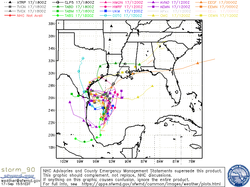
A cold front is predicted to push out into the northern Gulf this weekend and this will help trap the system south of the frontal boundary. It appears the trough associated with the front will try to pull the low toward the NE into the west-central Gulf of Mexico, but it likely won’t be quite strong enough to pull the system toward the north-central Gulf. As a result, the system is forecast to remain over the western /northwestern Gulf of Mexico through at least the first half of next week. The computer-forecast solutions offer up a number of possible track solutions, but confidence in any of the solutions is very low given the overall weak steering patterns that will be in place. It is quite possible this system may linger over the western Gulf of Mexico through late next week. With the low located just off the Texas coast, it may be close enough to bring periods of showers and thunderstorms to the middle and upper Texas coast next week.
Here is a look at the latest set of 5-day computer-model solutions/tracks which show no clear trends.
I’ll pass along further updates as the situation evolves.
Bob
Social Media