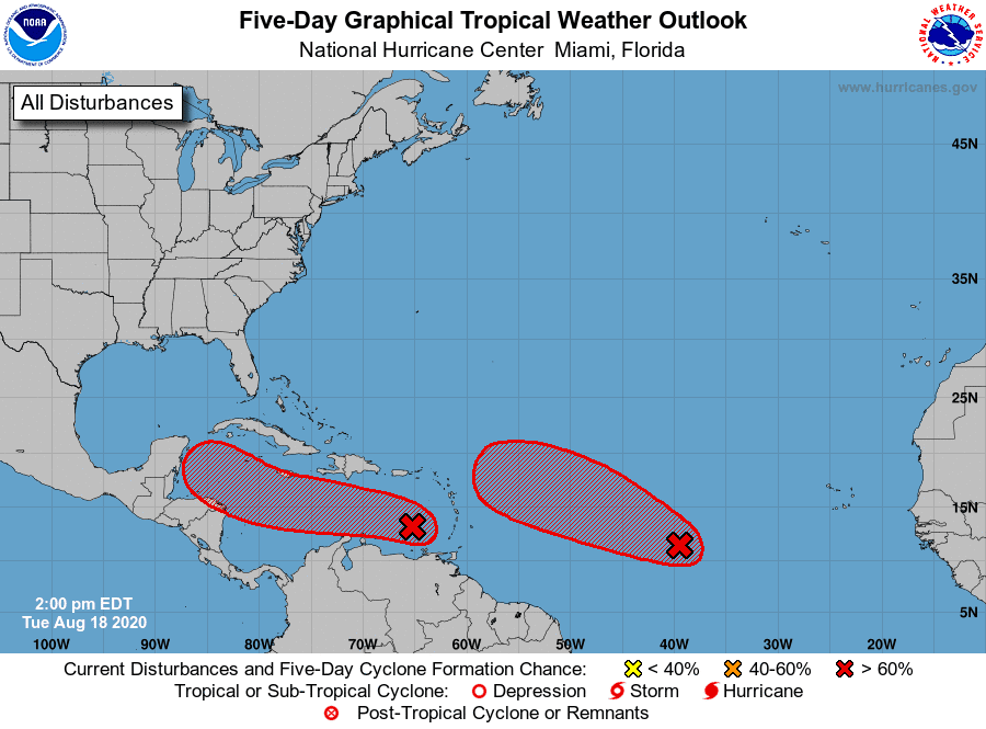
National Hurricane Center forecasters continue to closely track two strong tropical waves. The first was is located in the eastern Caribbean Sea and the second one is located in the east-central tropical Atlantic. While it is too early to tell, one or both systems may enter the Gulf of Mexico next week.
Wave number one over the eastern Caribbean Sea continues to produce an area of disorganized thunderstorms and gusty winds. This wave is moving quickly westward at about 20 mph and significant development is unlikely while it moves across the eastern and central Caribbean Sea during the next day or two. After that time, forecasters believe the wave will slow down, and a tropical depression is likely to form late this week or this weekend, about the time it reaches the northwestern Caribbean Sea.
NHC forecasters are giving this system a 70 percent chance for tropical development over the next 5 days.
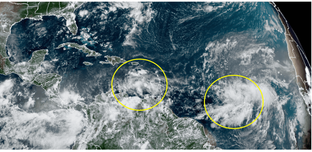
RAMMB-CIRA 08/18/2020 1:20 pm CDT
Wave number two is accompanied by an area of low pressure and is located about 1300 miles east of the Lesser Antilles. The system is producing a fairly large and concentrated area of showers and thunderstorms. Environmental conditions are conducive for development, and NHC forecasters believe a tropical depression will form within the next couple of days as the system moves west-northwestward at 15 to 20 mph across the central and western portions of the tropical Atlantic.
NHC forecasters are giving this system a 90 percent chance for tropical development over the next 5 days.
Stay tuned for additional updates as these systems evolve over the next couple of days.
Bob
Social Media