It’s hard to believe this is October weather! The combination of an unusually cold arctic air mass, widespread clouds and occasional light rain kept Tuesday’s temperature in the mid and upper 30s across the Hill Country and in the low and mid-40s across Central Texas. The coastal plains were a bit warmer with temperatures reaching the mid-50s to upper 60s.
Near steady temperatures are forecast Tuesday night into early Wednesday morning. A few Hill Country locations could see temperatures drop just below freezing. Occasional light rain and drizzle is forecast overnight, but rain amounts should remain quite low. No freezing or wintery precipitation is expected as the temperature will remain above freezing.
On Wednesday, showers look to increase in areal coverage and intensity through the morning hours when a reinforcing cold front sweeps southeast out of West Texas. The rain is forecast to end from west to east across the Hill Country and Central Texas regions Wednesday morning and in the early afternoon across the coastal plains regions. Rain totals Thursday morning are predicted to average around a quarter inch. Clouds should clear Wednesday afternoon, leading to warmer temperatures. Readings are forecast to generally warm to the mid-50s, and to near 60 degrees towards the coast.
A clear sky will be in place Wednesday night, continuing late week and through the weekend.
- Lows Thursday and Friday mornings will include the mid and upper 30s across the Hill Country, the low 40s across Central Texas and the upper 40s across the coastal plains.
- High temperatures Thursday will range from 60 degrees out west to the upper 60s near the coast.
- High temperatures Friday will be in the mid and upper 60s.
Tropical Storm Zeta Expected to Bring Hurricane Conditions and Storms Surge to the Northern Gulf Coast Wednesday
As of 4 pm CDT, the center of Tropical Storm Zeta was located over the south central Gulf of Mexico, about 450 miles south of Mouth of the Mississippi River. Zeta was moving toward the northwest near 14 mph. A turn toward the north is expected tonight, and a faster northward to north- northeastward motion is expected on Wednesday. On the forecast track, the center of Zeta will move over the central Gulf of Mexico Tuesday night.
Zeta is forecast to approach the northern Gulf Coast on Wednesday, make landfall over southeastern Louisiana late Wednesday or Wednesday night, and move across the southeastern and eastern United States on Thursday.
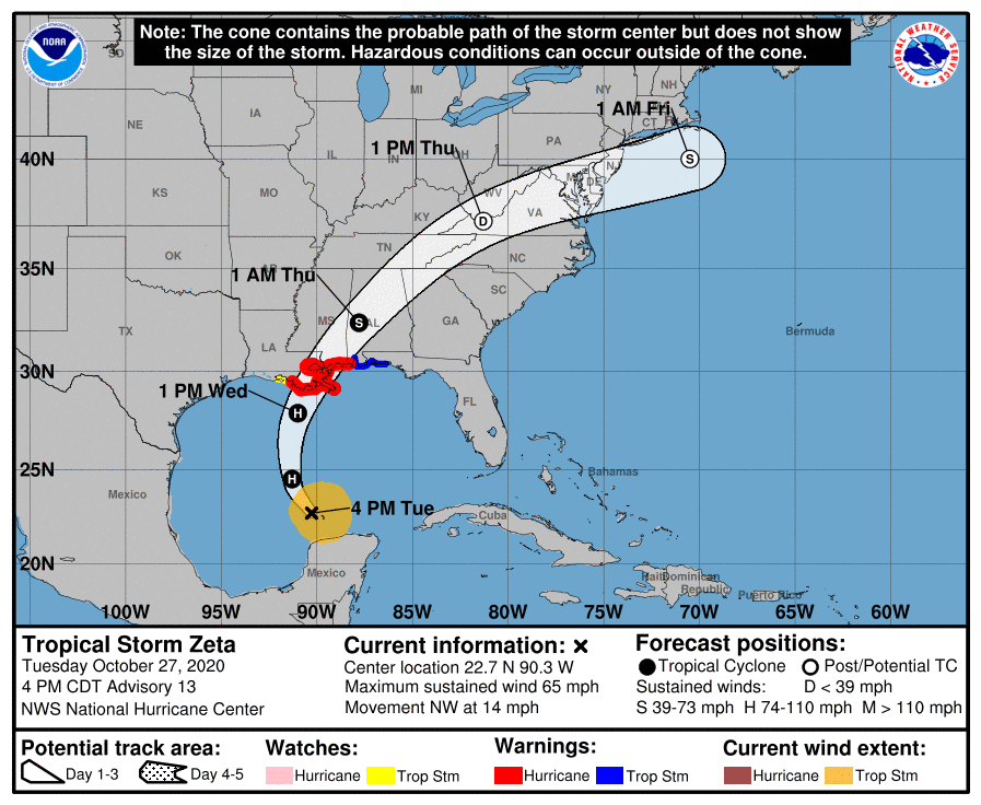
Maximum sustained winds were near 65 mph with higher gusts. Zeta is forecast to become a hurricane again tonight and is forecast to be at or near hurricane strength when it reaches the northern Gulf Coast late Wednesday.
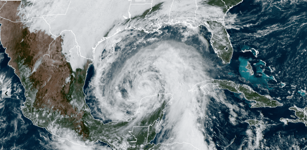
RAMMB-CIRA-Colorado State University 10/27/2020 2:40 pm CDT
Bob
Social Media