As of 4:00 pm CDT Tuesday, the center of Hurricane Delta was located over the western Caribbean Sea, about 215 miles east-southeast of Cozumel, Mexico. Delta was moving toward the west-northwest near 17 mph. A west-northwestward to northwestward motion is expected over the next couple of days. A slower northwestward to north-northwestward motion is forecast to begin on Thursday, and a northward motion is expected Thursday night and Friday.
Maximum sustained winds have increased to near 145 mph with higher gusts. Delta is a category 4 hurricane on the Saffir-Simpson Hurricane Wind Scale. Some additional strengthening is possible before the center reaches the coast Yucatan peninsula Wednesday. Although some weakening is likely when Delta moves over the Yucatan peninsula, re-strengthening is forecast when the hurricane moves over the southern Gulf of Mexico Wednesday night and Thursday.
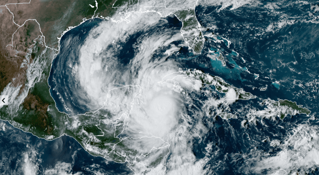
RAMMB-CIRA/Colorado State U 10/06/2020 2:40 pm CDT
Forecast Track
The center of Delta is expected to pass southwest of the Cayman Islands through early this afternoon, and move over the northeastern portion of the Yucatan peninsula late tonight or early Wednesday. Delta is forecast to move over the southern Gulf of Mexico Wednesday afternoon, and be over the southern or central Gulf of Mexico through Thursday. Delta will continue to move west-northwest then turn northwest over the south-central Gulf of Mexico as the hurricane reaches the western edge of a mid-level ridge positioned near the central Gulf of Mexico and ahead of an incoming trough over northwest Texas. This will likely force the hurricane to turn toward the north Thursday into Friday over the northwestern Gulf of Mexico. When this turn occurs and how sharp the turn is will determine the ultimate landfall location along the Gulf coast.
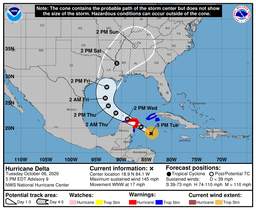
The National Hurricane Center’s official track forecast call for Delta to make landfall somewhere along the south central Louisiana coast Friday night. But do note the cone of uncertainty at landfall now runs from eastern Galveston Bay, to near Mobile, Alabama.
Potential Impacts to the Middle Texas Coast and Central Texas
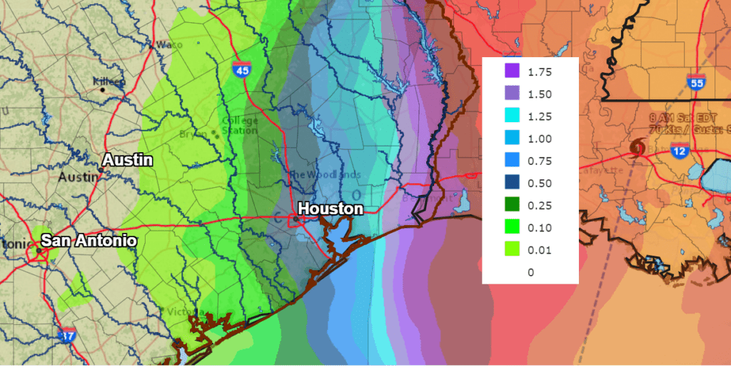
Based on the current forecast track, direct impacts to Southeast Texas are expected to be minimal. But any westward adjustment to the forecast track would bring greater impacts to the area. Northeasterly winds are forecast to increase to a range of 10-20 mph from Austin southeast to the middle Texas coast Thursday afternoon and continue through Friday.
Today’s forecast data indicates some outer rain bands on the west side of Delta may spread over parts of Southeast Texas and possibly the eastern counties of Central Texas beginning Thursday night and continue through Friday afternoon. Rain amounts, if any, should total less than a quarter inch across the middle Texas coast and less than a tenth of an inch from Bastrop to Columbus.
NWS Rainfall Forecast for the Period 7 pm Tuesday through 7 pm Friday:
 Bob
Bob
Social Media