Here’s an afternoon update on the tropical depression located over the western Caribbean Sea. Reports from an Air Force Reserve reconnaissance aircraft indicated the circulation of the depression became better defined Thursday afternoon and as a result, the depression was upgraded to Tropical Storm Ida. (For clarification purposes, Ida grew out of the area disturbed weather forecasters had been monitoring over the Caribbean since early in the week).
As of 4 pm CDT, the center of Tropical Storm Ida was centered over the western Caribbean Sea, roughly 100 miles west-southwest of Negril, Jamaica. Ida was moving toward the northwest near 14 mph, and this general motion should continue for the next few days. Maximum sustained winds were near 40 mph with higher gusts. Steady strengthening is forecast during the next few days and Ida is forecast to become a hurricane when it is near western Cuba or over the southeastern Gulf of Mexico. Additional strengthening is likely over the Gulf of Mexico, and the system could be near major hurricane strength when it approaches the northern Gulf coast late Sunday or early Monday.
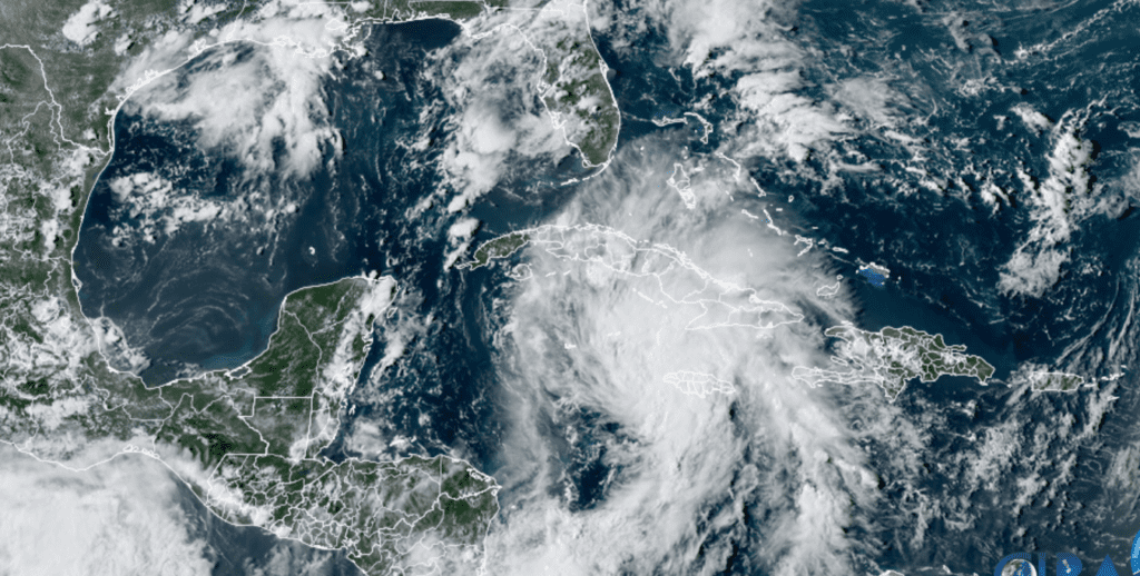
NOAA/Colorado State University/RAMMB 08/26/21 3:50 pm CDT
The 4 pm National Hurricane Center forecast track calls for Ida pass near or over the Cayman Islands Thursday night, the Isle of Youth and western Cuba Friday, and over the southeastern and central Gulf of Mexico Friday night and Saturday. The system is forecast to approach the U.S. northern Gulf coast on Sunday. The National Hurricane Center’s forecast track has tightened some since this morning, with the cone of uncertainty at landfall now stretching from the Texas/Louisiana border to near Gulfport, Mississippi, with the most likely path inland somewhere over southeastern Louisiana. A path toward the Texas coast is now looking less and less likely.
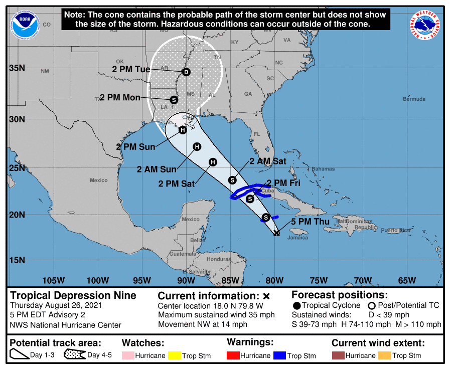
On the current forecast track, impacts from Ida across Central Texas and the middle Texas coast appear minimal. Scattered showers and isolated thunderstorms are forecast across the region Saturday and Sunday as a weak disturbance unrelated to Ida tracks west into Central Texas. Wrap-around moisture from Ida is forecast to bring a 20 percent chance for showers to Central Texas and 40 percent chance for showers to the middle Texas coast Monday and Tuesday. Rain amounts Monday and Tuesday are forecast to average less than a quarter inch across Central Texas and less than a half inch across the coastal plains. Hot temperatures are expected to develop in the wake of Ida the middle of next week.
Bob
Social Media