Showers and thunderstorms associated with an area of low pressure located over the northwestern Gulf of Mexico increased a bit Thursday, but they still remain disorganized. The Hurricane Hunters flew a reconnaissance mission through the disturbance Wednesday afternoon, and while they found a broad circulation and shifts in the wind direction, there was still no well-defined low-level circulation. National Hurricane forecasters call for the system to move slowly westward and approach the coast of southern Texas and northern Mexico by early Thursday. They feel some slow development is still possible and the system it could become a short-lived tropical depression near the coast before it turns northwestward and moves inland on Thursday. NHC forecasters continue to show a medium, or 40 percent chance, for tropical development over the next 48 hours.
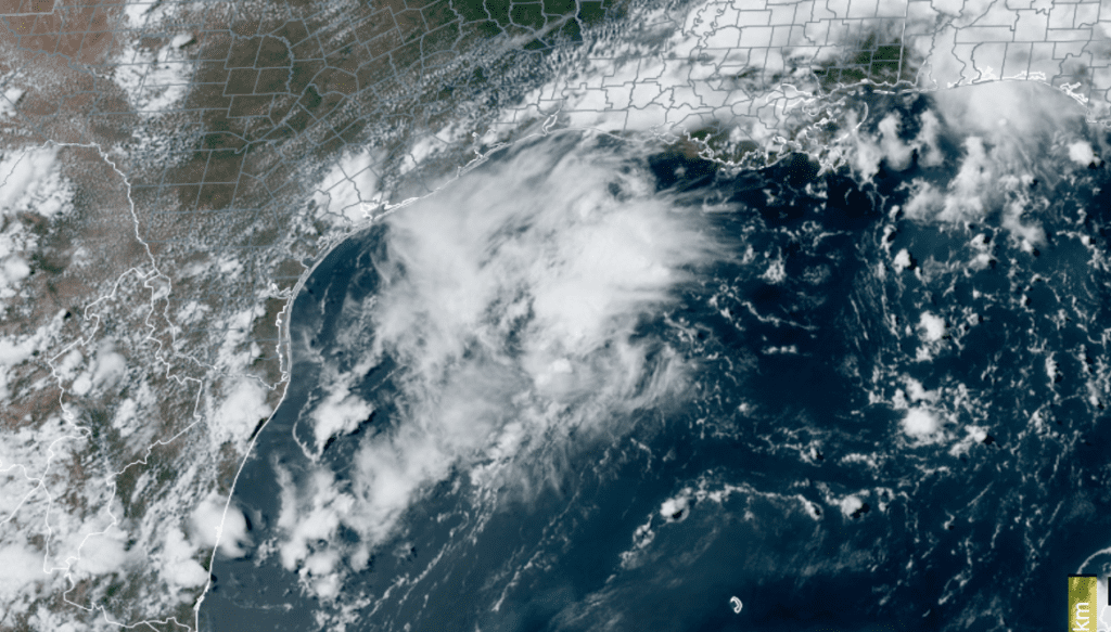
NOAA/Colorado State University/RAMMB 06/29/2022 3:30 pm CDT
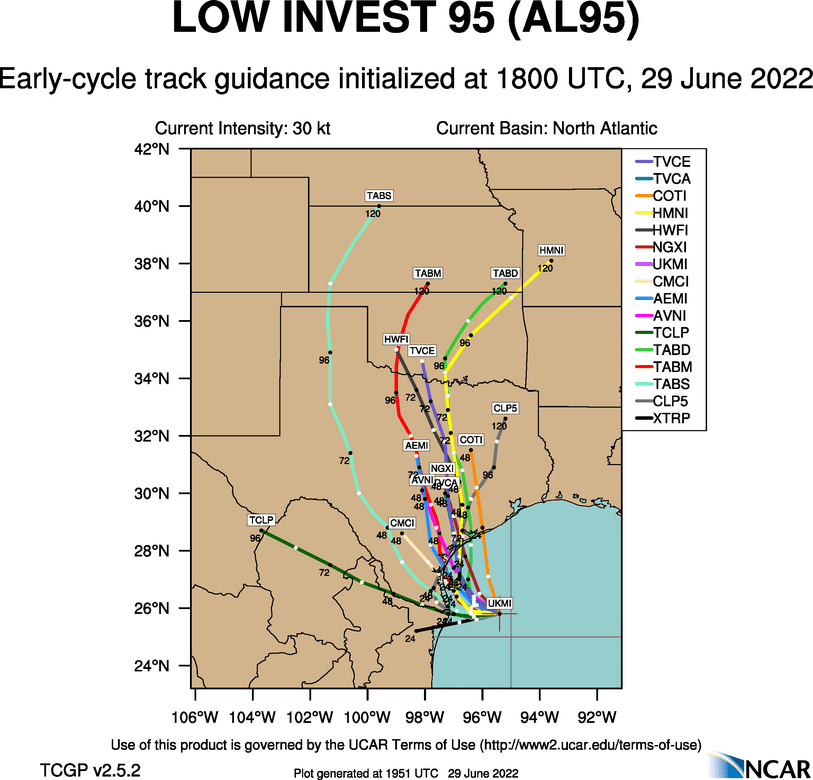
Most of Wednesday’s forecast solutions continue to cluster the model tracks, taking the system inland between Corpus Christi and Matagorda Bay late Thursday, then pulling the system north, to the east of Interstate 35, Friday and Saturday.
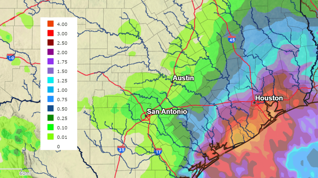
Forecasts continue to call for widespread and potentially heavy rain developing on the eastern side of the low Thursday through Friday as the disturbance tracks to the north. In general, expect widespread amounts of 2″-4″ for areas near and to the south of Interstate 10, with coastal areas potentially receiving between 4 and 7 inches. Based on the current track of the system, rain amounts through Saturday should average around a quarter inch or less across the Hill Country and Central Texas regions.
NWS Rainfall Forecast for the Period 7 pm Wednesday through 7 pm Saturday:
Bob
Social Media